CloudTAK · Program Update
Distribution Statement A — Distribution is Unlimited
Center of Excellence for Advanced Technology Aerial Firefighting Colorado Division of Fire Prevention & Control
Presented by
Center of Excellence for Advanced Technology Aerial Firefighting Division of Fire Prevention & Control · Colorado Department of Public Safety
COTAK
Presented at
2026 TAK Offsite August 18–20, 2026
Program Update Twelve Months of CloudTAK v10.43 → v13.68

From web map to
fielded platform.

Period
Aug 2025 – Aug 2026
Versions
v10.43.0 – v13.68.1
Presenters
Nicholas Ingalls, CloudTAK Engineering Lead
Brad Schmidt, COTAK Program Director
Distribution
Statement A

CloudTAK development · 11 August 2025 – 13 August 2026
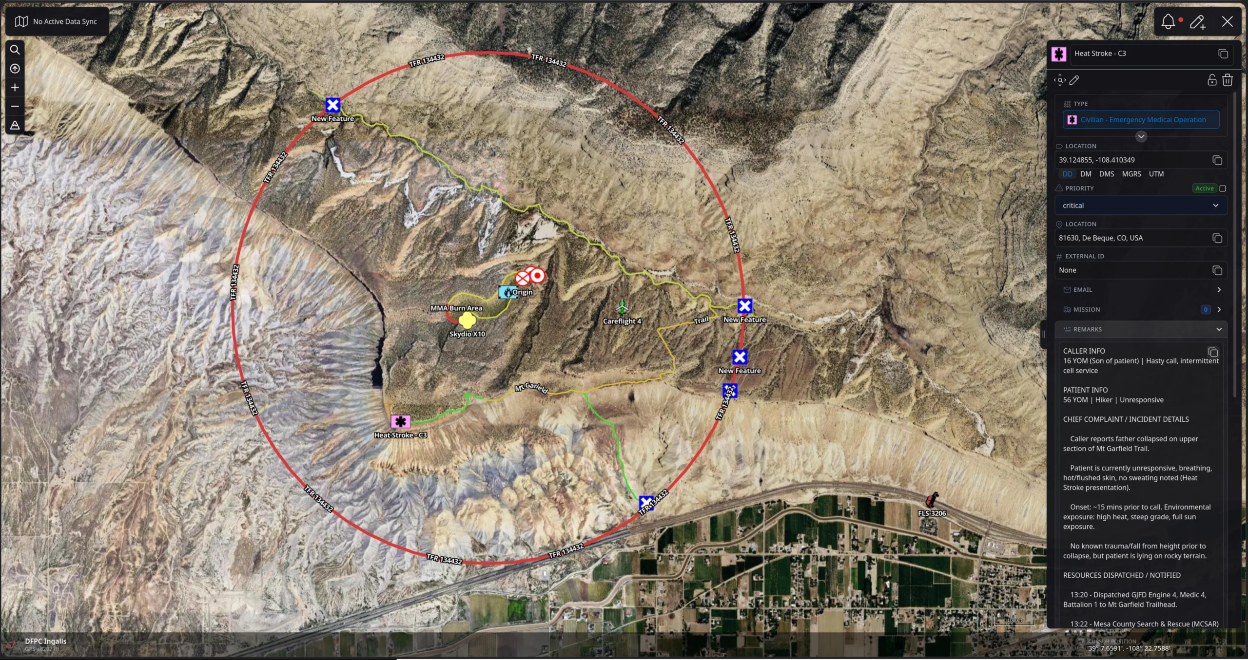
The CloudTAK map interface showing responder icons, drawn features, and an incident detail panel.
472
ReleasesOne roughly every 19 hours
206
New capabilitiesTracked as features in the changelog
267
Defects fixedField-reported and internally found
1,005
Changelog entriesEvery change, publicly recorded
User Facing Features

tl;dr End User Features

CloudTAK coninued to ship features in parity with TPC Core Applications

  • 01

    MIL-2525E Support in both rendering and SIDC selection

  • 02

    Turn-by-turn Routing & Route Creation

  • 03

    Event & Video Boards

  • 04

    Deeper Data Sync Integration

  • 05

    Weather

  • 06

    Unified Search

Feature Walkthrough · 01 — MIL-STD-2525E

2525E Built In

CloudTAK now features complete support for MIL-STD-2525E. When you place a point on the map, you'll be greeted by an intuitive, categorized menu. This allows you to quickly filter through and select the appropriate symbol, ensuring your map data is always clear and contextualized.
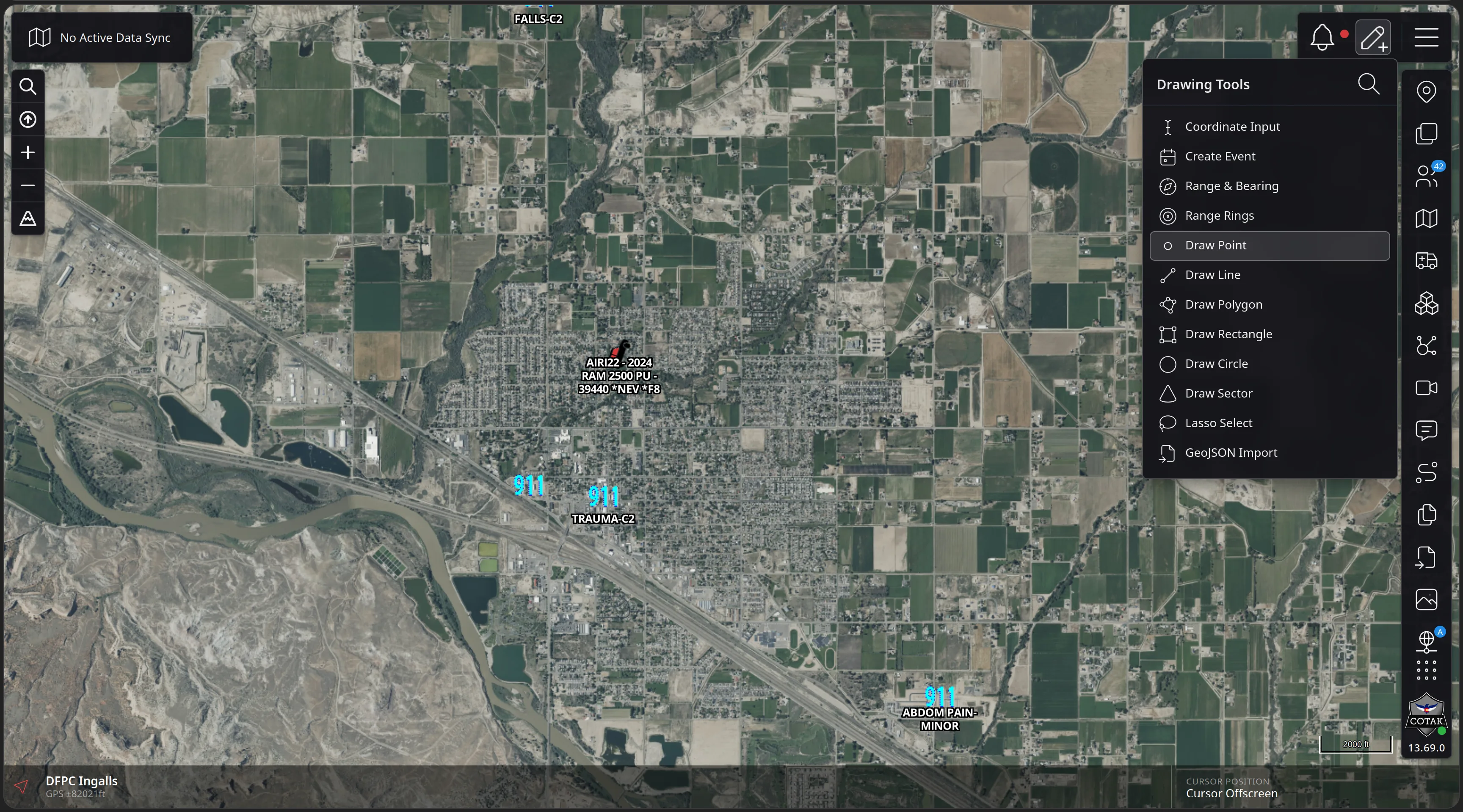
Feature Walkthrough · 01 — MIL-STD-2525E · 1/8
The CloudTAK map over Grand Junction with the Drawing Tools panel open on the right and Draw Point highlighted among Coordinate Input, Create Event, Range and Bearing, Range Rings and the draw tools.
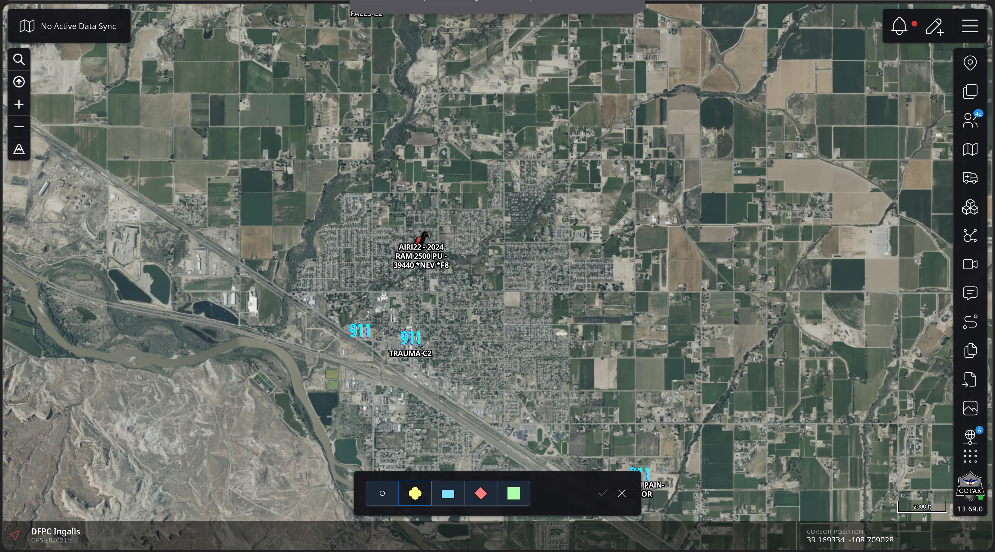
Feature Walkthrough · 01 — MIL-STD-2525E · 2/8
The CloudTAK map with a compact style bar at the bottom of the screen offering a circle and four coloured marker swatches, with confirm and cancel controls.
Feature Walkthrough · 01 — MIL-STD-2525E · 3/8
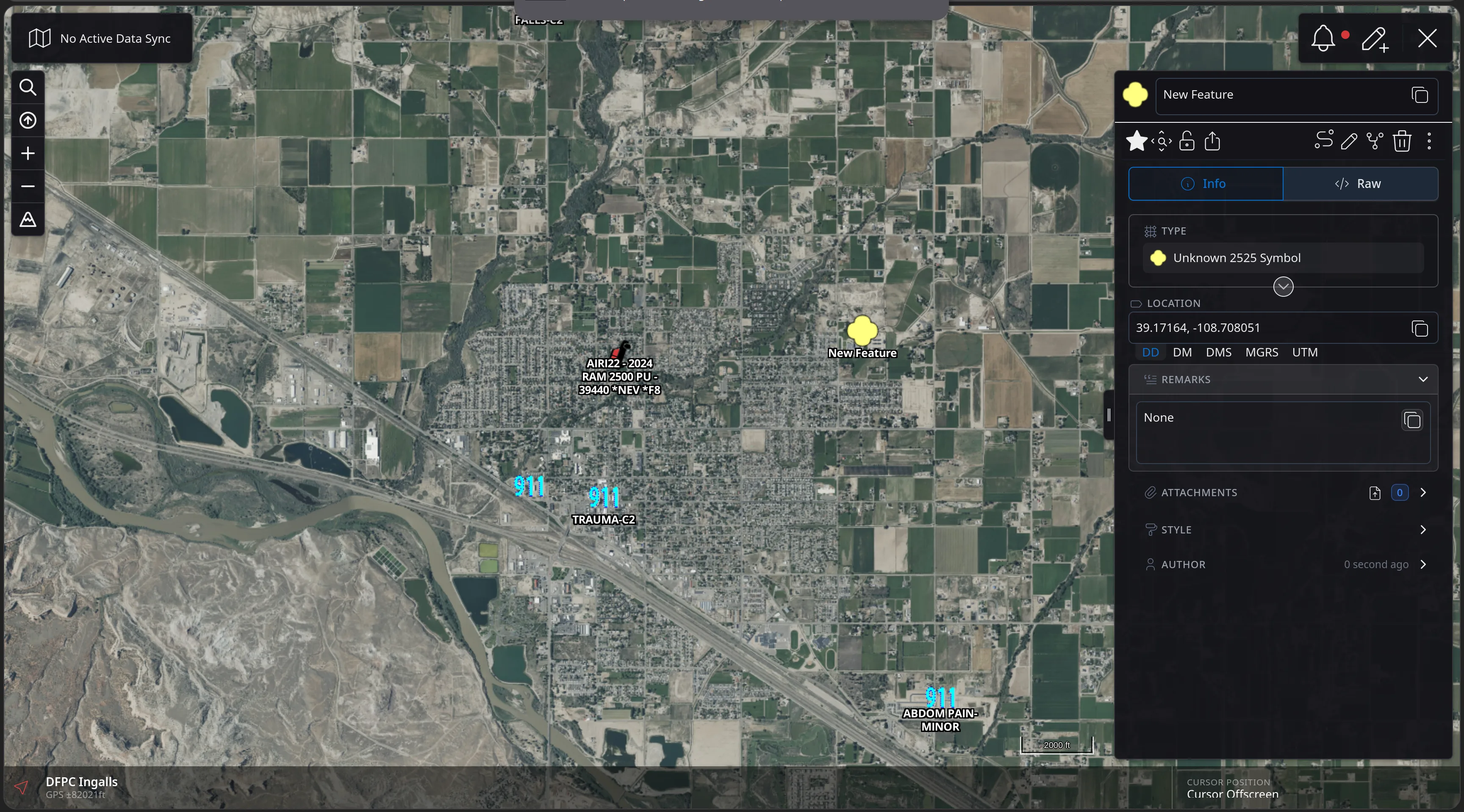
The CloudTAK feature panel for a newly drawn point showing Info and Raw tabs, a TYPE field reading Unknown 2525 Symbol, a decimal-degrees location of 39.17164, -108.708051, and Remarks, Attachments, Style and Author rows.
Feature Walkthrough · 01 — MIL-STD-2525E · 4/8
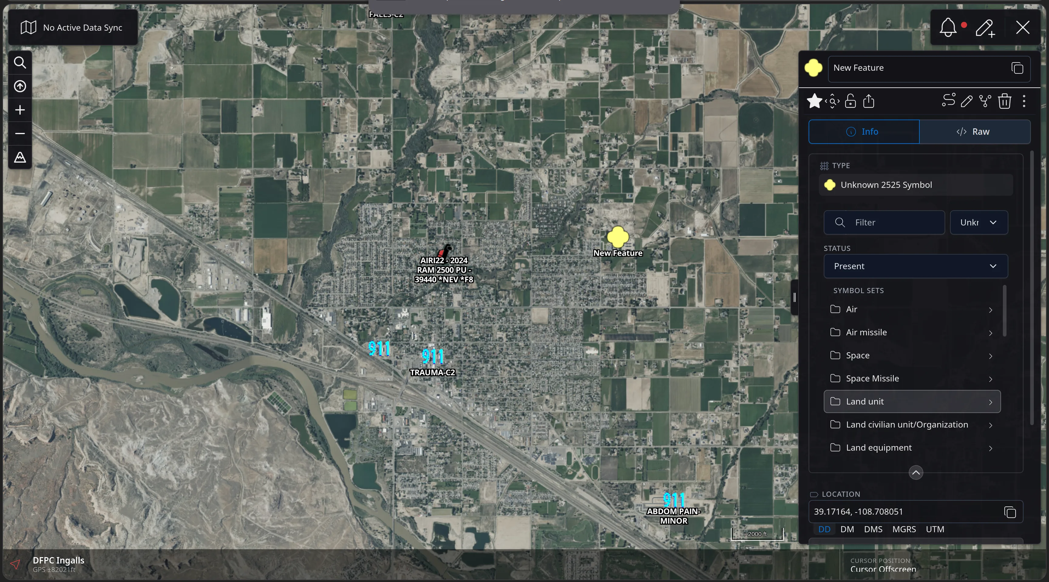
The CloudTAK 2525E symbol picker expanded, showing a Filter box, an identity dropdown, a Status field set to Present, and a scrollable Symbol Sets list: Air, Air missile, Space, Space Missile, Land unit, Land civilian unit/Organization, Land equipment.
Feature Walkthrough · 01 — MIL-STD-2525E · 5/8
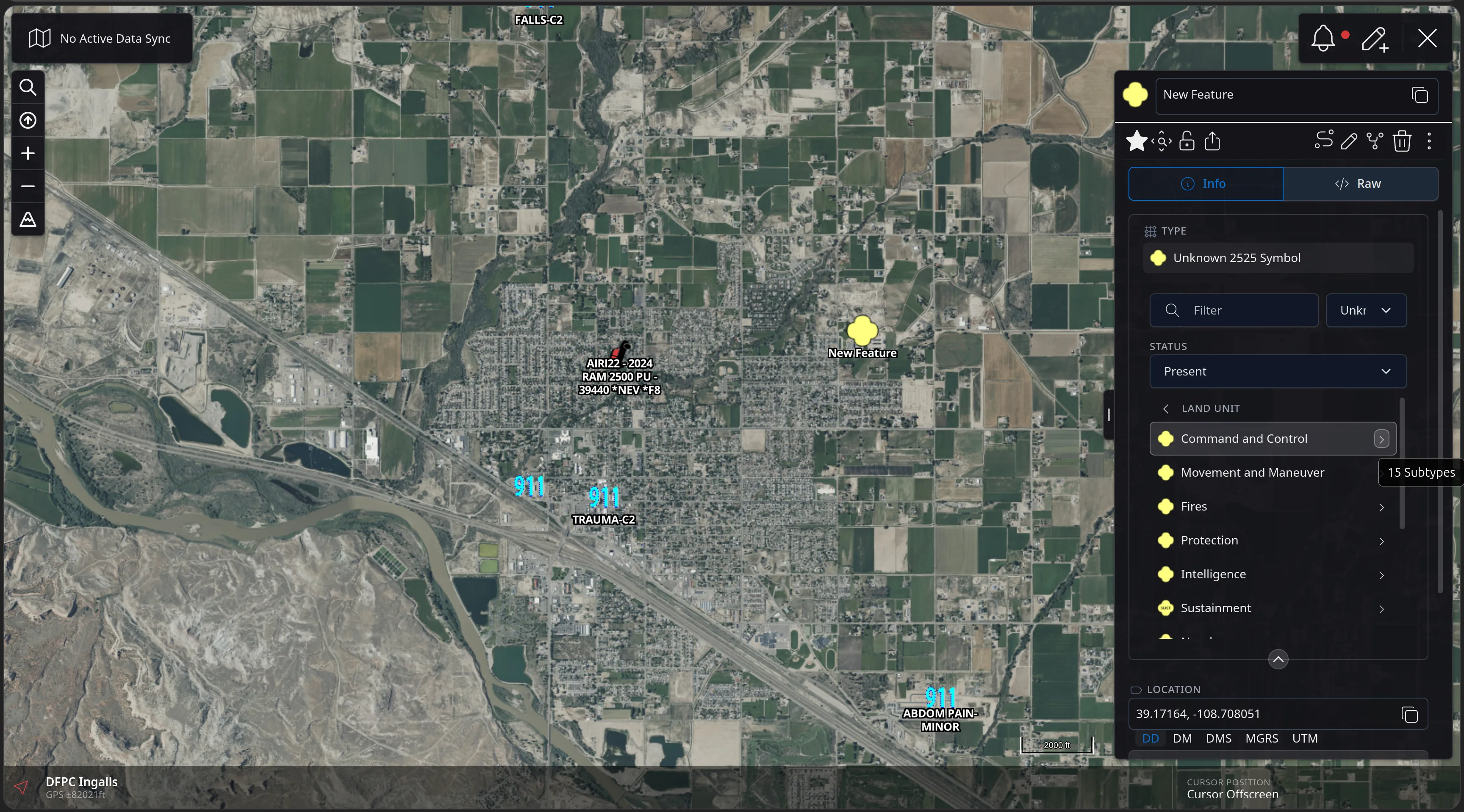
The 2525E picker drilled into the Land Unit symbol set, listing Command and Control with a 15 Subtypes tooltip, plus Movement and Maneuver, Fires, Protection, Intelligence and Sustainment, each with its rendered symbol.
Feature Walkthrough · 01 — MIL-STD-2525E · 6/8
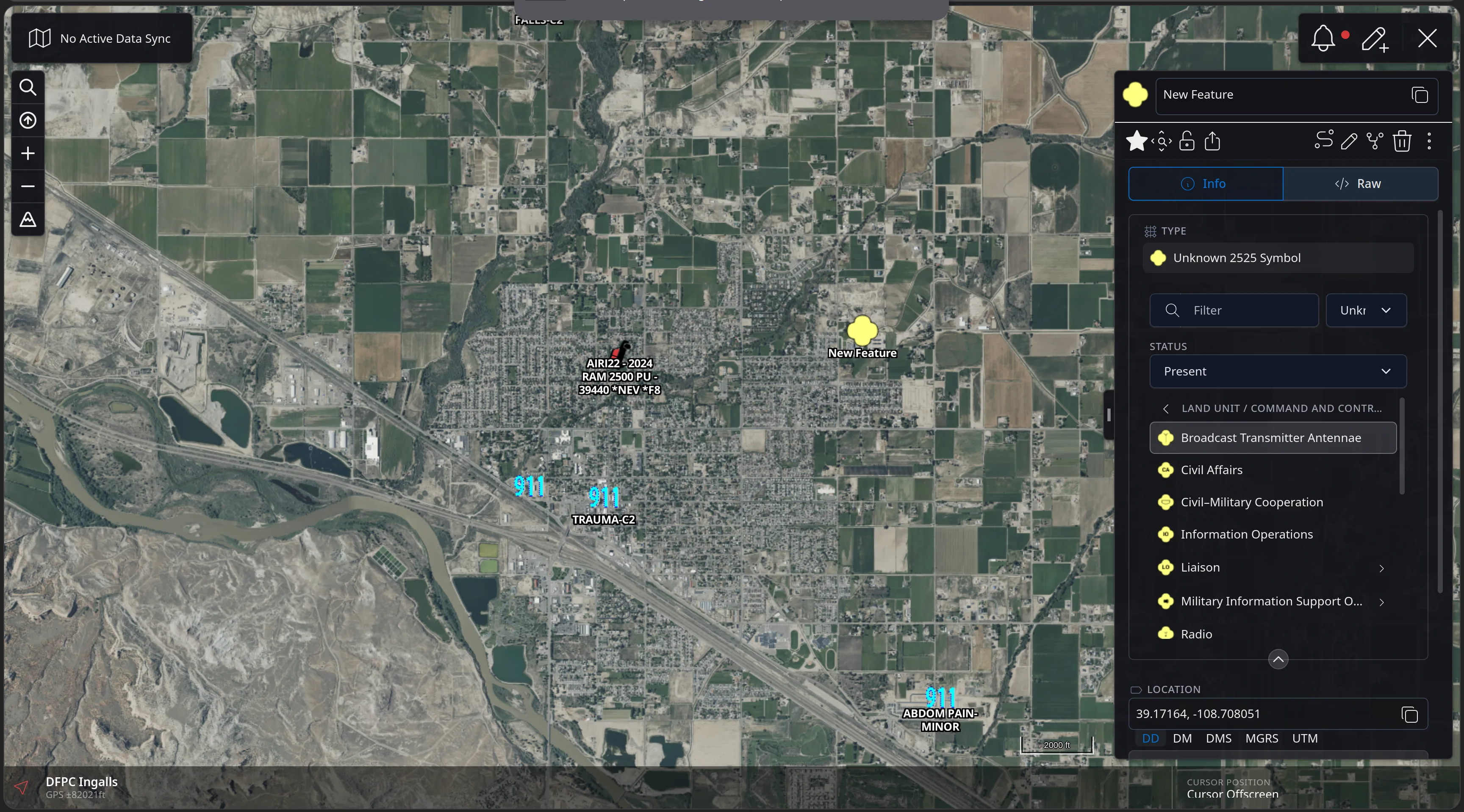
The 2525E picker drilled into Land Unit / Command and Control, listing Broadcast Transmitter Antennae, Civil Affairs, Civil-Military Cooperation, Information Operations, Liaison, Military Information Support Operations and Radio, each with its rendered symbol.
Feature Walkthrough · 01 — MIL-STD-2525E · 7/8
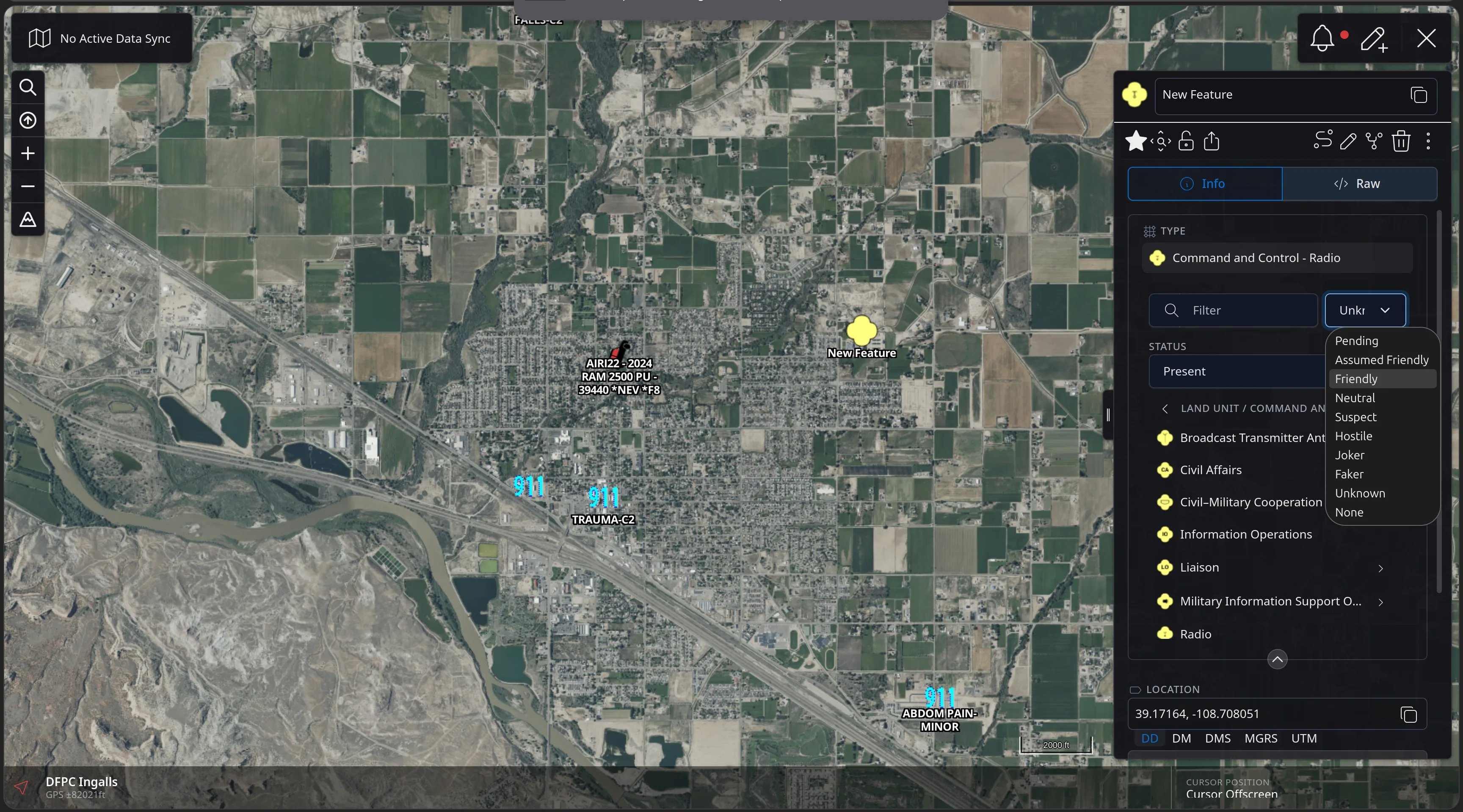
The 2525E picker with TYPE reading Command and Control - Radio and the identity dropdown open, listing Pending, Assumed Friendly, Friendly, Neutral, Suspect, Hostile, Joker, Faker, Unknown and None.
Feature Walkthrough · 01 — MIL-STD-2525E · 8/8
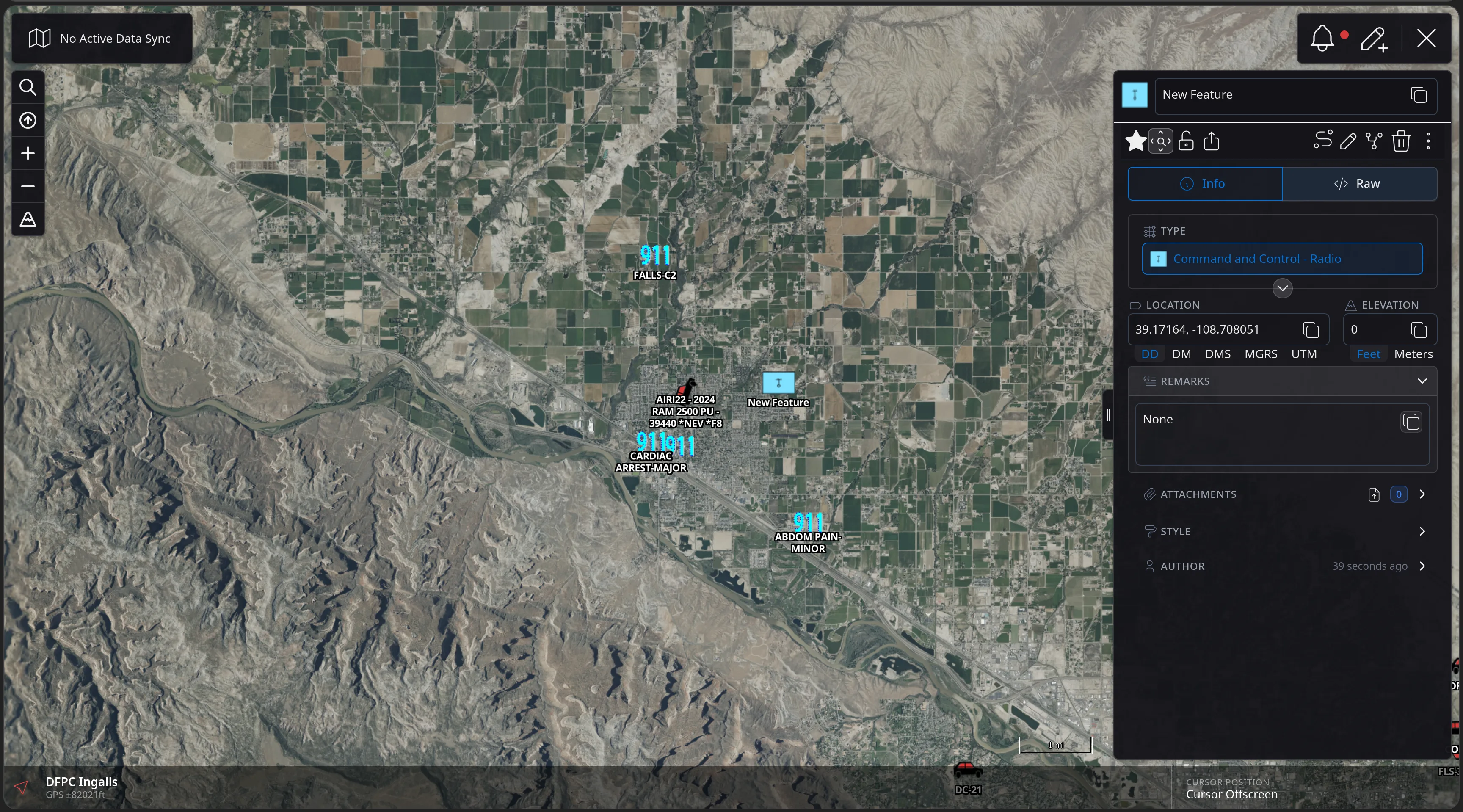
The CloudTAK map with the new feature now rendered as a blue friendly Command and Control Radio symbol, and its panel showing TYPE Command and Control - Radio with location, elevation, remarks and author rows.
Feature Walkthrough · 02 — Routing

Fully Integrated Directions

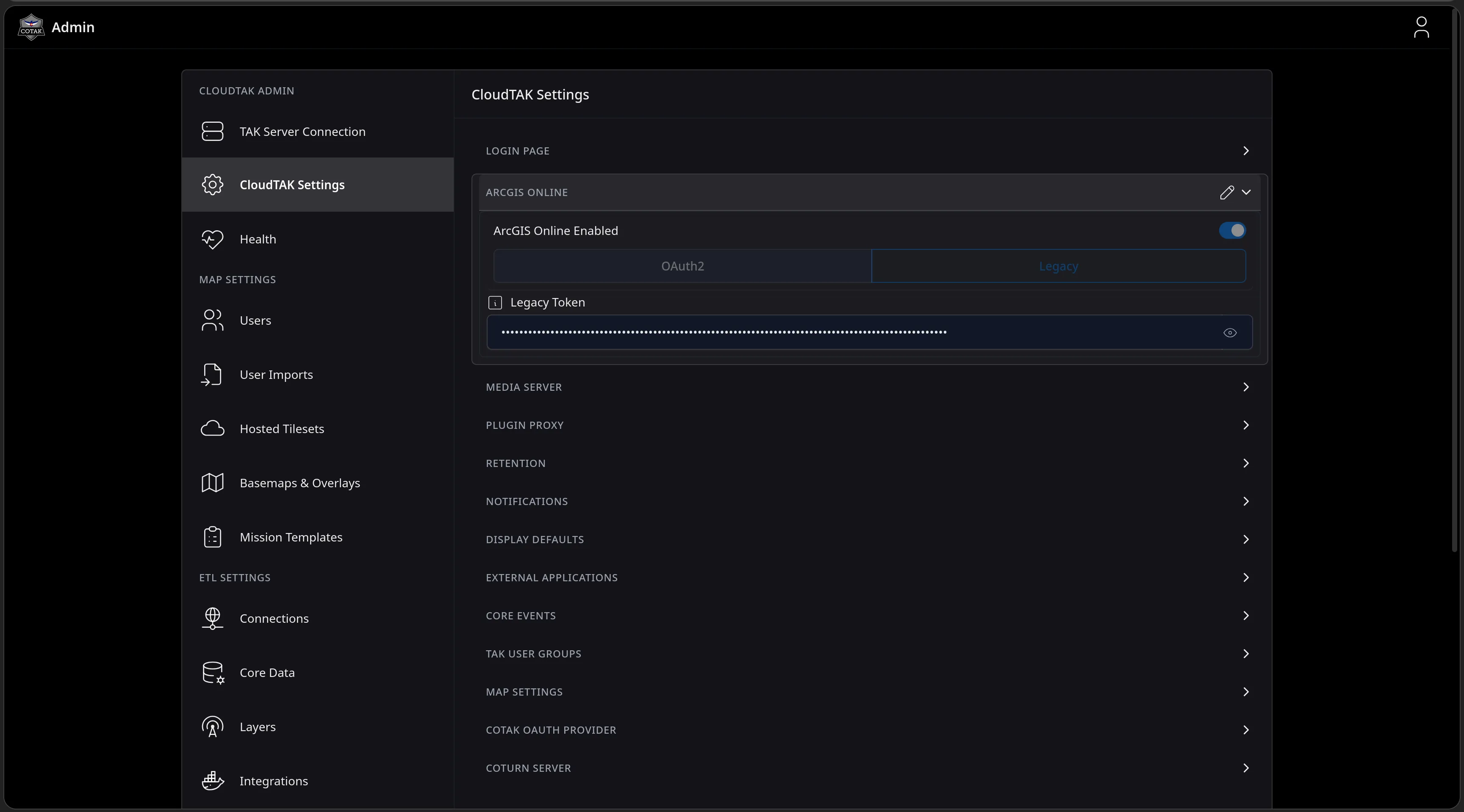
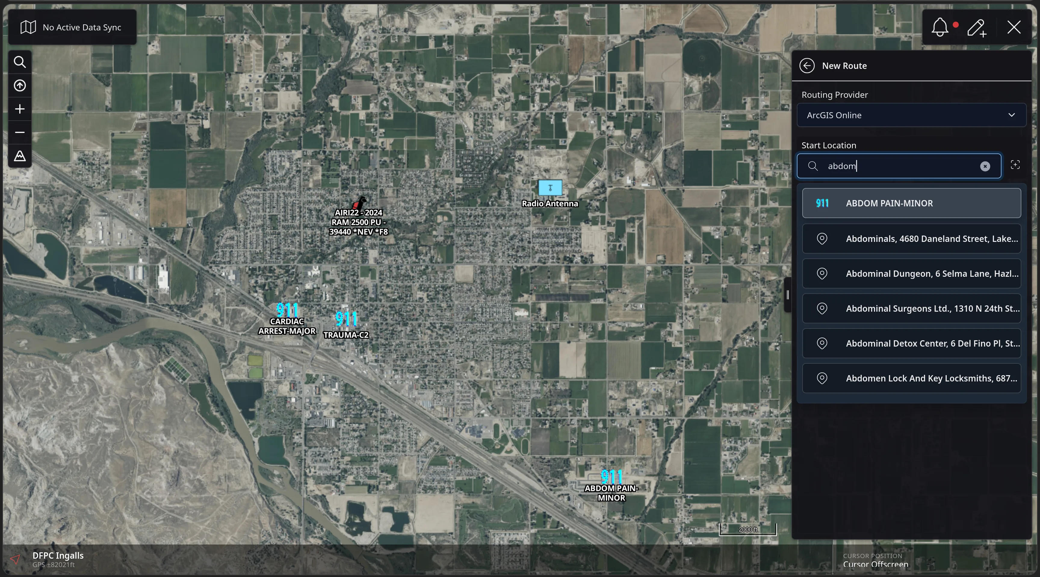
CloudTAK now handles driving directions right inside the map. An admin only needs to connect a routing provider once for your entire server. After that, operators can build a route between any two points on the map, including active incidents. Because the route gets added as a standard map feature, it saves, shares, and syncs with the rest of your team just like everything else.
Feature Walkthrough · 02 — Routing · 1/7
The CloudTAK Admin console on the CloudTAK Settings page with the ArcGIS Online section expanded, showing an ArcGIS Online Enabled toggle switched on, OAuth2 and Legacy tabs, and a masked Legacy Token field.
Feature Walkthrough · 02 — Routing · 2/7
The CloudTAK New Route panel with Routing Provider set to ArcGIS Online and a Start Location search for abdom, listing the on-map 911 feature ABDOM PAIN-MINOR above geocoded address results.
Feature Walkthrough · 02 — Routing · 3/7
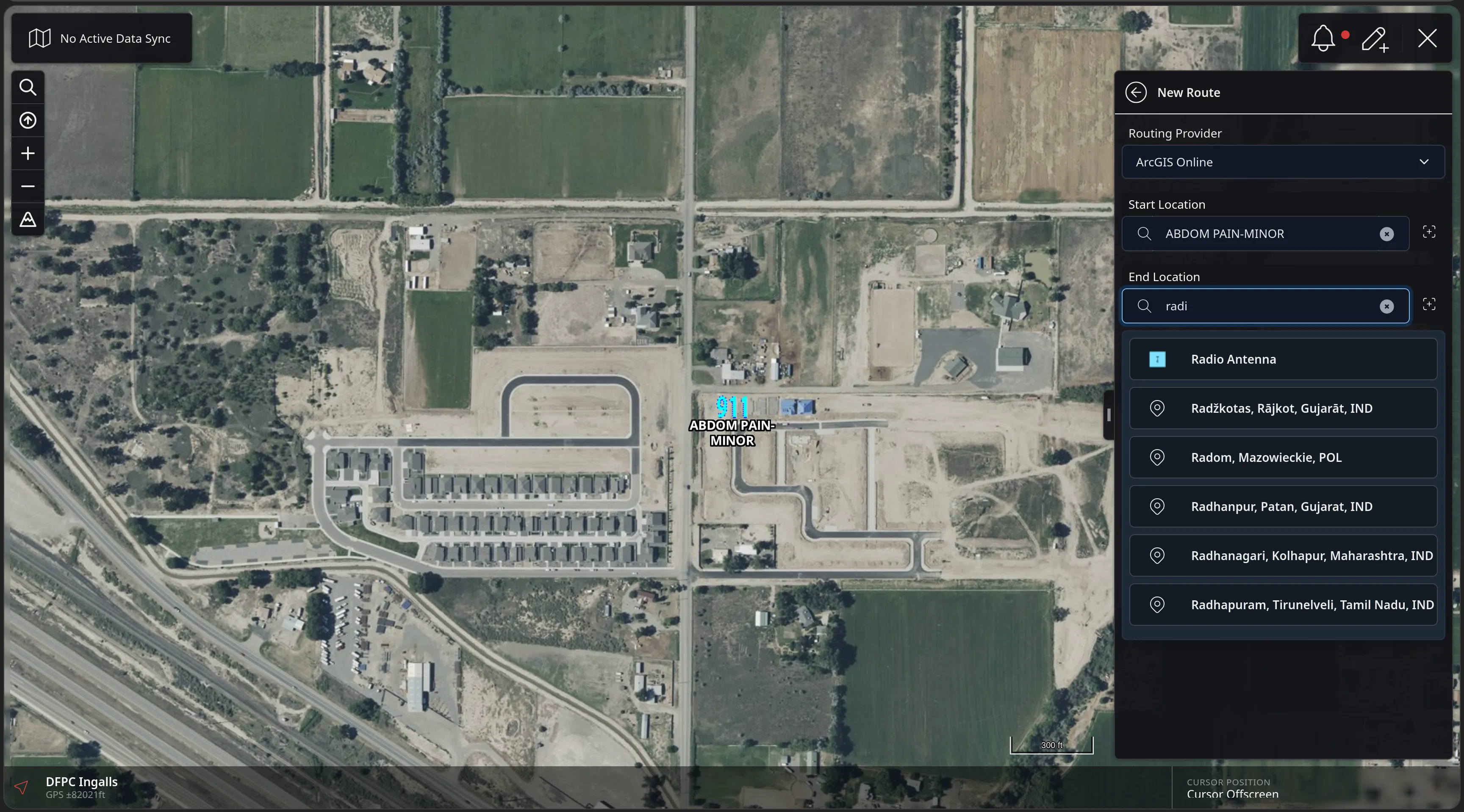
The CloudTAK New Route panel with Start Location set to ABDOM PAIN-MINOR and an End Location search for radi, listing the on-map Radio Antenna feature above geocoded place results.
Feature Walkthrough · 02 — Routing · 4/7
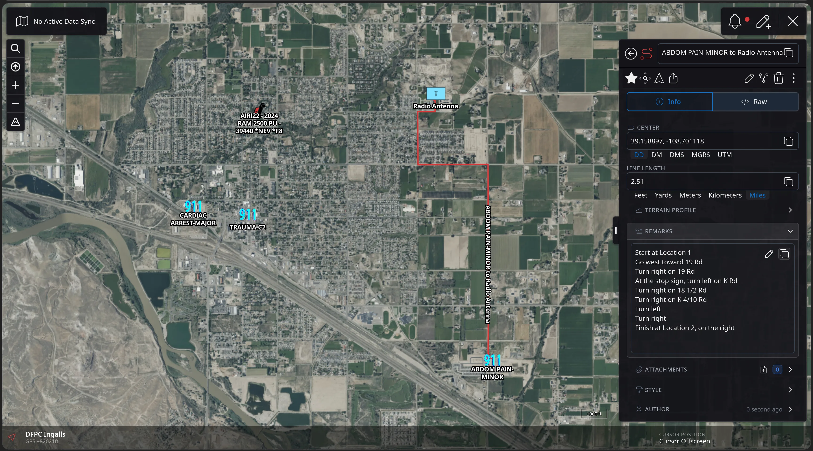
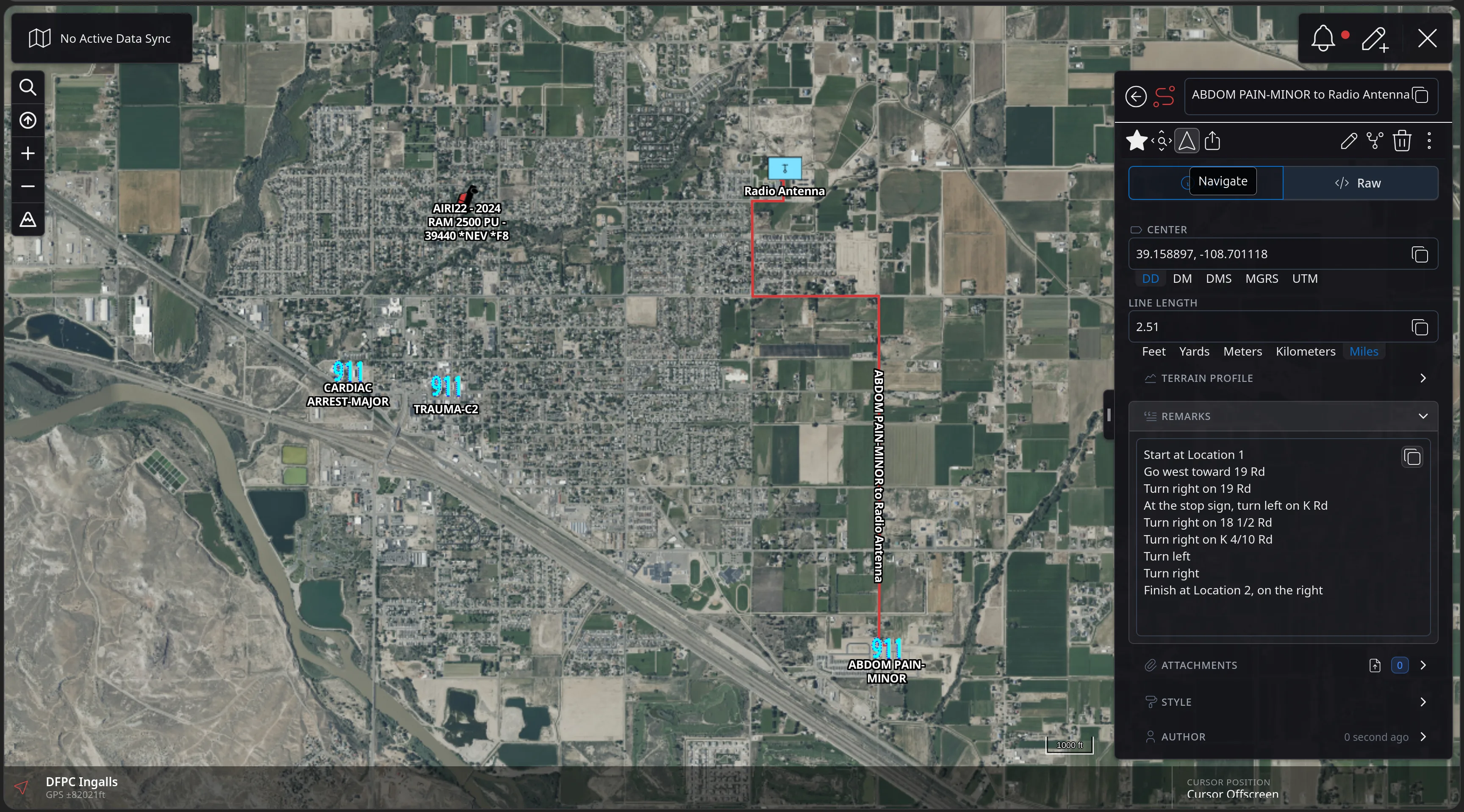
The CloudTAK map showing a red route line from ABDOM PAIN-MINOR to Radio Antenna, with a detail panel listing centre coordinates, a 2.51 mile line length, a terrain profile row, and remarks containing step-by-step directions ending Finish at Location 2, on the right.
Feature Walkthrough · 02 — Routing · 5/7
The same route detail panel with the Navigate control in the feature toolbar hovered, showing its Navigate tooltip.
Feature Walkthrough · 02 — Routing · 6/7
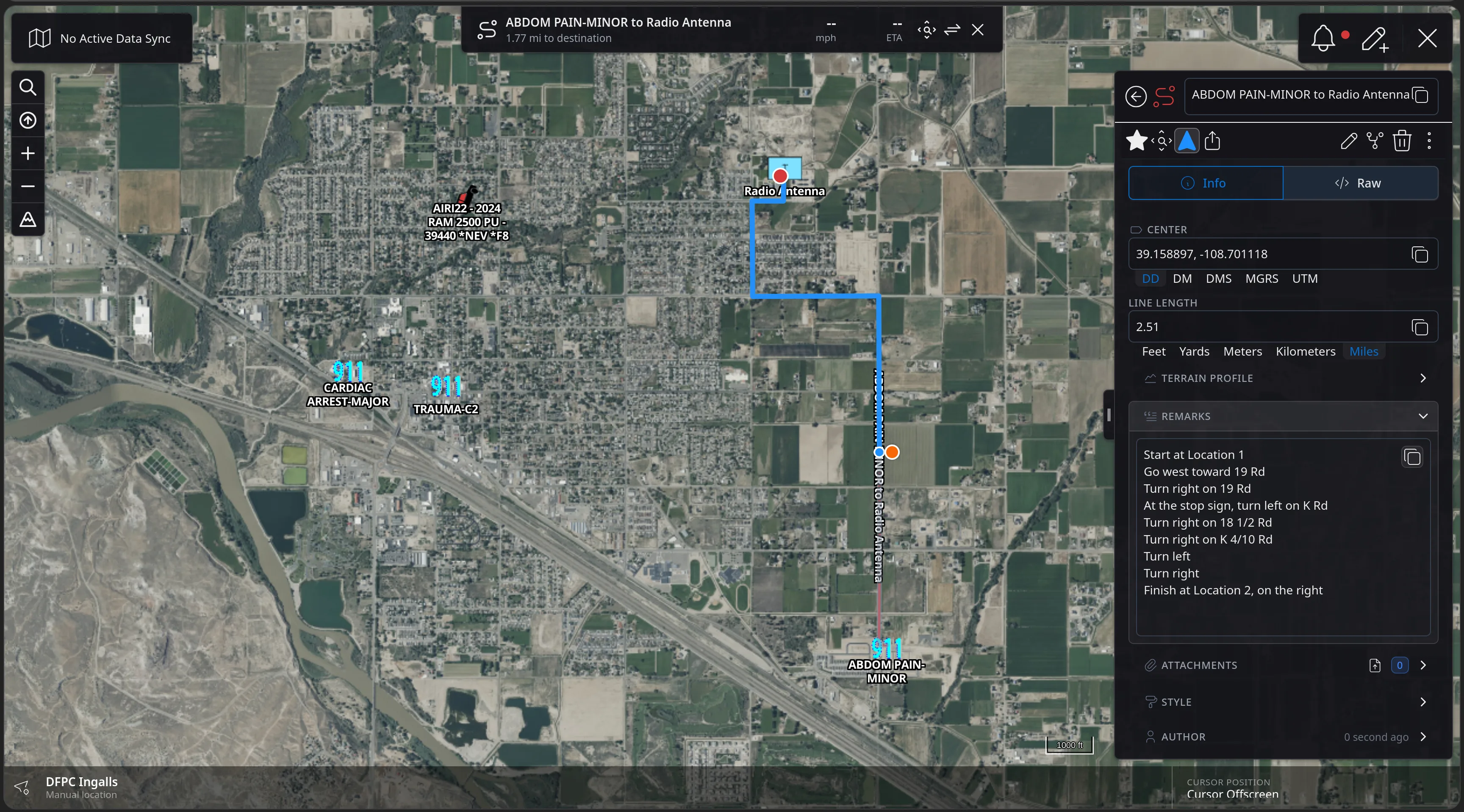
The CloudTAK map in navigation mode with the route line highlighted blue, the operator position snapped to the line by a short connector, and a banner reading ABDOM PAIN-MINOR to Radio Antenna, 1.77 mi to destination, with speed, ETA, reverse and close controls.
Feature Walkthrough · 02 — Routing · 7/7
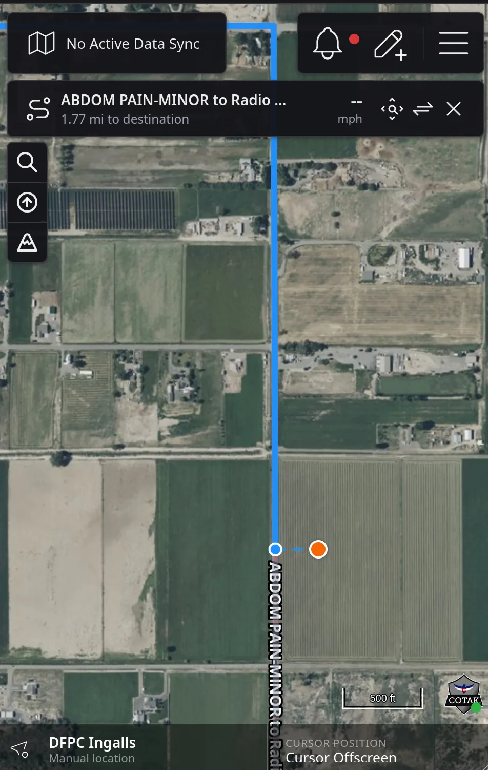
CloudTAK at phone width in navigation mode: the ABDOM PAIN-MINOR to Radio Antenna banner reading 1.77 mi to destination above a satellite map with the blue route line and the operator position snapped to it.
Feature Walkthrough · 03 — Video

Fixed Position & ISR Video

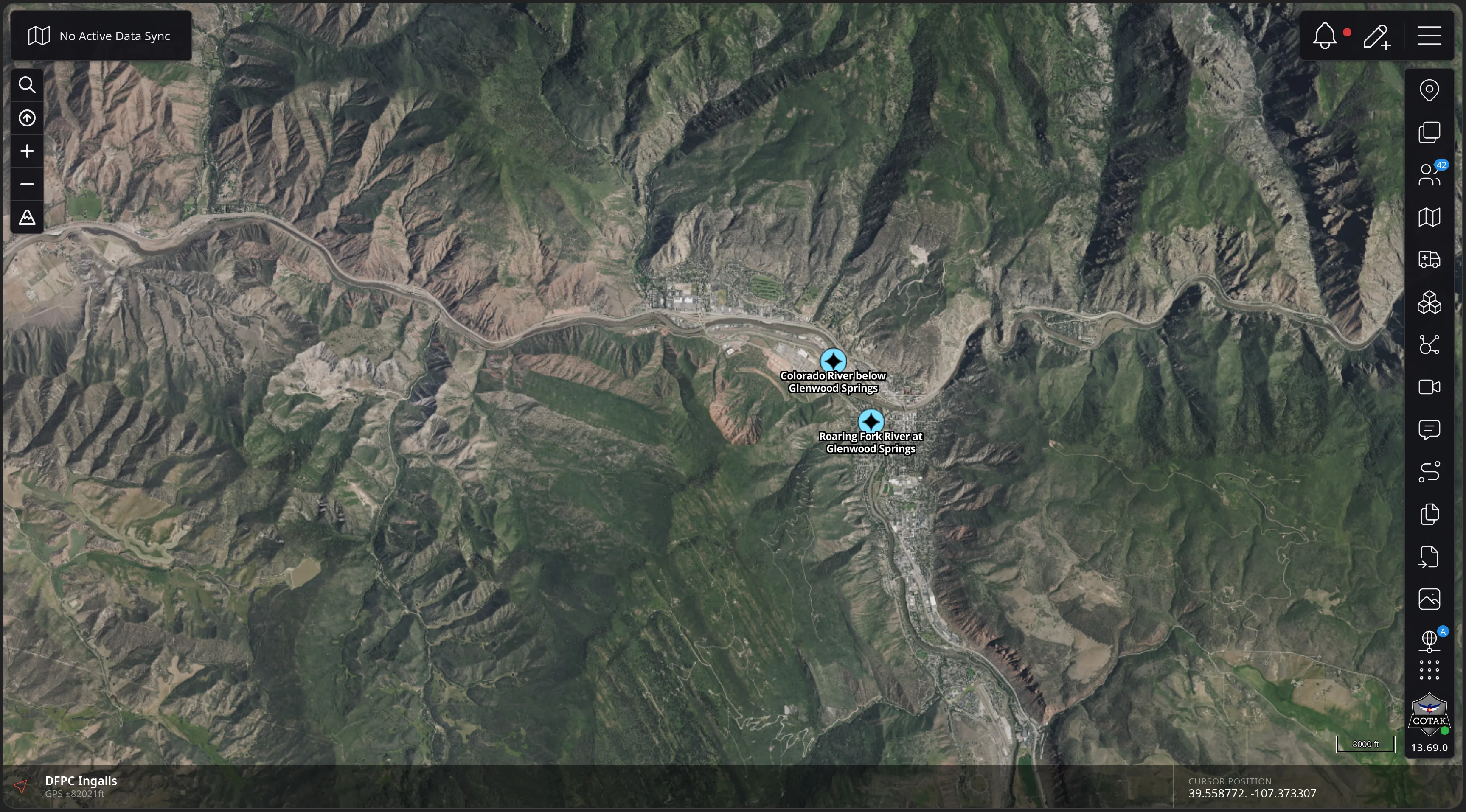
CloudTAK supports both Cursor-On-Target video ingestion as well as the TAK Server Video v2 API. In this demo cameras are synced from a 3rd party source into a Data Sync via CloudTAK's integrated ETL system. Click one and the stream plays in a window over the map, with the map still live underneath it. Streams an operator watches often can be saved and tiled together on a Video Wall.

The next six slides add the Colorado DOT highway cameras to a map and watch them.
Feature Walkthrough · 03 — Video · 1/6
The CloudTAK map over the Colorado River canyon at Glenwood Springs showing two river gauge markers - Colorado River below Glenwood Springs and Roaring Fork River at Glenwood Springs - and no camera feeds.
Feature Walkthrough · 03 — Video · 2/6
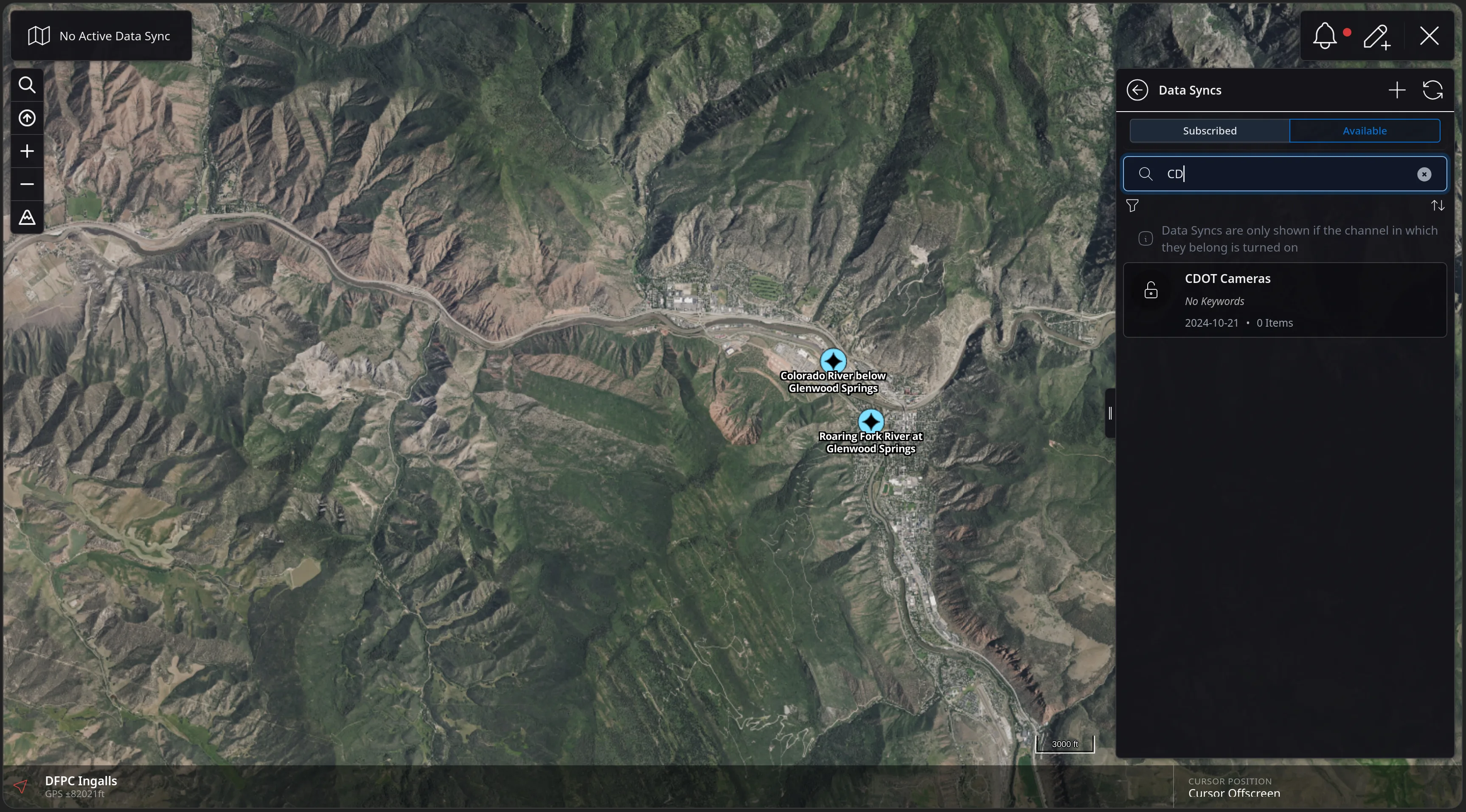
The CloudTAK Data Syncs panel on the Available tab with a search for CD returning one result, CDOT Cameras, dated 2024-10-21 with 0 items, above a note that Data Syncs only appear if their channel is turned on.
Feature Walkthrough · 03 — Video · 3/6
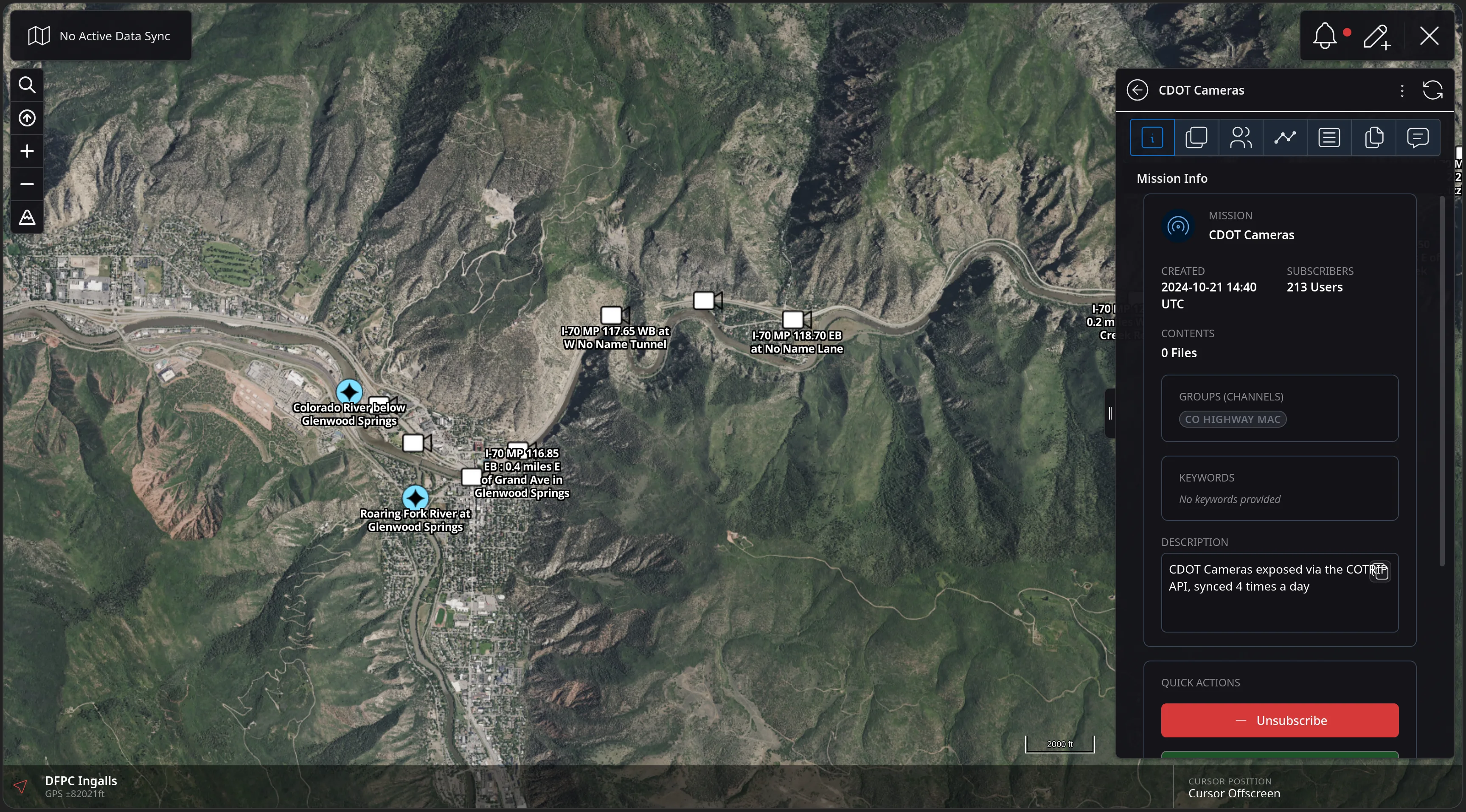
The CDOT Cameras mission panel showing created 2024-10-21, 213 subscribers, the CO HIGHWAY MAC channel, and a description reading CDOT Cameras exposed via the COTRIP API, synced 4 times a day - with camera markers now on the map along I-70.
Feature Walkthrough · 03 — Video · 4/6
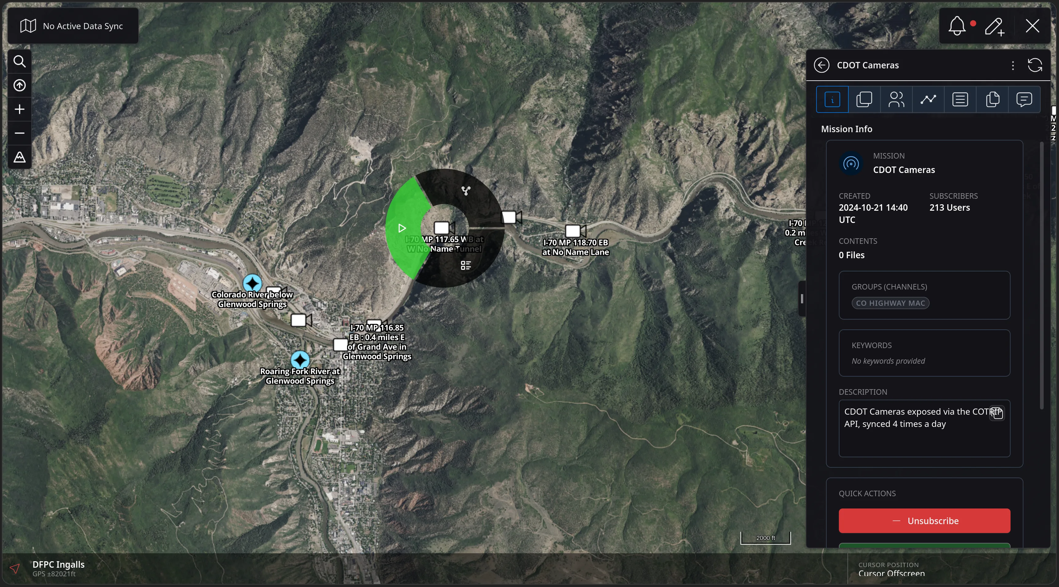
A radial context menu opened on an I-70 camera marker on the CloudTAK map, with a highlighted green play segment alongside the other feature actions.
Feature Walkthrough · 03 — Video · 5/6
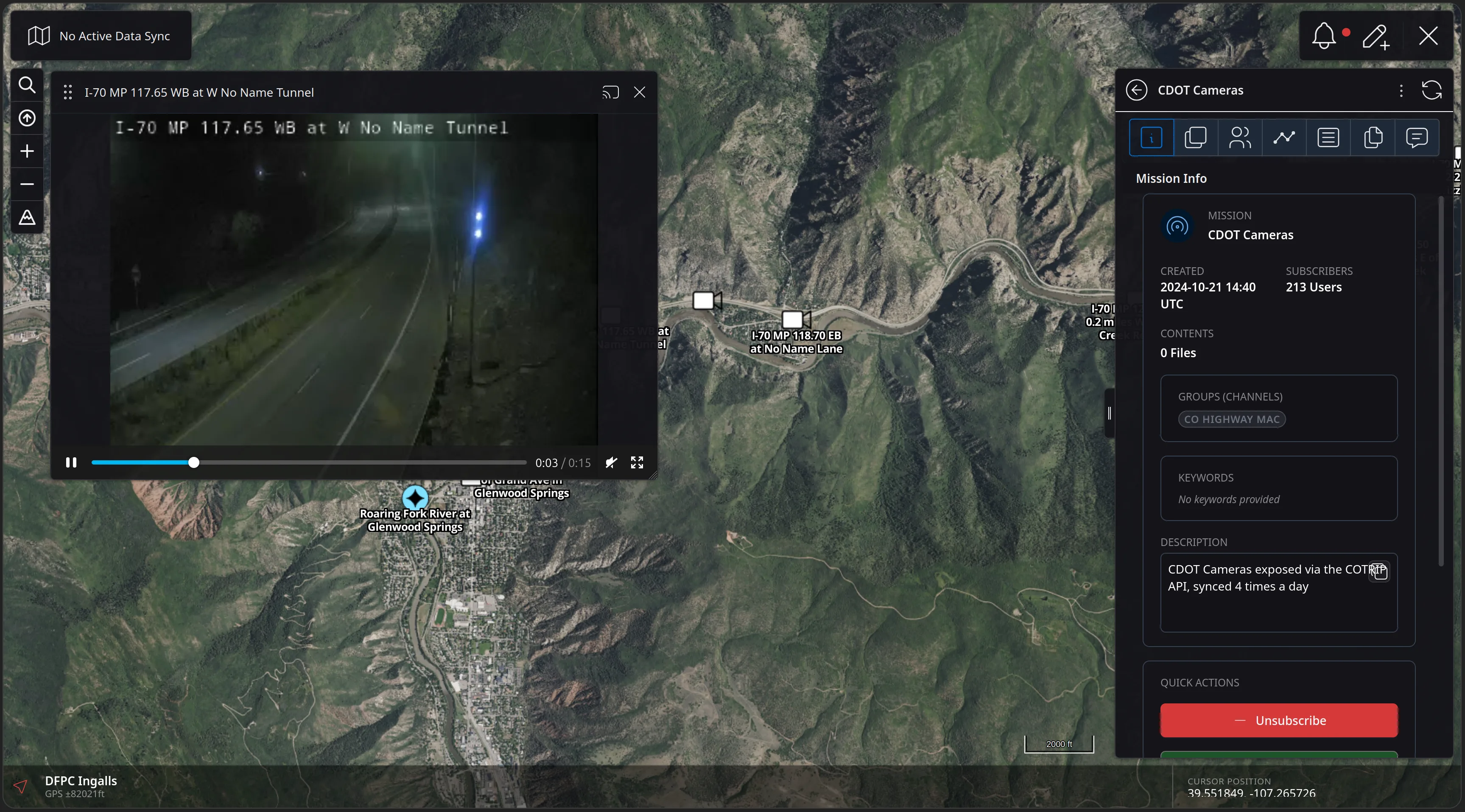
A floating video player over the CloudTAK map playing the I-70 MP 117.65 WB at W No Name Tunnel camera, with a scrub bar reading three seconds of fifteen, and cast and close controls.
Feature Walkthrough · 03 — Video · 6/6
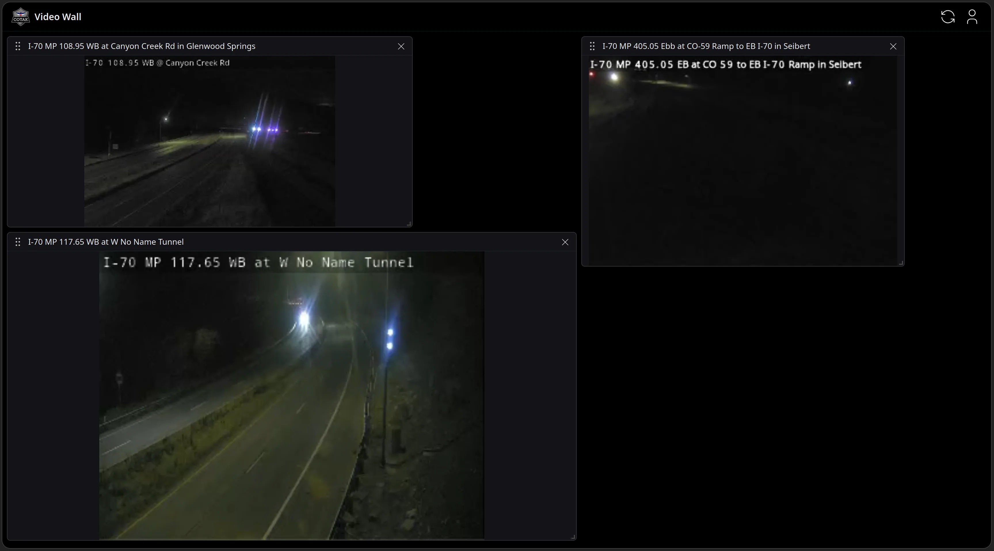
The CloudTAK Video Wall as a full-page dark grid holding three live CDOT night-time highway camera tiles - Canyon Creek Road, the CO-59 ramp at Seibert, and W No Name Tunnel - each re-sizable.
Feature Walkthrough · 04 — Event Boards

Events & Event Boards

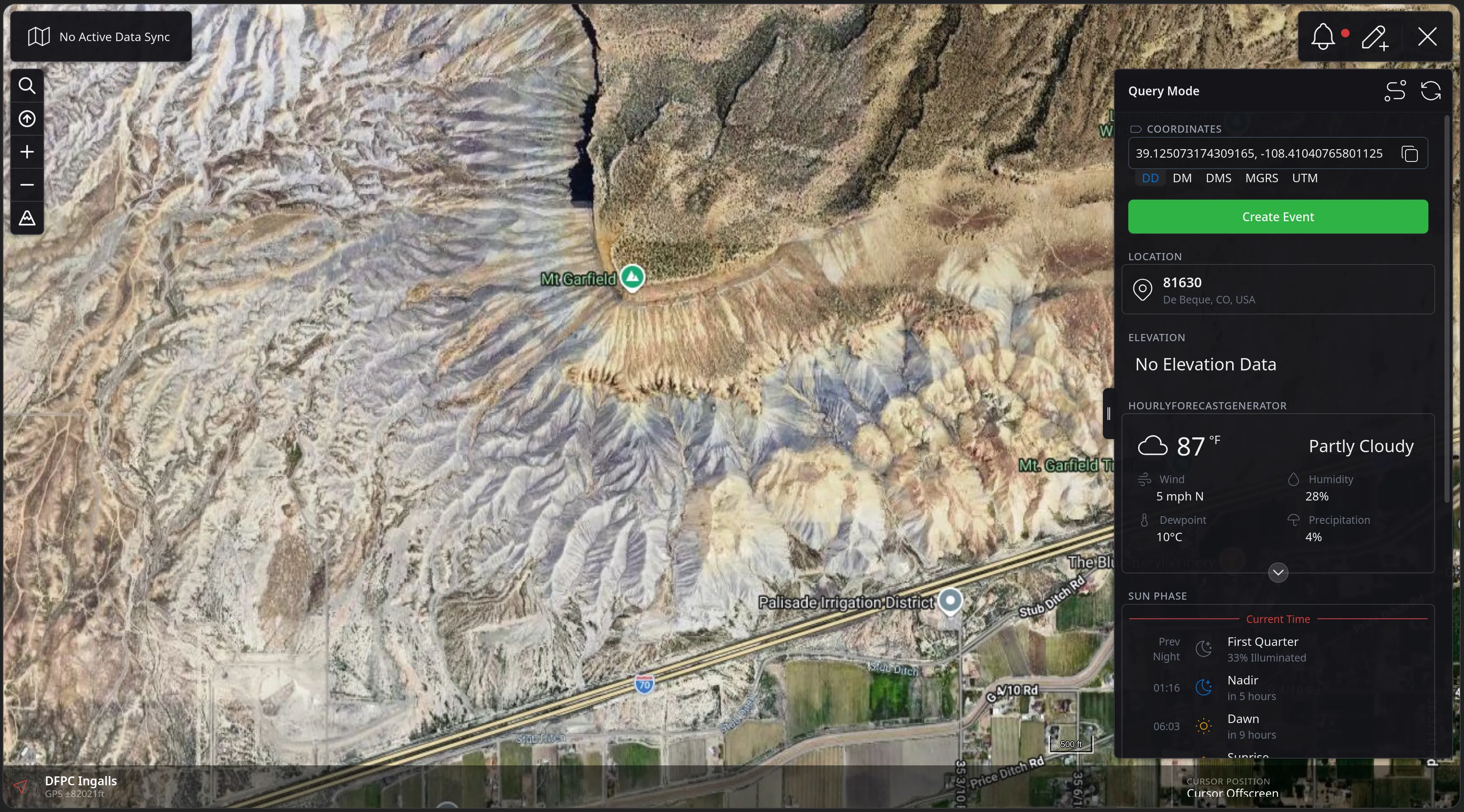
Events are shareable, taskable points of interest. Create one anywhere on the map, share it to your channels, and nominate it to a channel's Event Board — a Kanban-style board where coordinators drag events through the stages of a response.

The next eleven slides take an injured hiker from a point on the map to a managed event on the board.
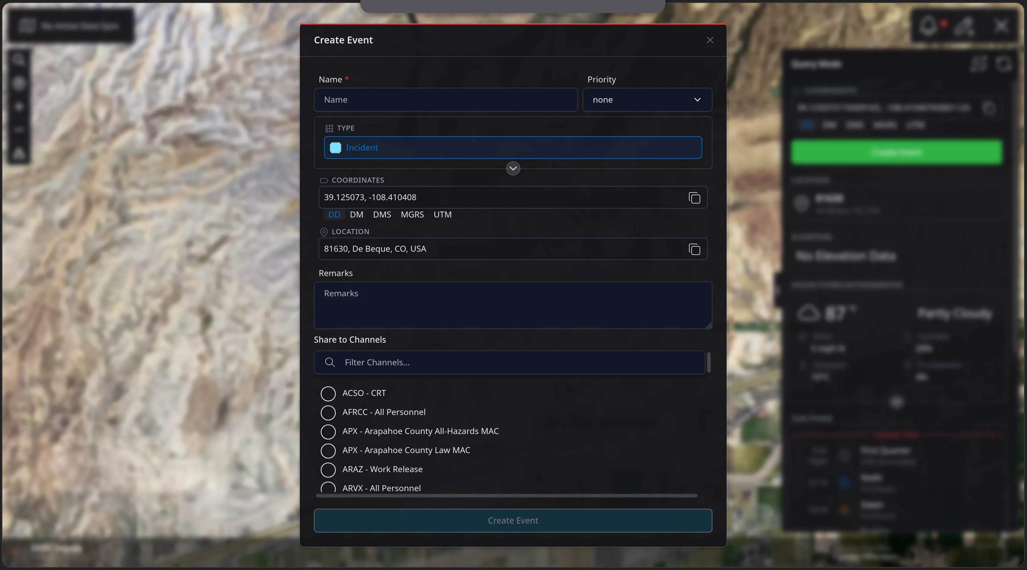
Feature Walkthrough · 04 — Event Boards · 1/11
The CloudTAK map over Mt Garfield with the Query Mode panel open, showing the queried coordinates, a green Create Event button, a reverse-geocoded location of 81630 De Beque, CO, USA, an hourly forecast of 87 degrees and Partly Cloudy, and the sun phase timeline.
Feature Walkthrough · 04 — Event Boards · 2/11
The Create Event dialog with Name and Priority fields, a Type of Incident, the coordinates and reverse-geocoded location carried in from Query Mode, a Remarks box, and a Share to Channels filter listing channels such as ACSO - CRT and AFRCC - All Personnel.
Feature Walkthrough · 04 — Event Boards · 3/11
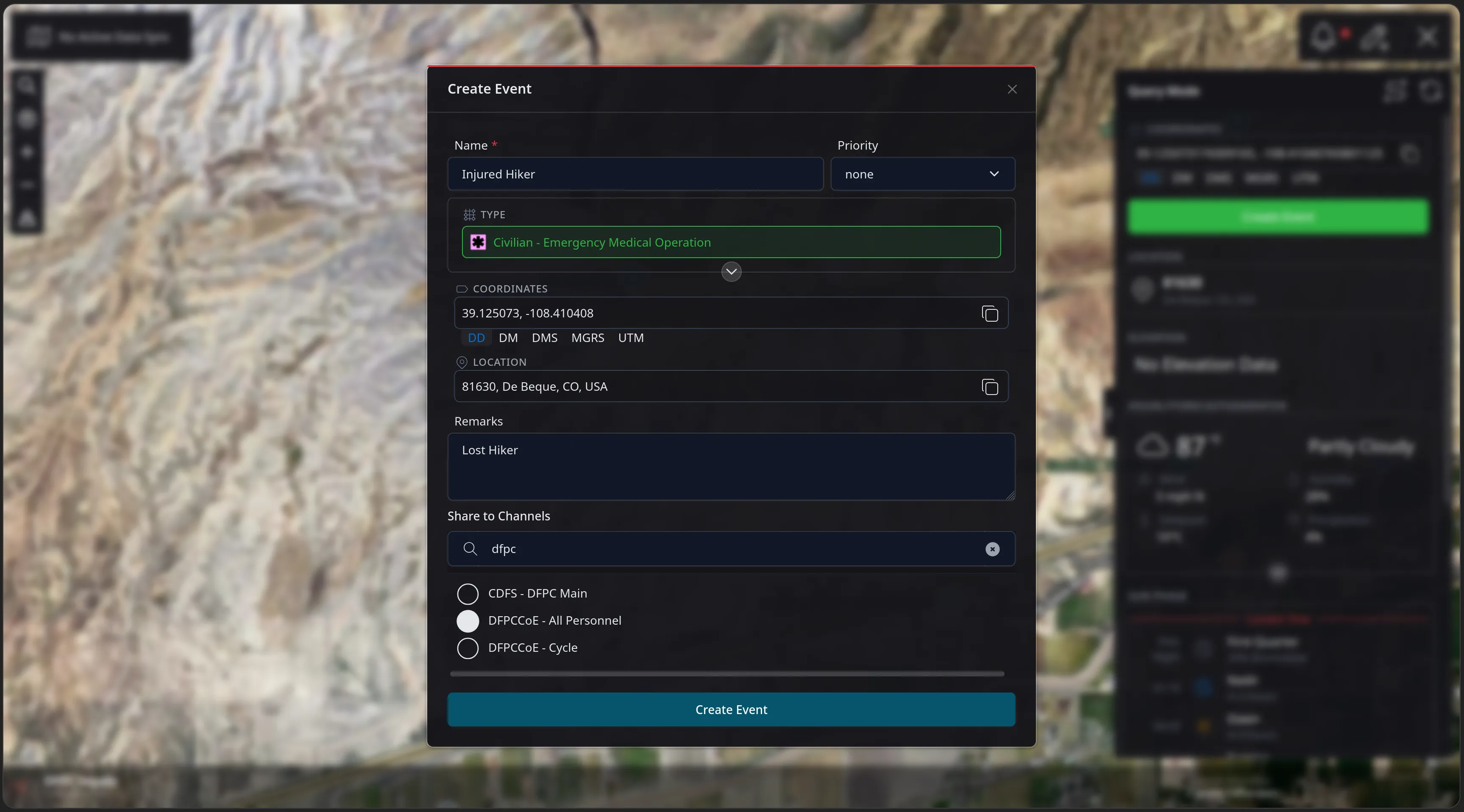
The Create Event dialog filled out: named Injured Hiker, the type changed to Civilian - Emergency Medical Operation, remarks reading Lost Hiker, and the DFPCCoE - All Personnel channel selected for sharing.
Feature Walkthrough · 04 — Event Boards · 4/11
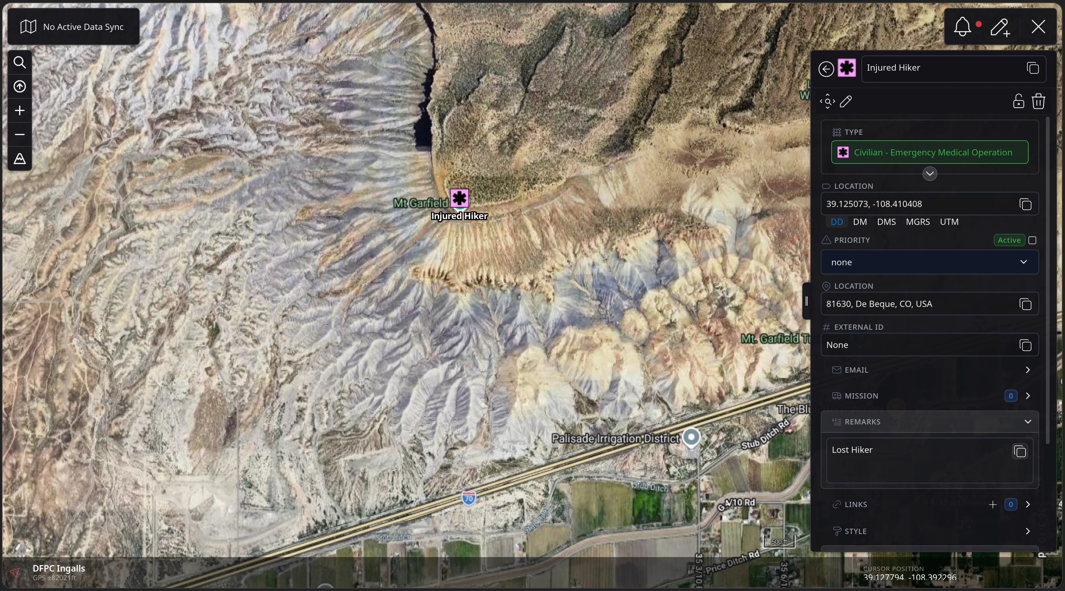
The created Injured Hiker event drawn on the map below Mt Garfield with its pink medical symbol, and its detail panel showing the type, an Active priority toggle, the location, an External ID row, and the Lost Hiker remarks.
Feature Walkthrough · 04 — Event Boards · 5/11
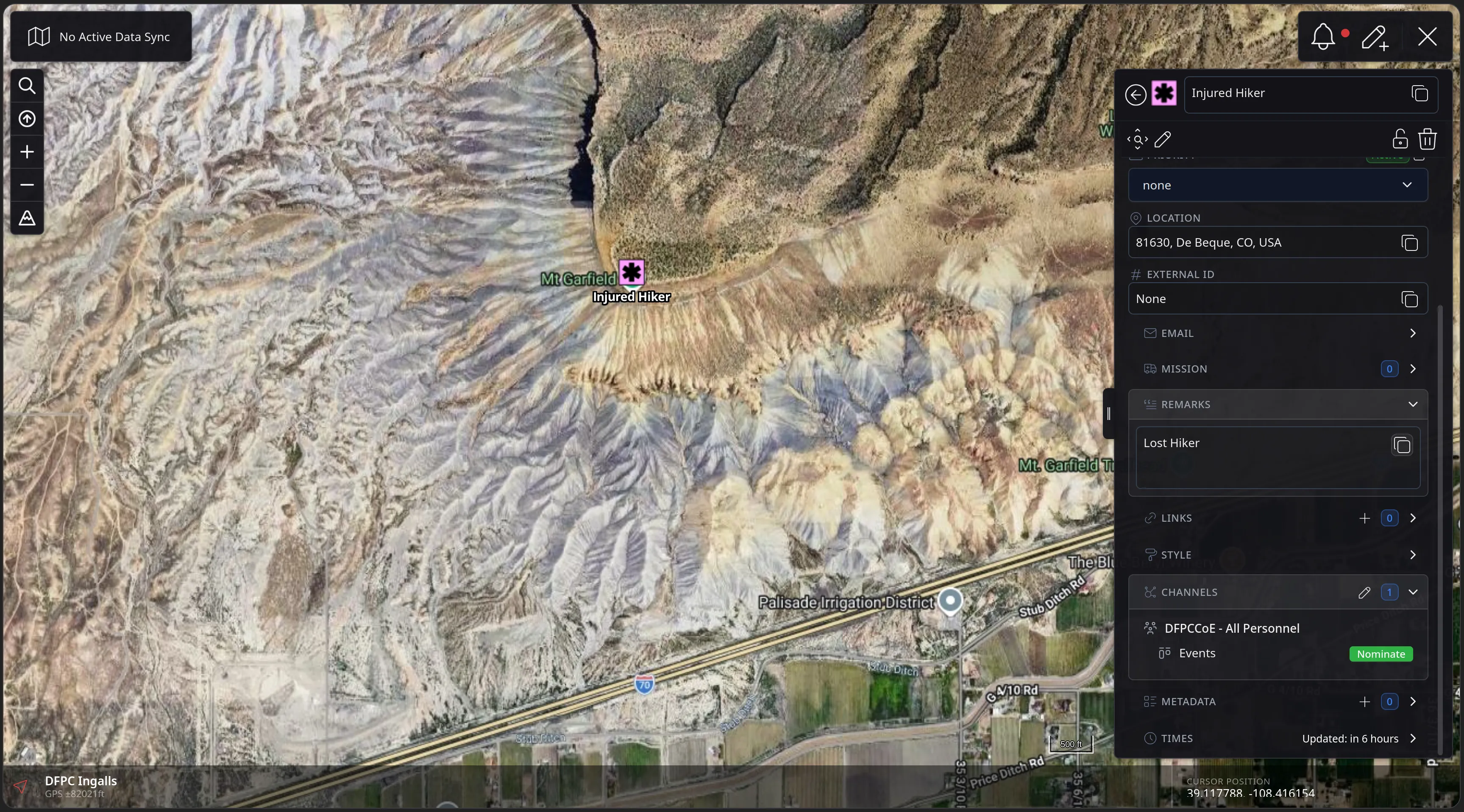
The event detail panel scrolled to the CHANNELS section, showing the event shared to DFPCCoE - All Personnel with its Events board listed and a green Nominate button beside it.
Feature Walkthrough · 04 — Event Boards · 6/11
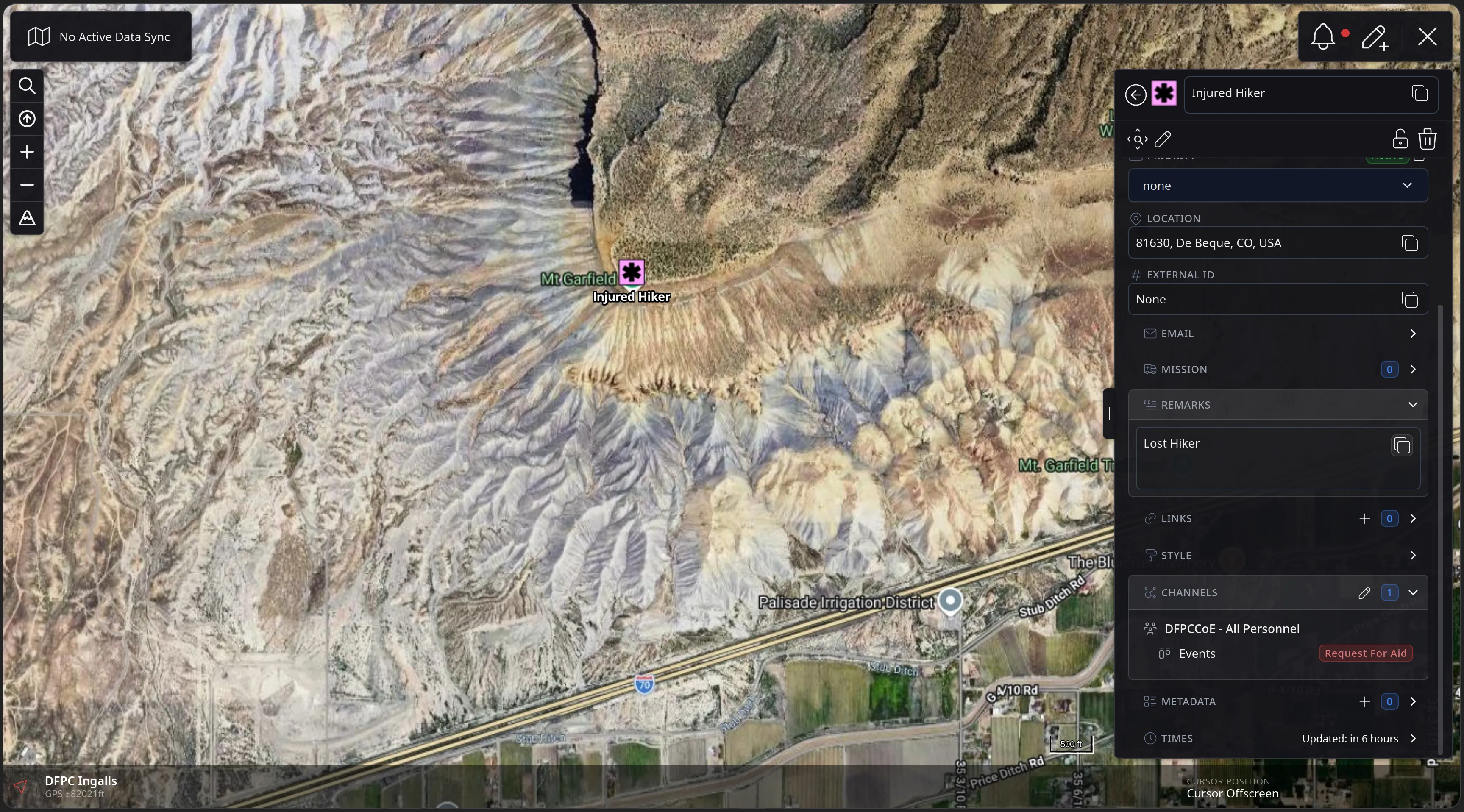
The same CHANNELS section after nominating: the Events board entry now reads Request For Aid in red, placing the event in the board's intake column.
Feature Walkthrough · 04 — Event Boards · 7/11
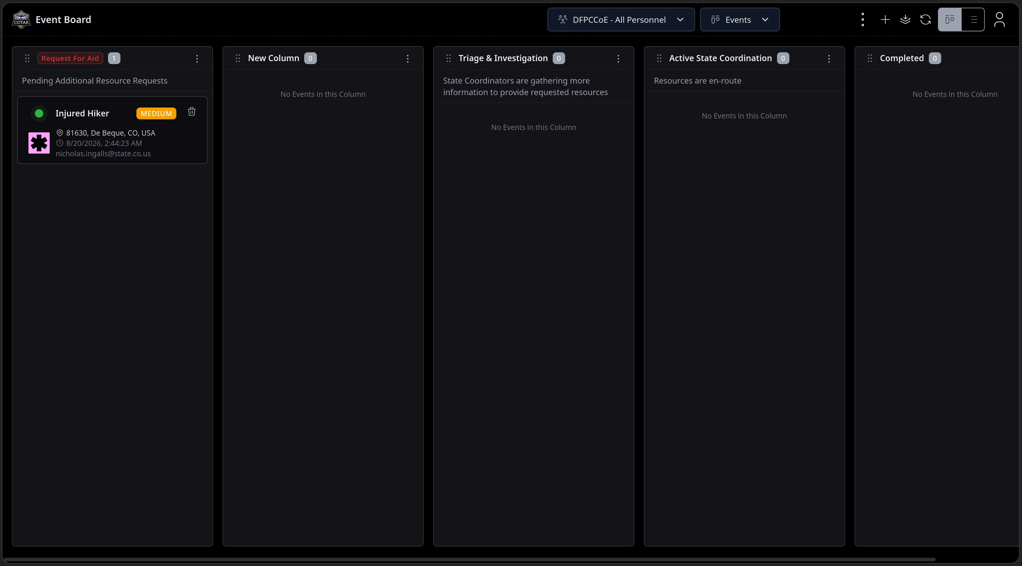
The Event Board app for the DFPCCoE - All Personnel channel with Kanban columns Request For Aid, New Column, Triage and Investigation, Active State Coordination and Completed - the Injured Hiker card sitting in Request For Aid with a MEDIUM priority chip, its location, timestamp and creator.
Feature Walkthrough · 04 — Event Boards · 8/11
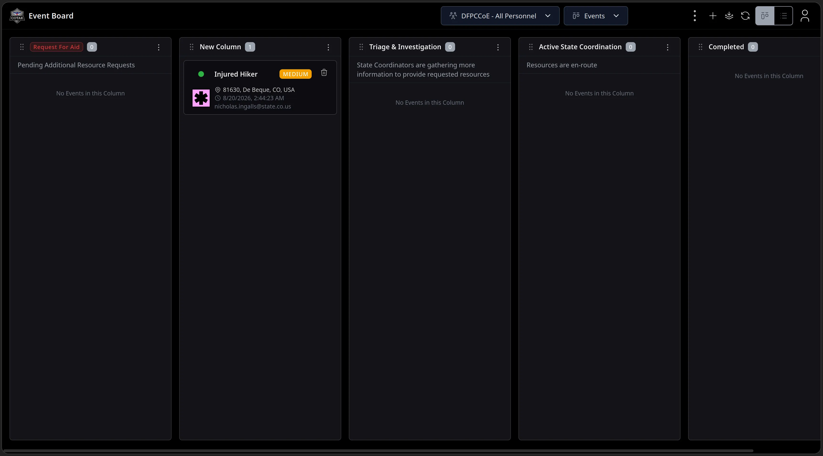
The board after triage: the Injured Hiker card has been moved out of Request For Aid into the next column, and the Request For Aid count has dropped to zero.
Feature Walkthrough · 04 — Event Boards · 9/11
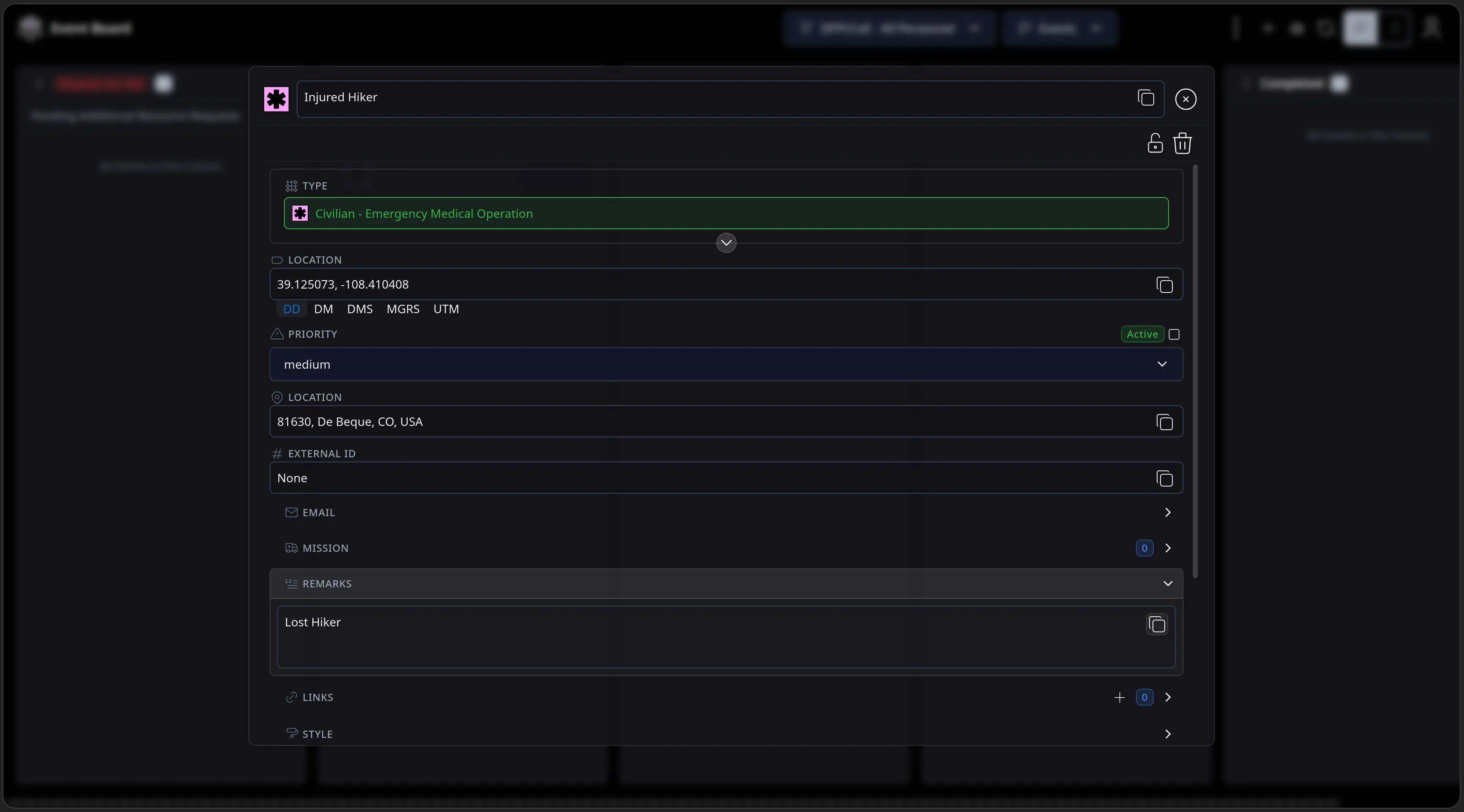
The Injured Hiker card opened from the board into a full edit panel - type, coordinates, a priority of medium, location, external ID and remarks all editable without leaving the board.
Feature Walkthrough · 04 — Event Boards · 10/11
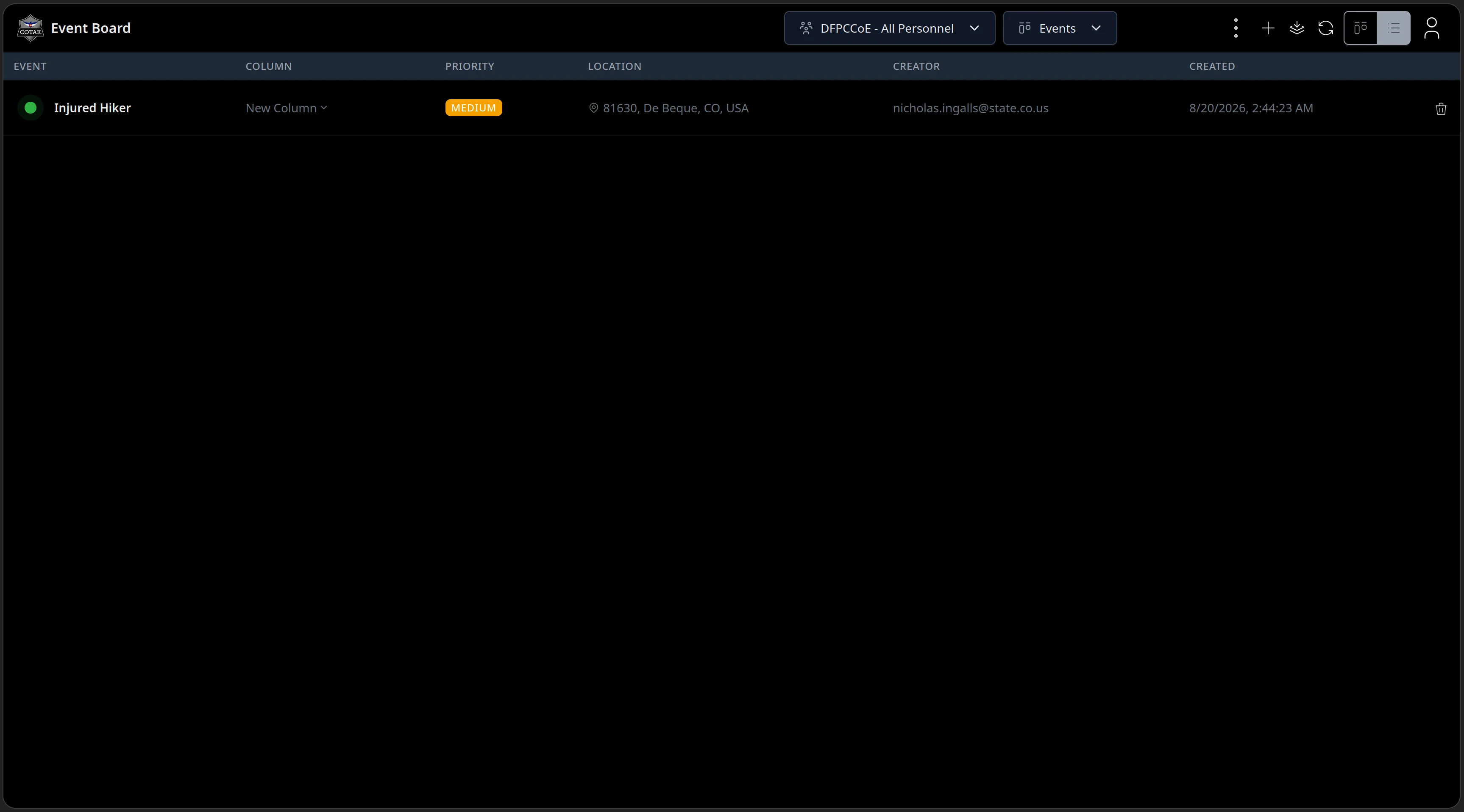
The same board in list view: a table of events with columns for Event, Column, Priority, Location, Creator and Created, listing Injured Hiker with its MEDIUM chip and creator nicholas.ingalls@state.co.us.
Feature Walkthrough · 04 — Event Boards · 11/11
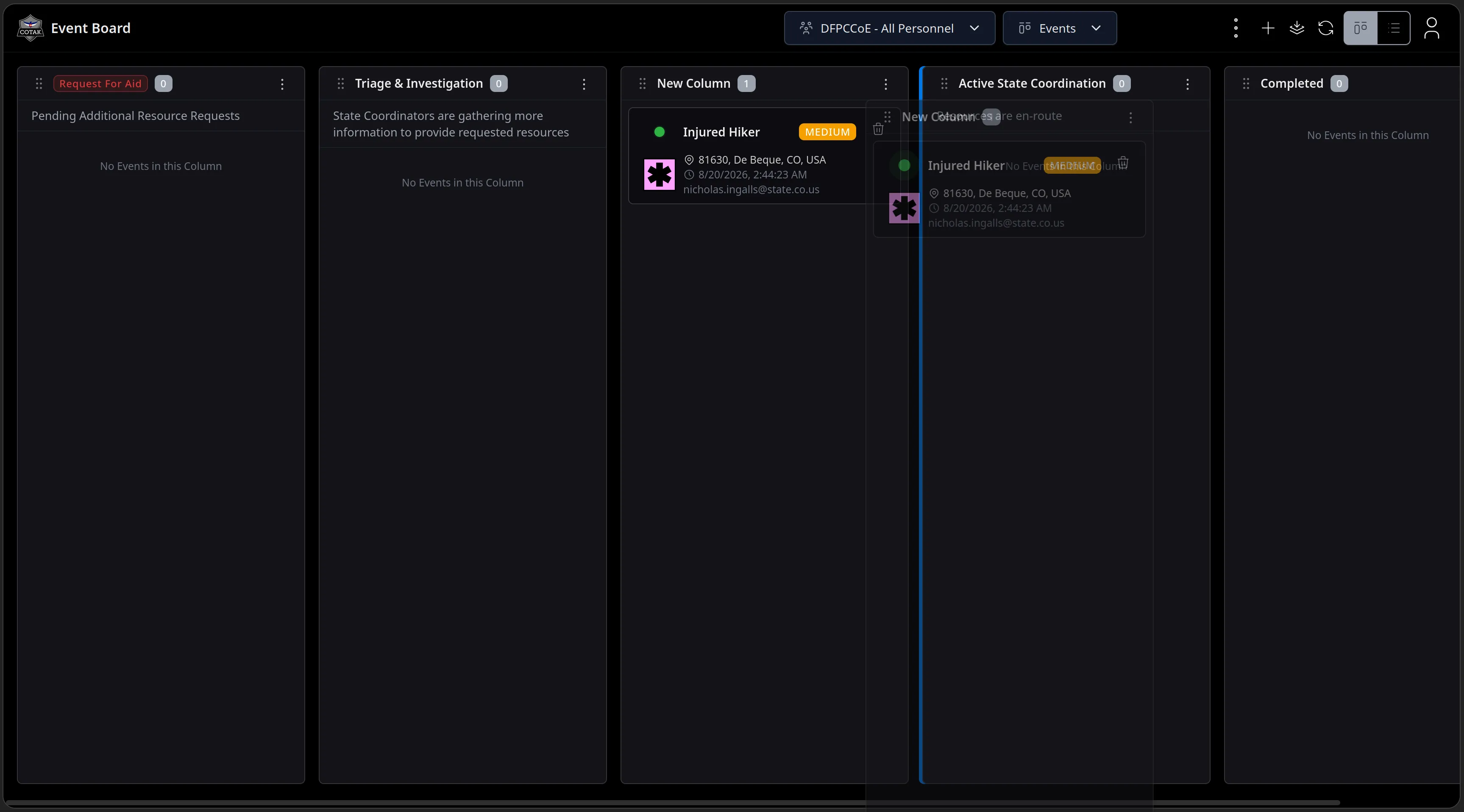
The Injured Hiker card mid-drag between Kanban columns, its ghost following the cursor with a blue drop indicator on the Active State Coordination column.
Feature Walkthrough · 05 — Data Sync

Data Sync

Data Sync has seen the most rapid evolution of any CloudTAK feature. Data Sync now supports Chat, full Mission Logs support, & Mission Layers.

An active data sync can also be selected giving the user quick access to data sync functionality directly from the map.

The next ten slides run a live SAR mission end to end inside a Data Sync.
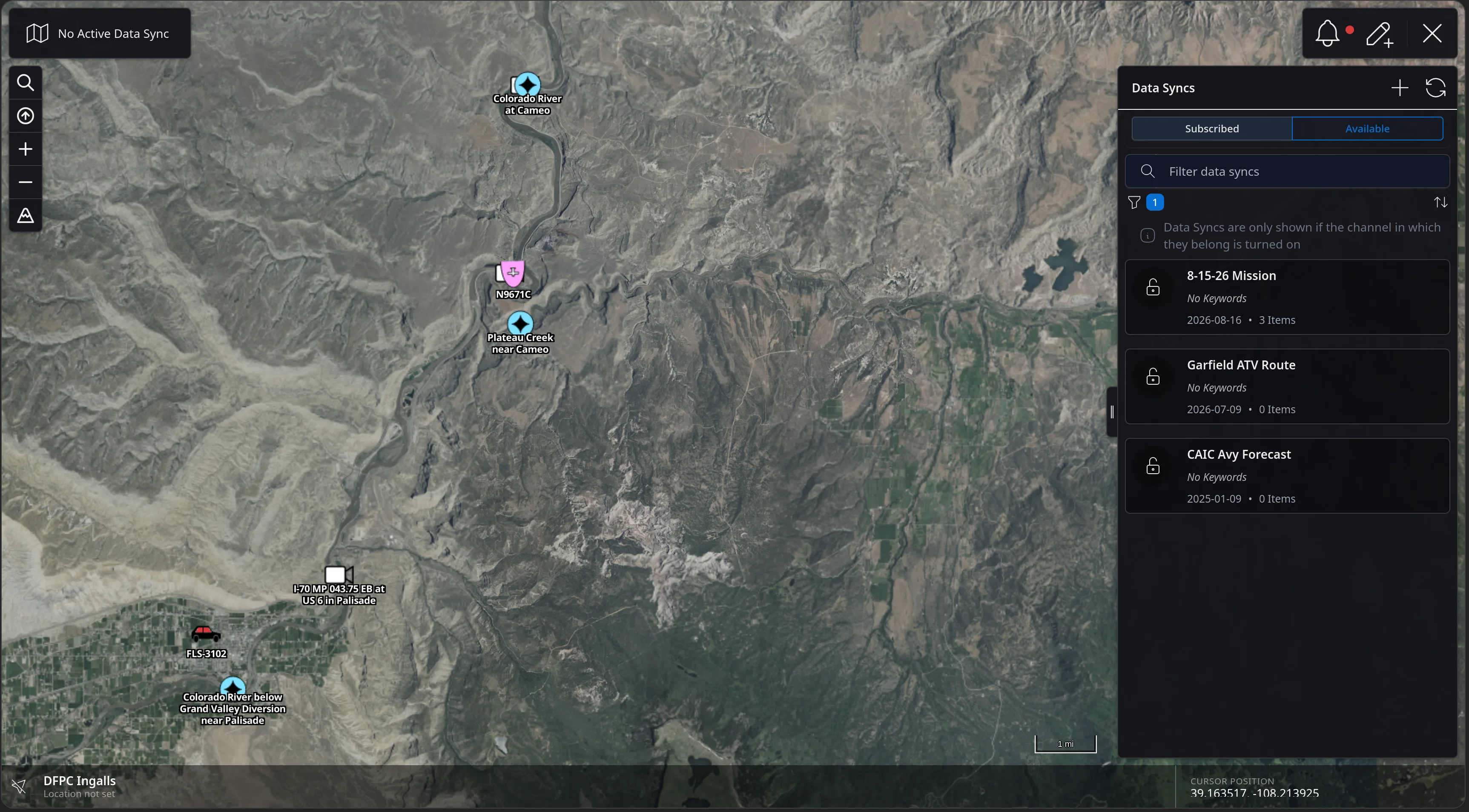
Feature Walkthrough · 05 — Data Sync · 1/10
The CloudTAK map over the Colorado River near Palisade with the Data Syncs panel open on the right, Subscribed and Available tabs, a filter box, and three Data Syncs listed: 8-15-26 Mission with 3 items, Garfield ATV Route, and CAIC Avy Forecast.
Feature Walkthrough · 05 — Data Sync · 2/10
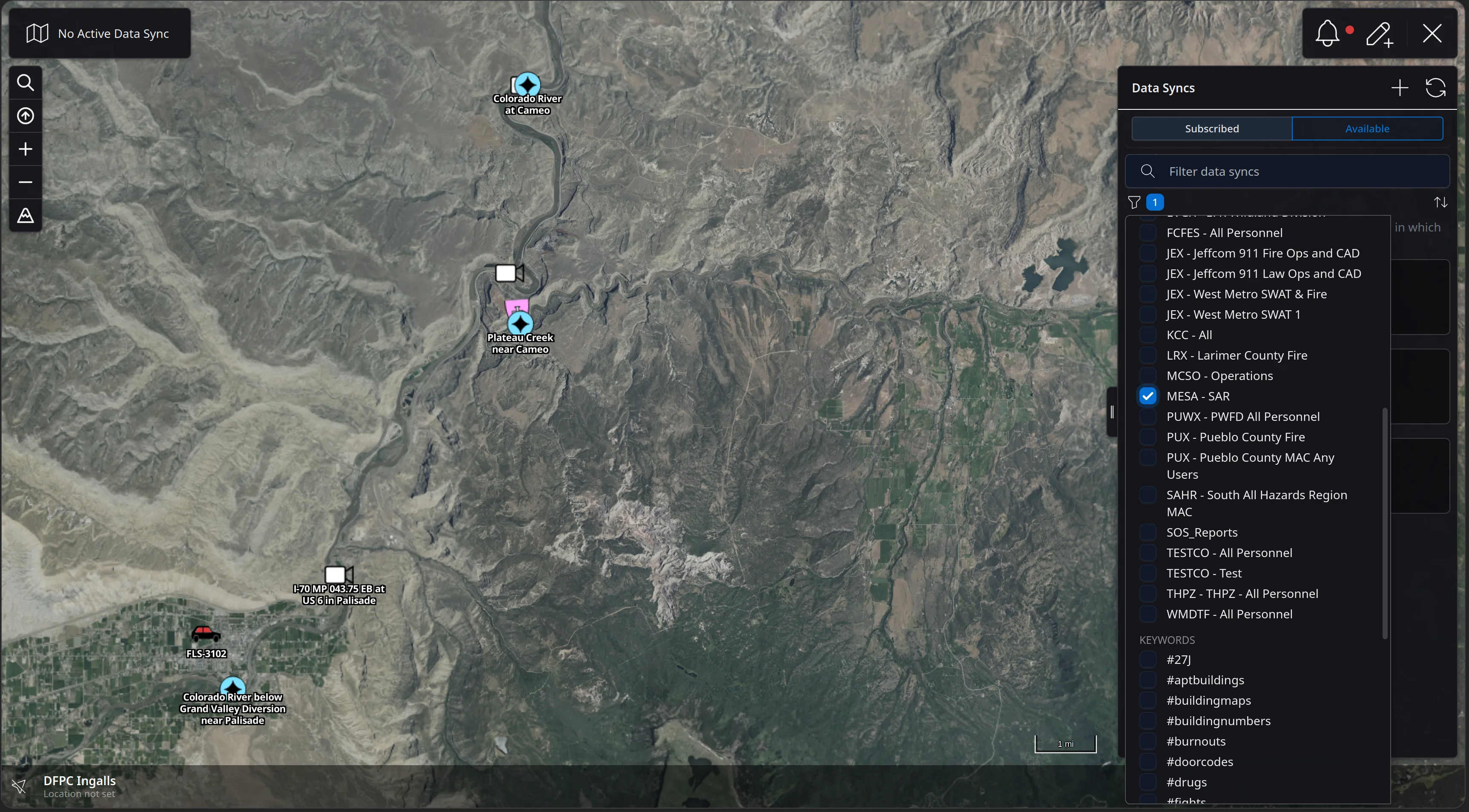
The Data Syncs panel with its filter dropdown open, listing channels such as FCFES, JEX Jeffcom 911 Fire Ops and CAD, LRX Larimer County Fire, MCSO Operations and MESA - SAR, with MESA - SAR checked, and a KEYWORDS section below listing tags such as #buildingmaps and #doorcodes.
Feature Walkthrough · 05 — Data Sync · 3/10
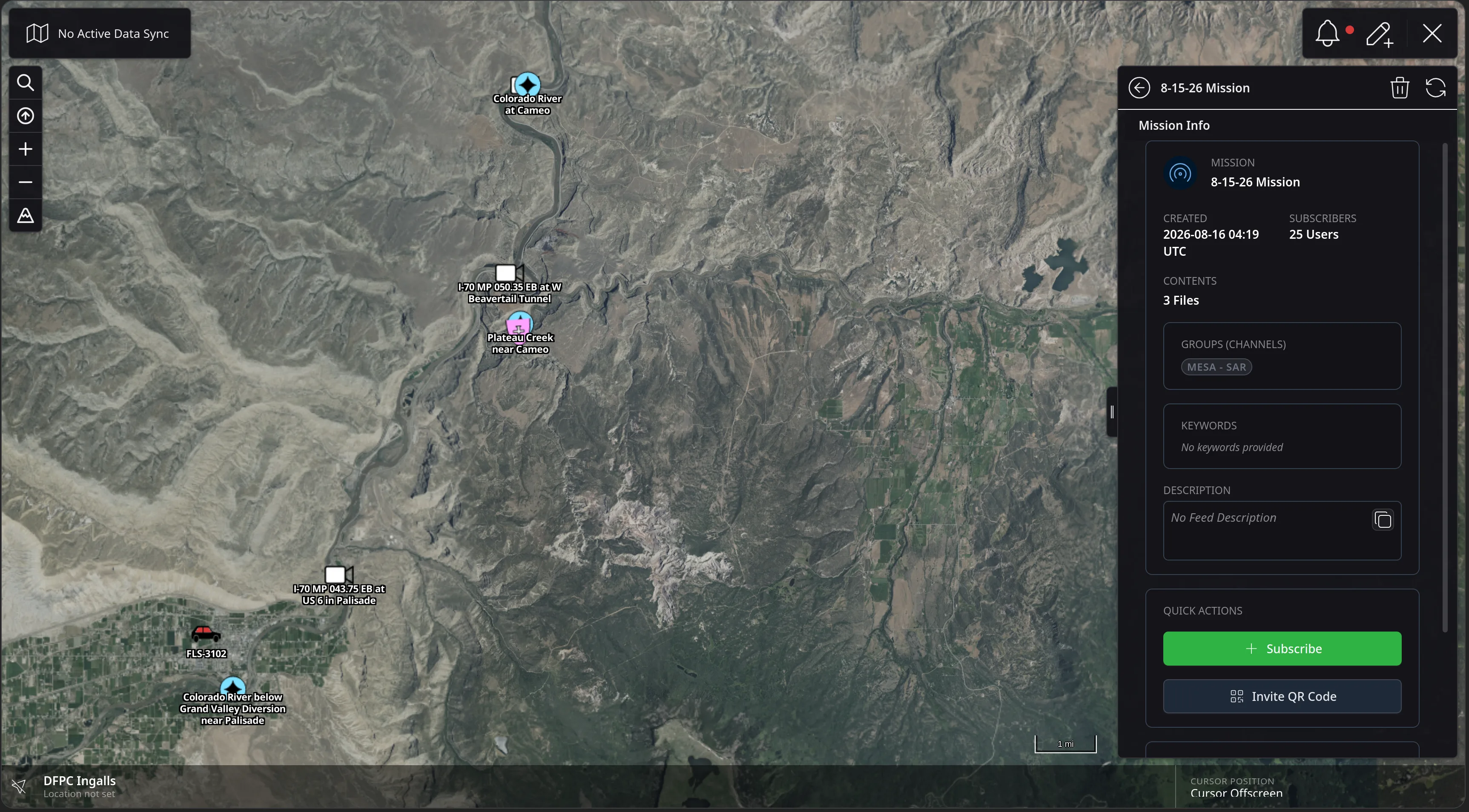
The Mission Info panel for 8-15-26 Mission showing created 2026-08-16 04:19 UTC, 25 subscribers, contents of 3 files, a GROUPS (CHANNELS) row reading MESA - SAR, an empty KEYWORDS box, a DESCRIPTION box reading No Feed Description, and Quick Actions with a green Subscribe button and Invite QR Code.
Feature Walkthrough · 05 — Data Sync · 4/10
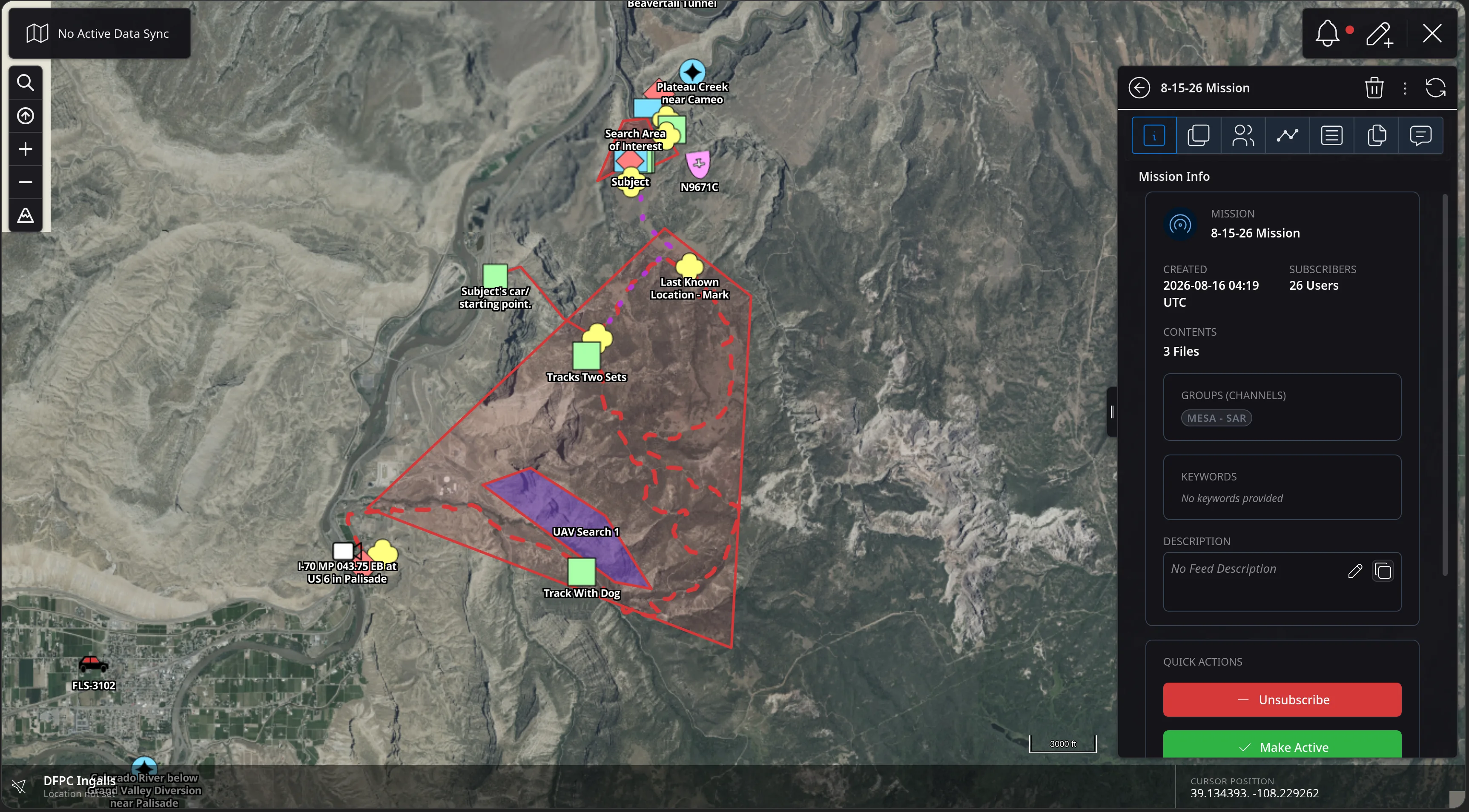
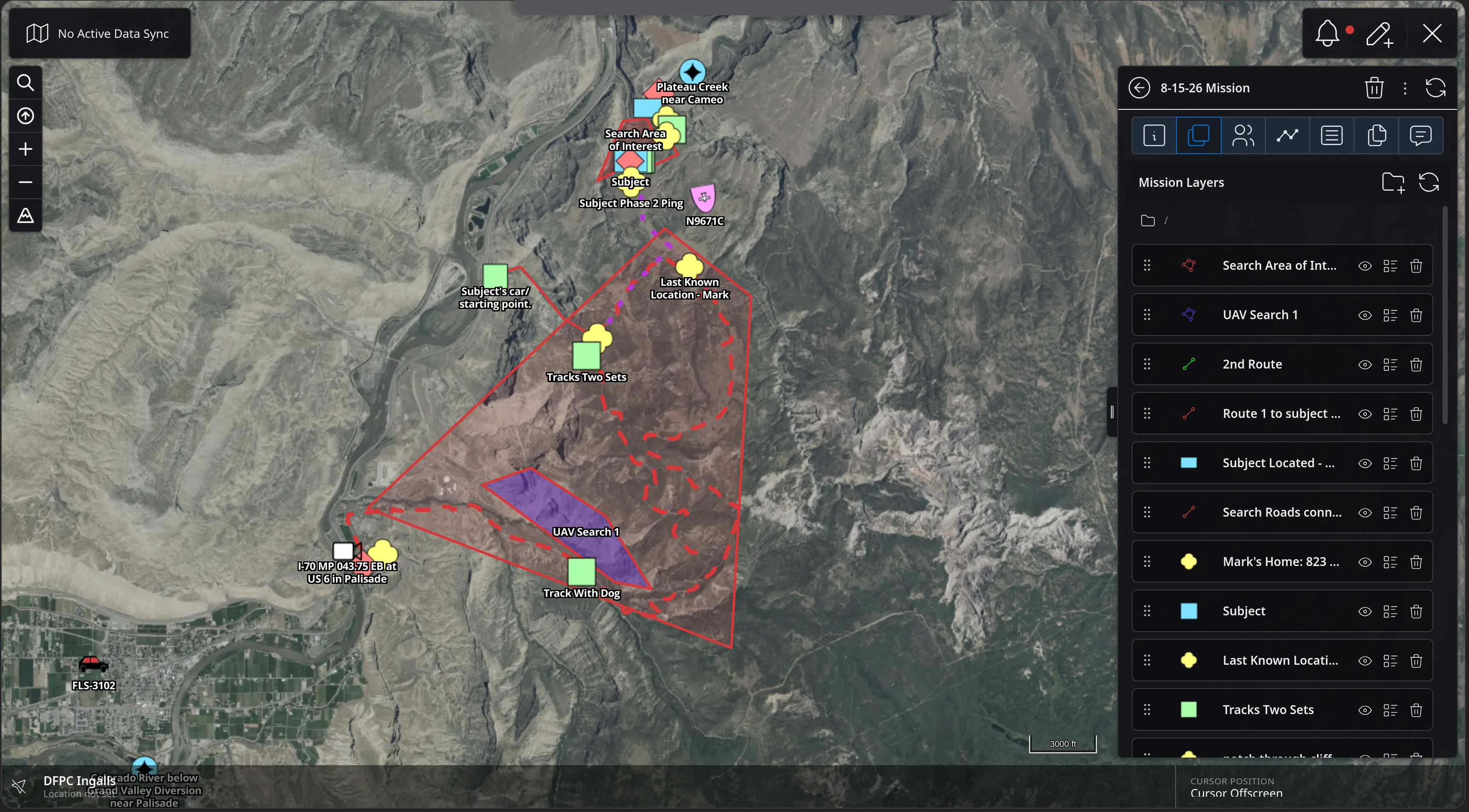
The same mission after subscribing: the map now draws the mission contents - a red Search Area of Interest polygon, a purple UAV Search 1 box, tracks, Last Known Location and Subject markers - and the panel gains a tab strip with 26 subscribers, an editable description, and Quick Actions offering Unsubscribe and Make Active.
Feature Walkthrough · 05 — Data Sync · 5/10
The Mission Layers tab listing the mission's layers - Search Area of Interest, UAV Search 1, 2nd Route, Route 1 to subject, Subject Located, Search Roads, Mark's Home, Subject, Last Known Location and Tracks Two Sets - each with a symbol, a visibility eye, a list control and a delete control.
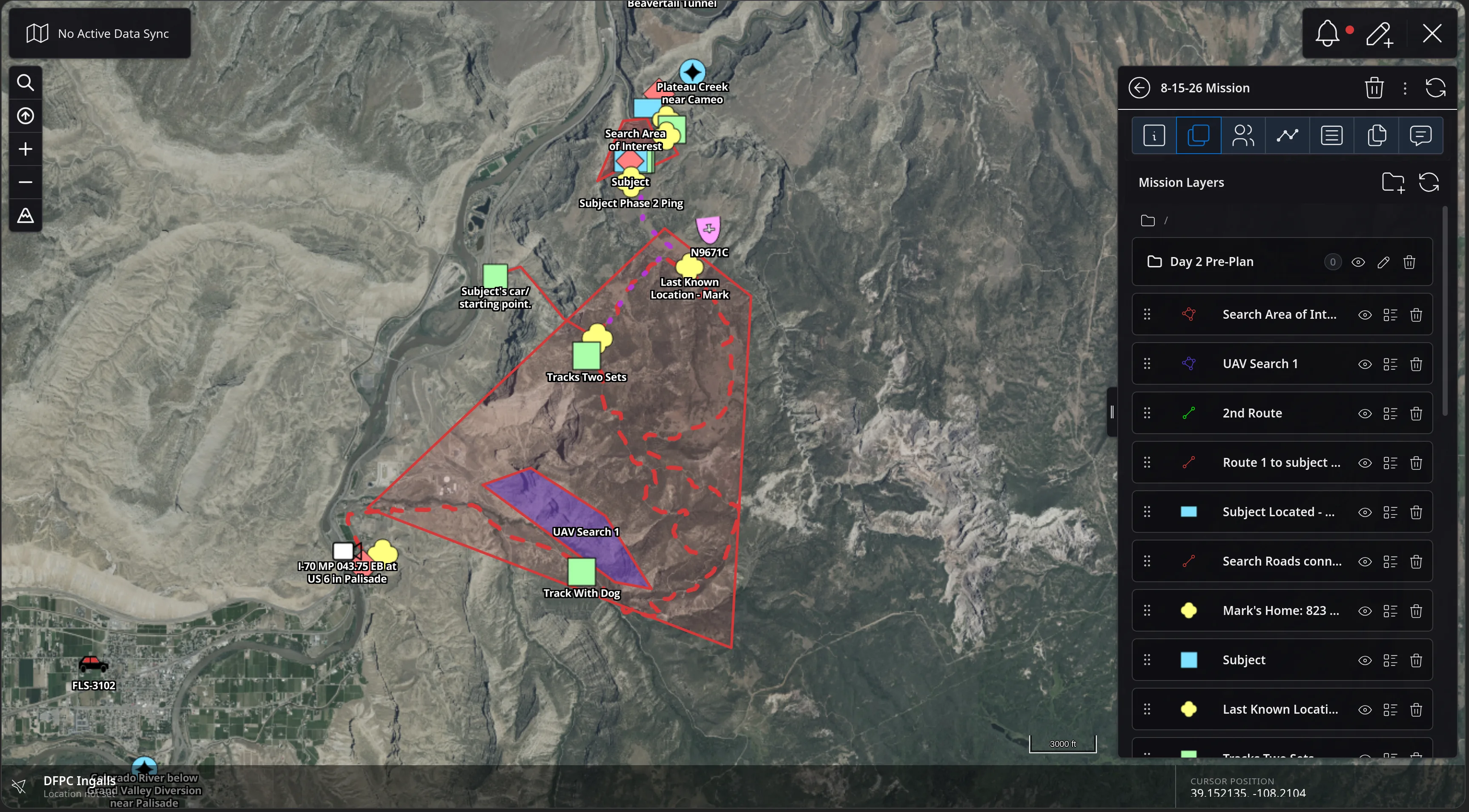
Feature Walkthrough · 05 — Data Sync · 6/10
The Mission Layers list with a new folder named Day 2 Pre-Plan created at the top of the list, holding 0 items, above the existing Search Area of Interest, UAV Search 1, 2nd Route and other layers.
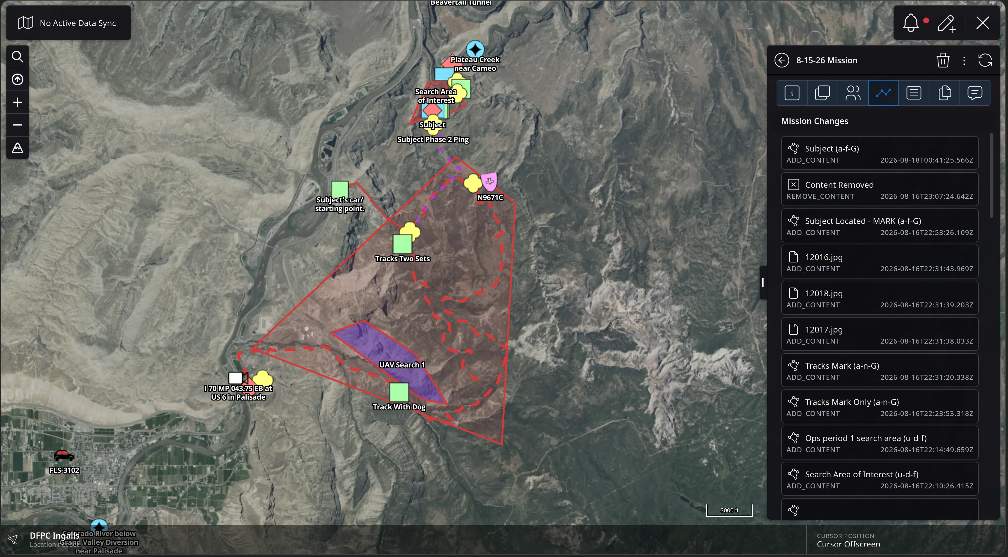
Feature Walkthrough · 05 — Data Sync · 7/10
The Mission Changes tab listing a timestamped audit trail: Subject ADD_CONTENT, Content Removed REMOVE_CONTENT, Subject Located - MARK, three photo files 12016.jpg, 12018.jpg and 12017.jpg, Tracks Mark, Ops period 1 search area and Search Area of Interest, each with a UTC timestamp.
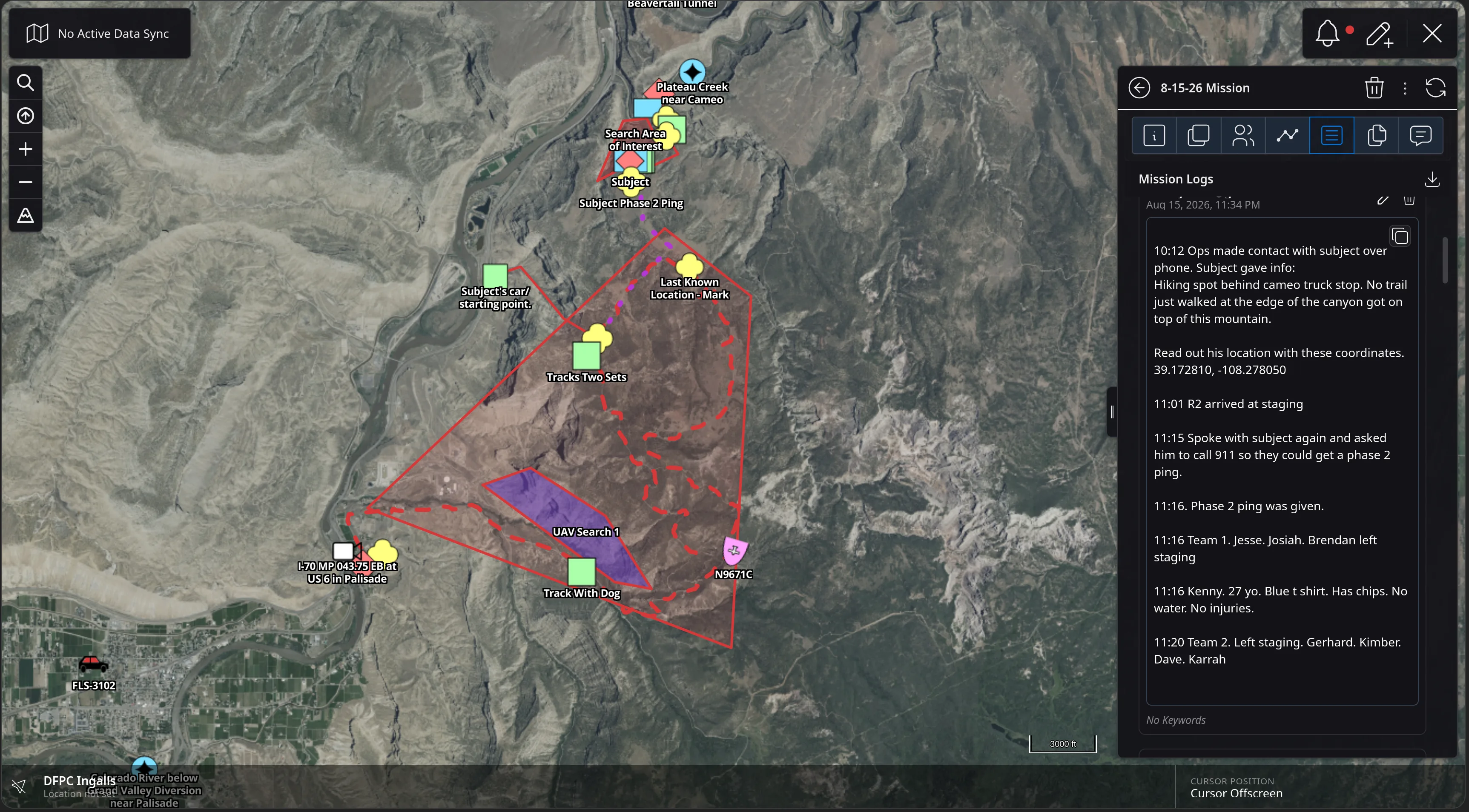
Feature Walkthrough · 05 — Data Sync · 8/10
The Mission Logs tab showing a log entry dated Aug 15, 2026, 11:34 PM with a timestamped narrative: ops contact with the subject by phone, the coordinates he read out, R2 arriving at staging, a 911 phase 2 ping being requested and given, and teams leaving staging with names and subject description.
Feature Walkthrough · 05 — Data Sync · 9/10
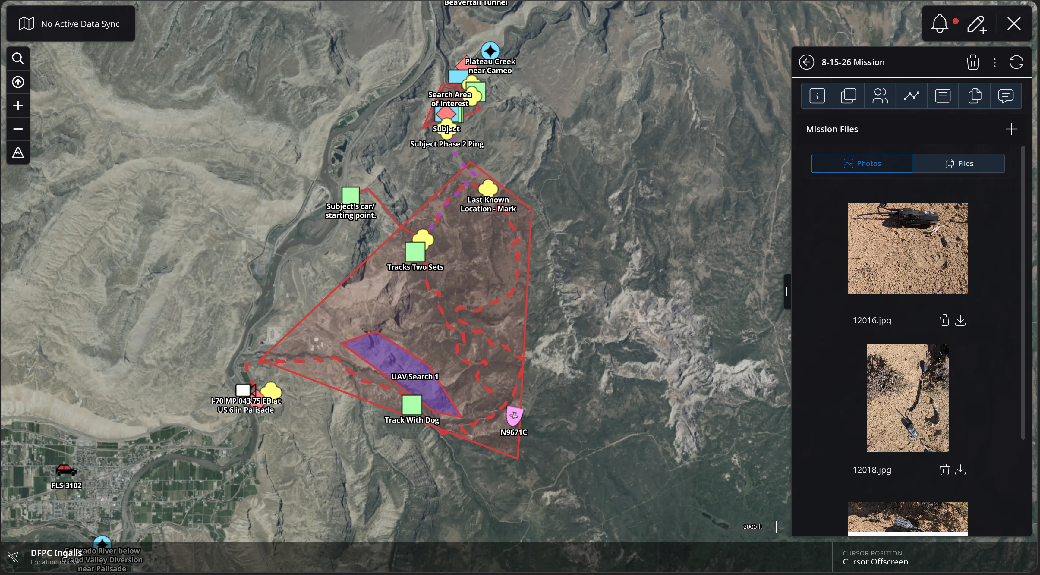
The Mission Files tab with Photos and Files sub-tabs, showing field photographs 12016.jpg and 12018.jpg - boot prints and a discarded item in sand - each with delete and download controls.
Feature Walkthrough · 05 — Data Sync · 10/10
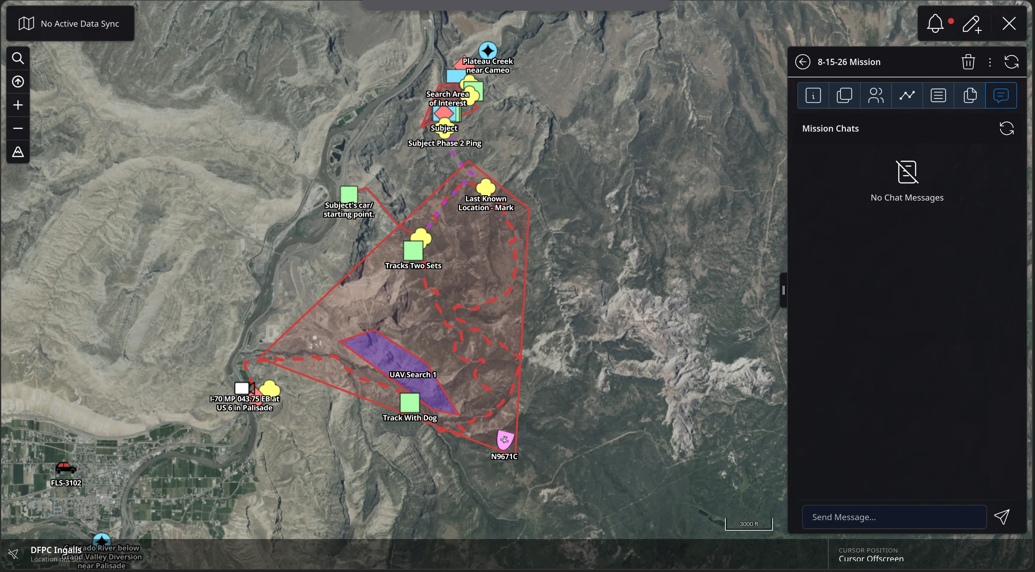
The Mission Chats tab, empty with a No Chat Messages placeholder and a Send Message box at the bottom, alongside the mission's search areas and markers still drawn on the map.
Feature Walkthrough · 06 — Mission Templates

Mission Templates

Mission Templates let you structure the data users generate in the field. That could be transcribing radio traffic into a Data Sync Log, or running a standard resource request flow inside a Data Sync.

A template also defines the field mapping experience — which fields a user is asked for, and how the resulting features are styled before they ever hit the map.

The next twelve slides build a SAR MEDEVAC template and use it to take structured radio traffic in the field.
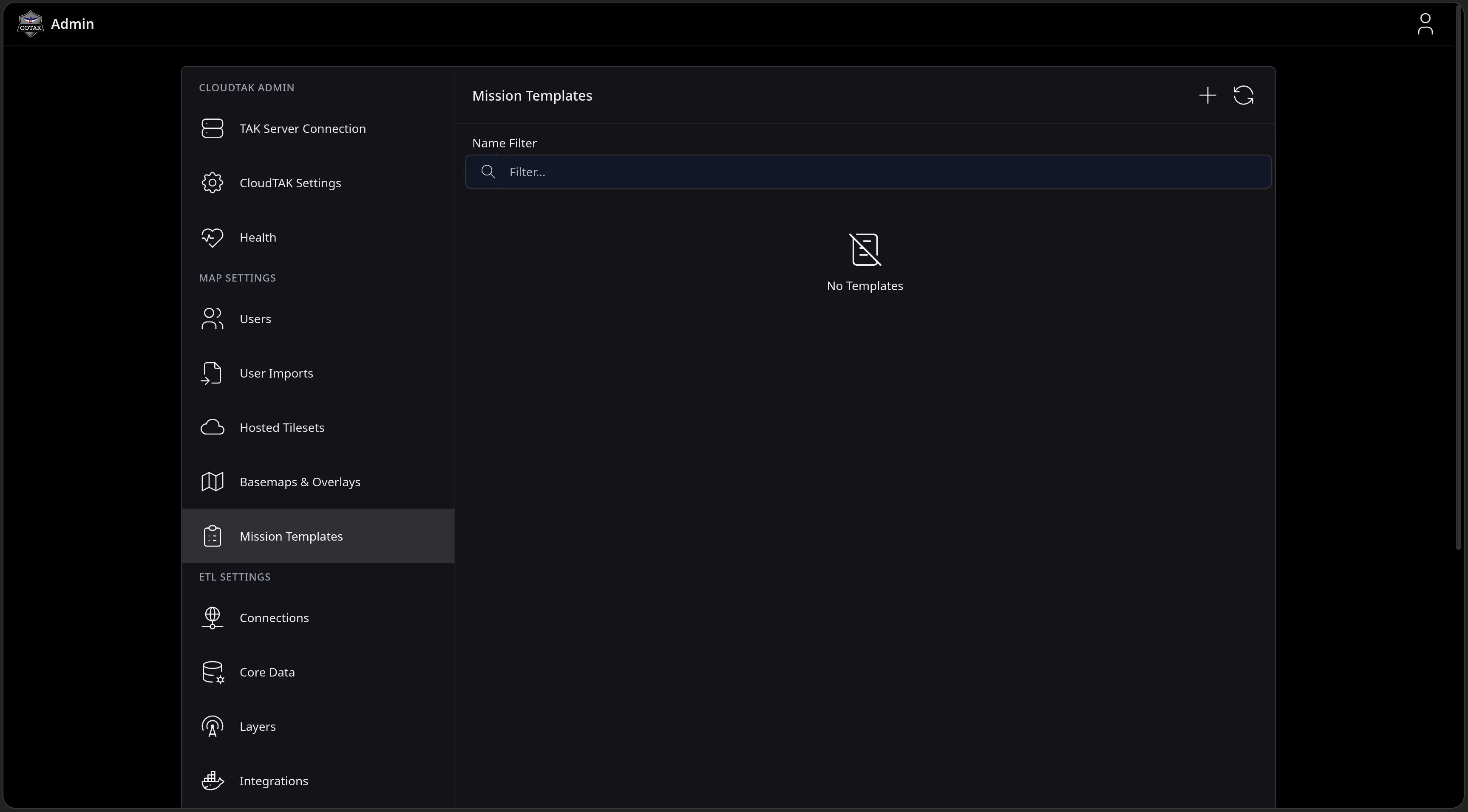
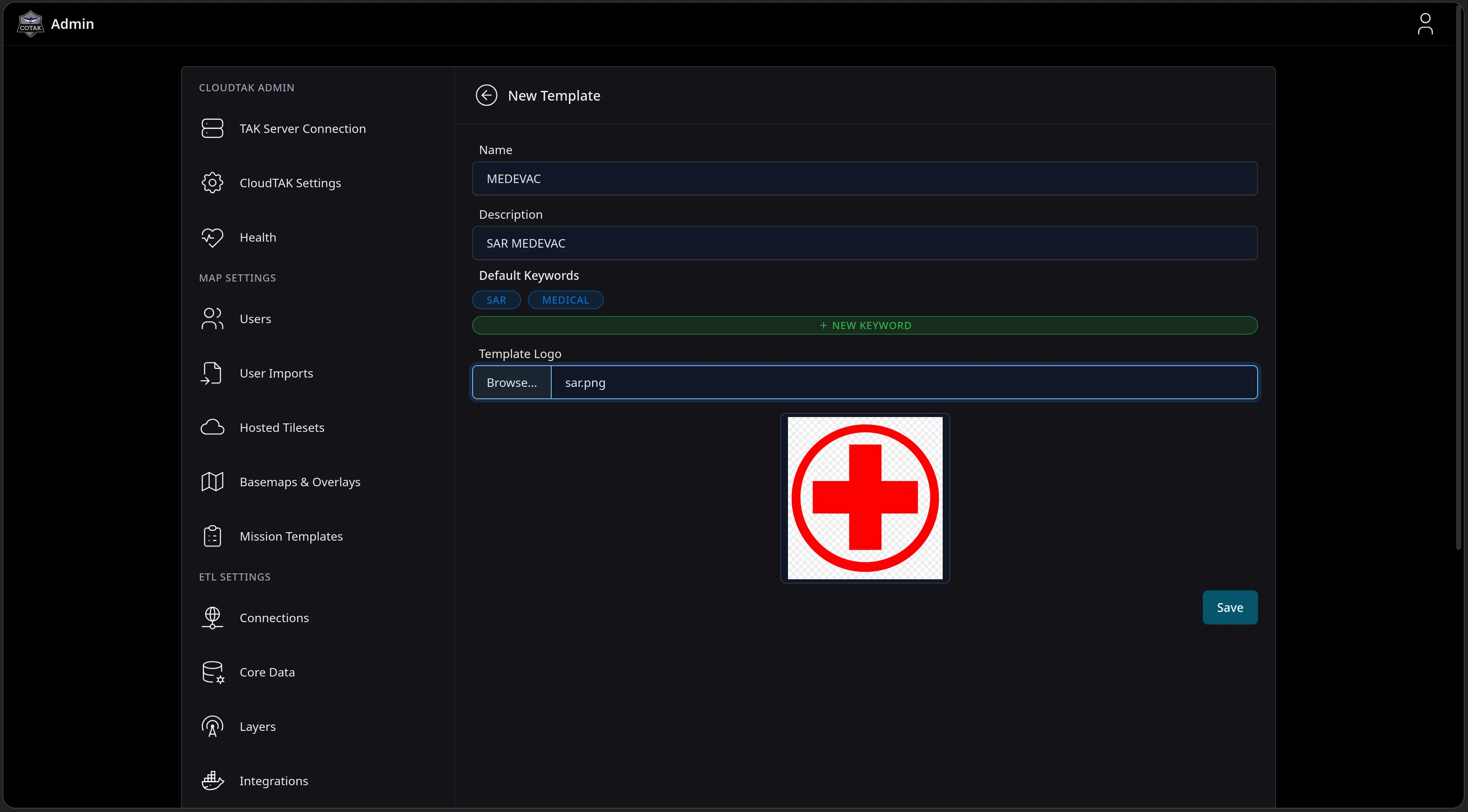
Feature Walkthrough · 06 — Mission Templates · 1/12
The CloudTAK Admin console on the new Mission Templates page under Map Settings, with a Name Filter box, a No Templates placeholder, and controls to add or refresh templates.
Feature Walkthrough · 06 — Mission Templates · 2/12
The New Template form in the Admin console with the Name MEDEVAC, a Description of SAR MEDEVAC, Default Keywords of SAR and MEDICAL with a New Keyword button, and an uploaded Template Logo showing a red cross in a circle.
Feature Walkthrough · 06 — Mission Templates · 3/12
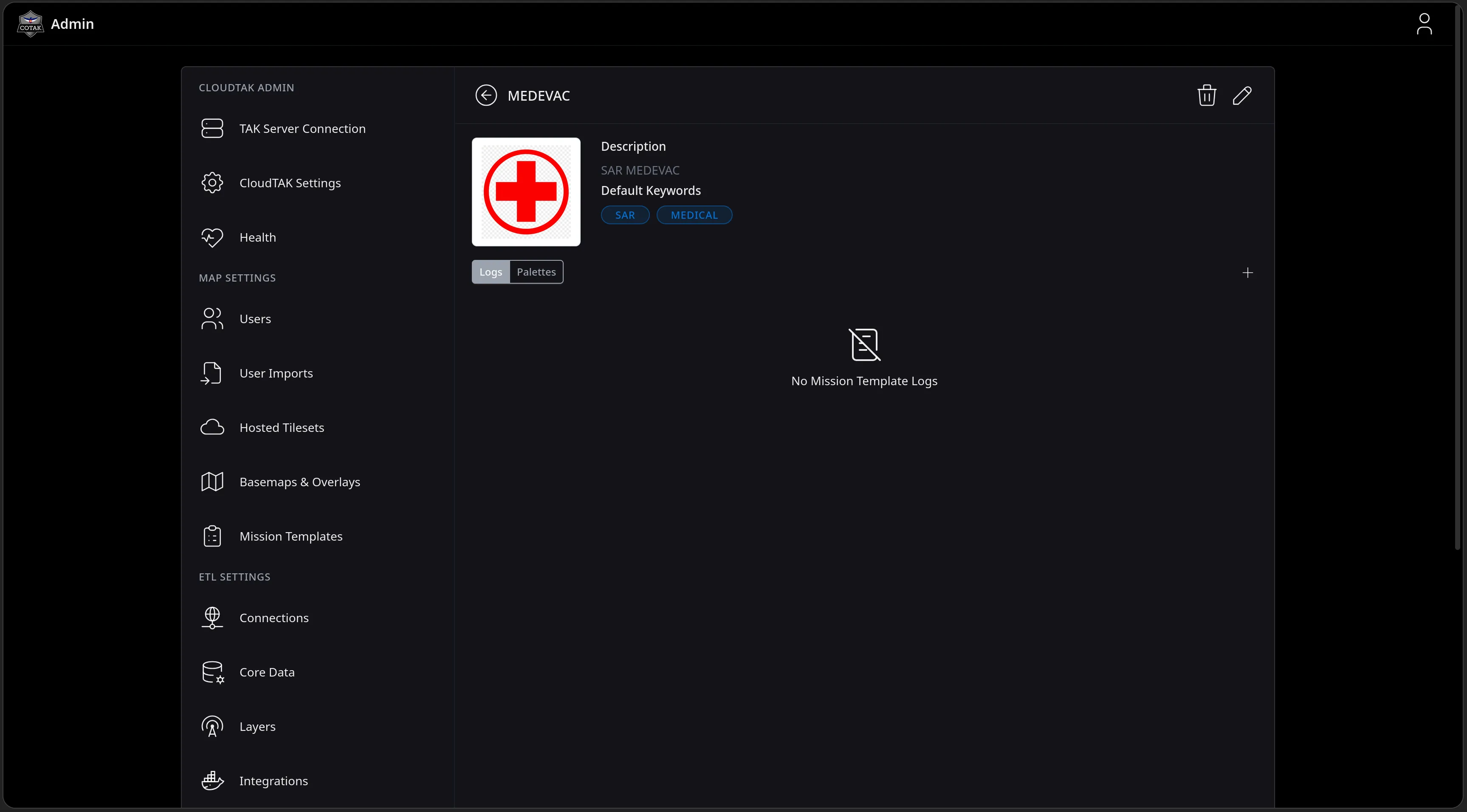
The saved MEDEVAC template's detail page showing its red cross logo, description, SAR and MEDICAL default keywords, and Logs and Palettes tabs with a No Mission Template Logs placeholder.
Feature Walkthrough · 06 — Mission Templates · 4/12
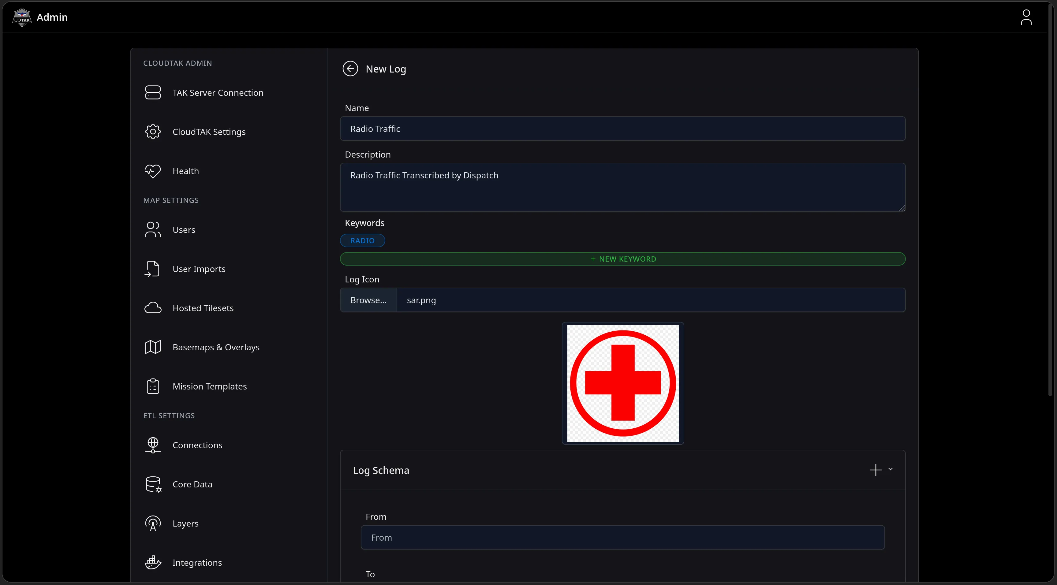
The New Log form for the template: Name Radio Traffic, Description Radio Traffic Transcribed by Dispatch, a RADIO keyword, a Log Icon upload, and the start of a Log Schema builder with From and To fields.
Feature Walkthrough · 06 — Mission Templates · 5/12
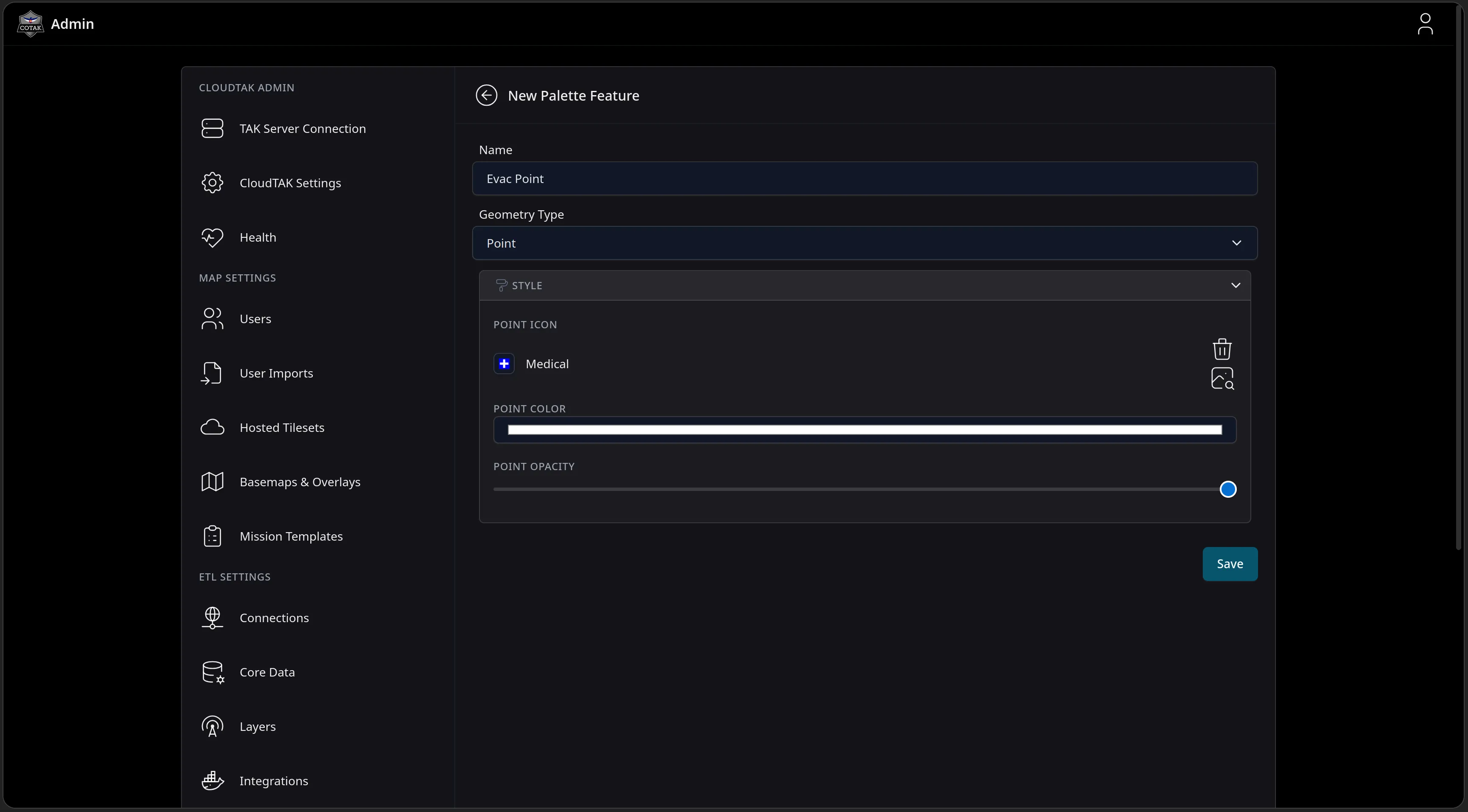
The New Palette Feature form: Name Evac Point, Geometry Type Point, and a Style section defining a Medical point icon, point color and point opacity - the styling applied before a templated feature ever hits the map.
Feature Walkthrough · 06 — Mission Templates · 6/12
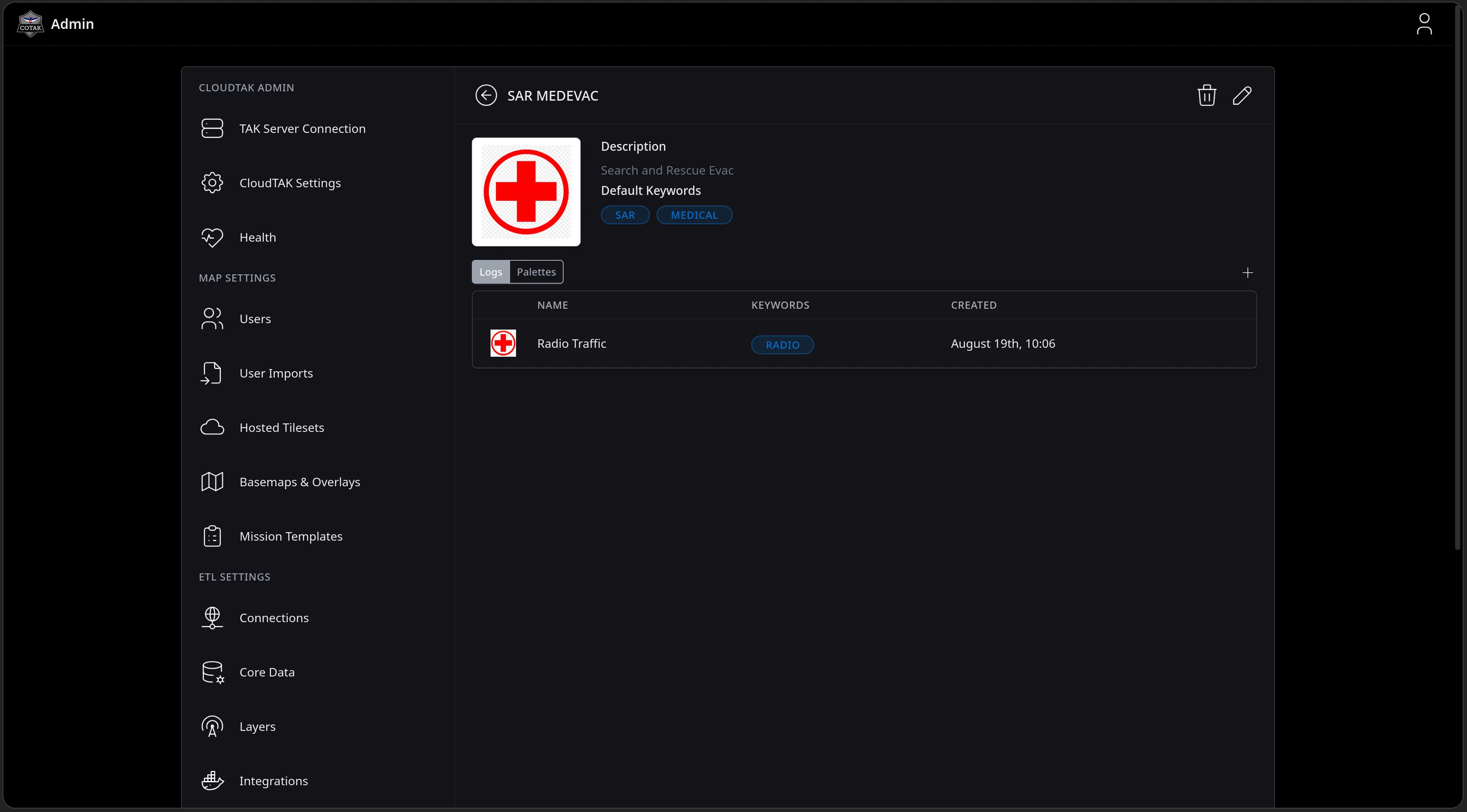
The finished SAR MEDEVAC template detail page with its Logs tab listing the Radio Traffic log, its RADIO keyword, and a created timestamp of August 19th, 10:06.
Feature Walkthrough · 06 — Mission Templates · 7/12
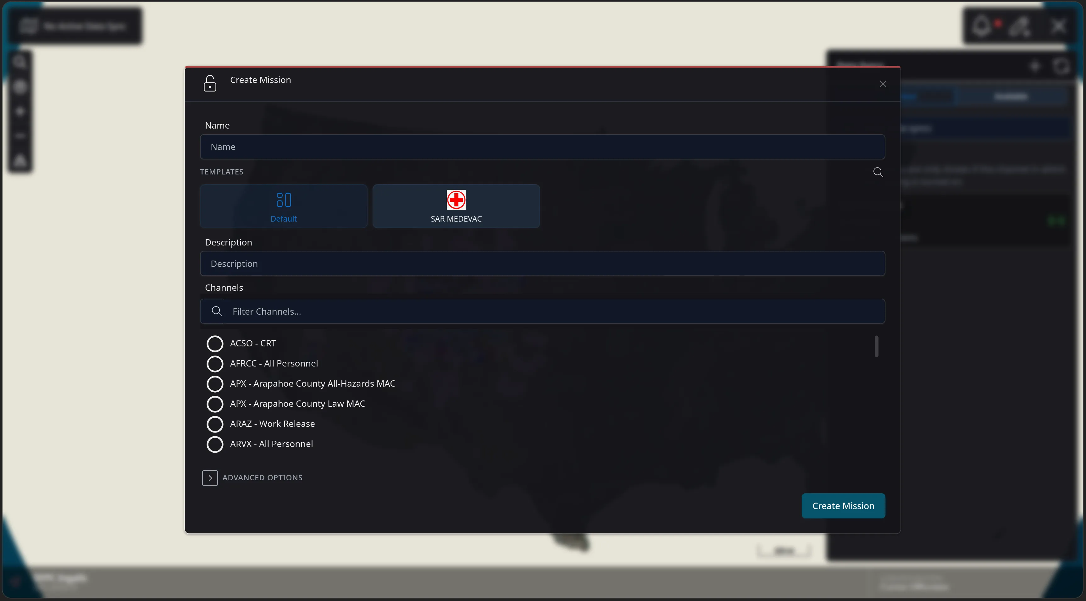
The Create Mission dialog in CloudTAK with a TEMPLATES row offering Default and the red-cross SAR MEDEVAC template, above Description, a channel filter listing channels such as ACSO - CRT and AFRCC - All Personnel, and Advanced Options.
Feature Walkthrough · 06 — Mission Templates · 8/12
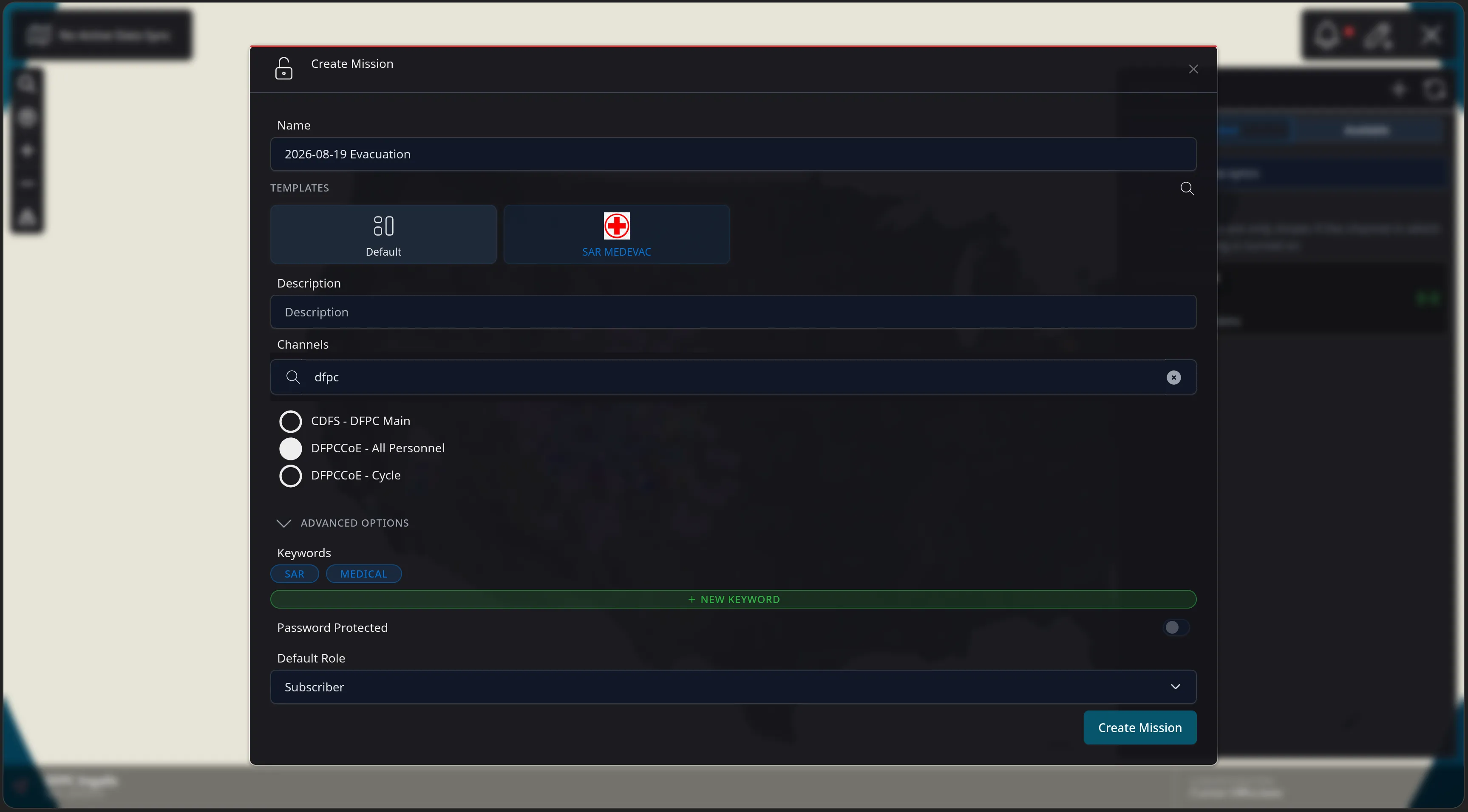
The Create Mission dialog filled out: name 2026-08-19 Evacuation, the SAR MEDEVAC template selected, the DFPCCoE - All Personnel channel checked, and Advanced Options expanded showing the template's inherited SAR and MEDICAL keywords, a Password Protected toggle and a Subscriber default role.
Feature Walkthrough · 06 — Mission Templates · 9/12
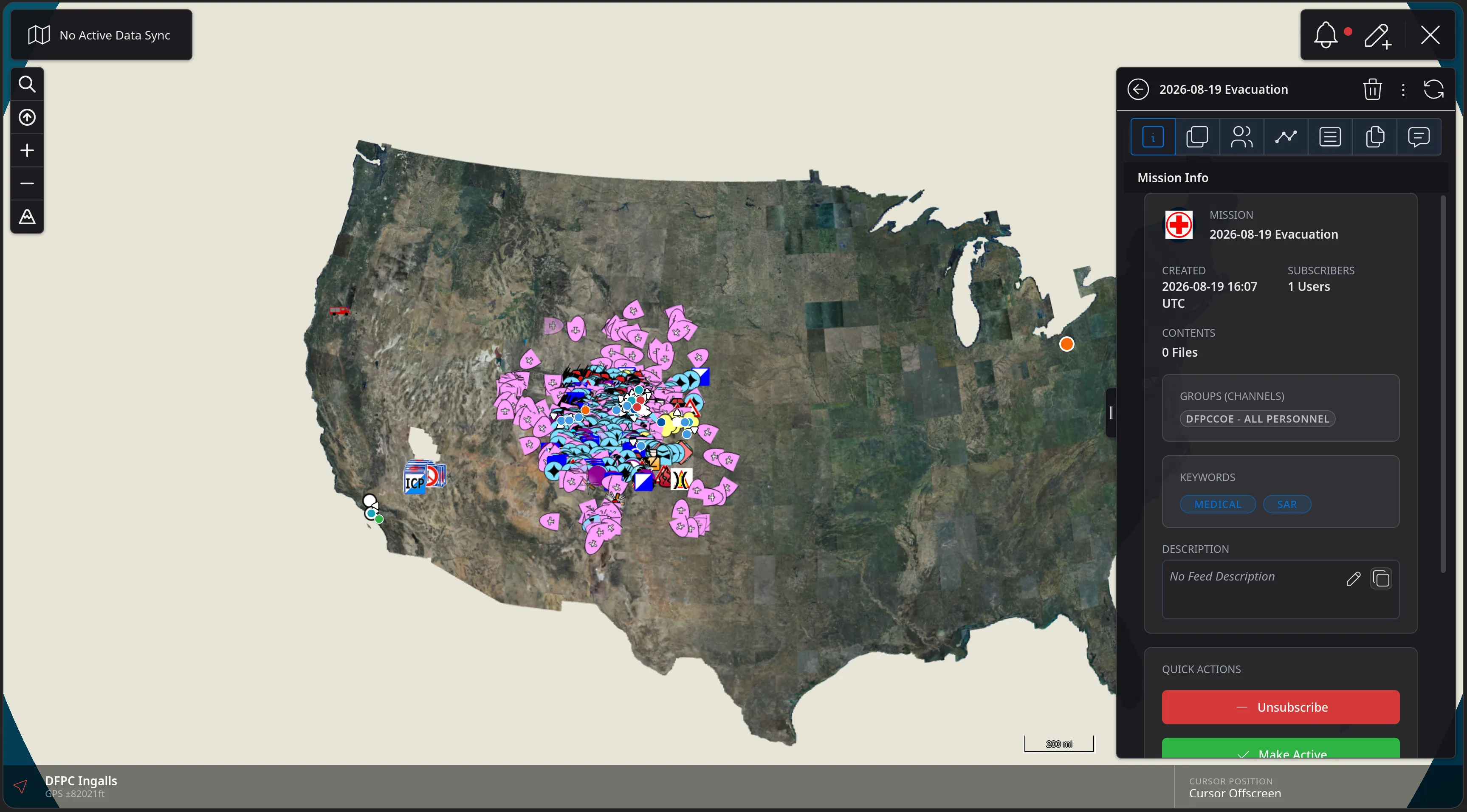
The Mission Info panel for the new 2026-08-19 Evacuation Data Sync, badged with the template's red cross logo and carrying the MEDICAL and SAR keywords, a DFPCCOE - ALL PERSONNEL channel, one subscriber and Quick Actions to Unsubscribe or Make Active.
Feature Walkthrough · 06 — Mission Templates · 10/12
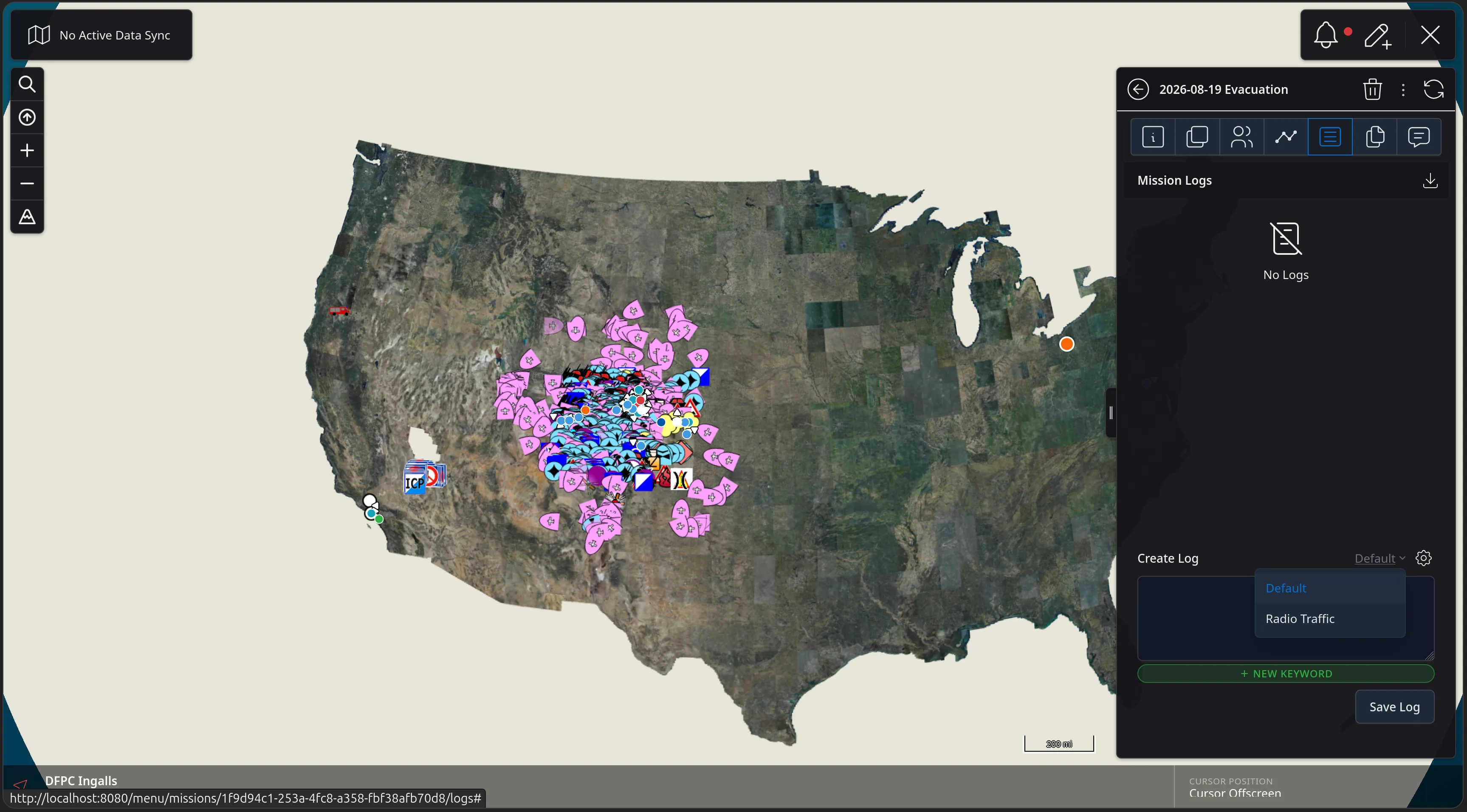
The Mission Logs tab of the new Data Sync with the Create Log type dropdown open, offering the freeform Default log or the template's structured Radio Traffic log.
Feature Walkthrough · 06 — Mission Templates · 11/12
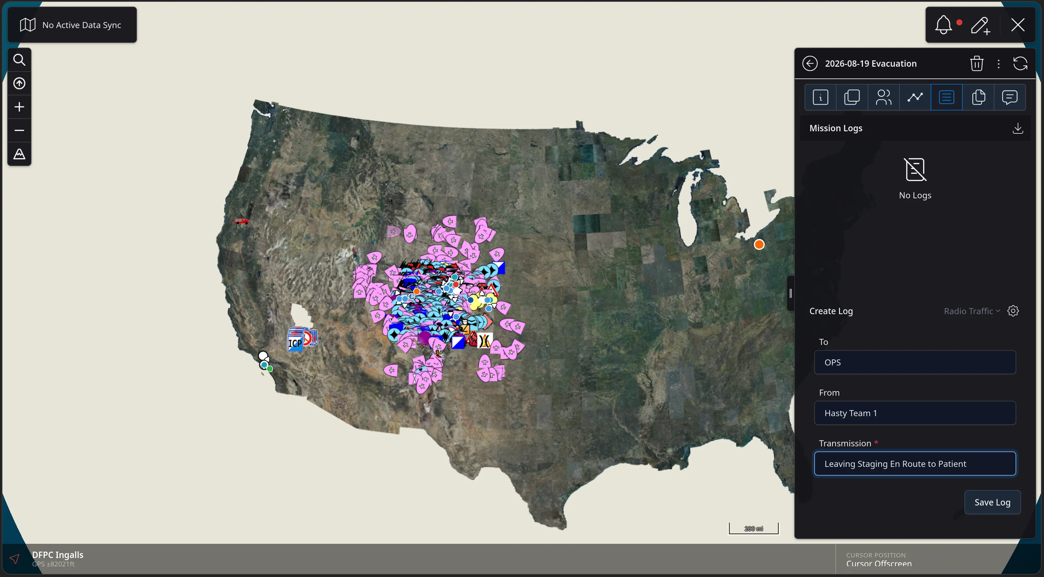
The Create Log form rendered from the Radio Traffic schema, prompting for the fields the template defined: To reading OPS, From reading Hasty Team 1, and a required Transmission reading Leaving Staging En Route to Patient.
Feature Walkthrough · 06 — Mission Templates · 12/12
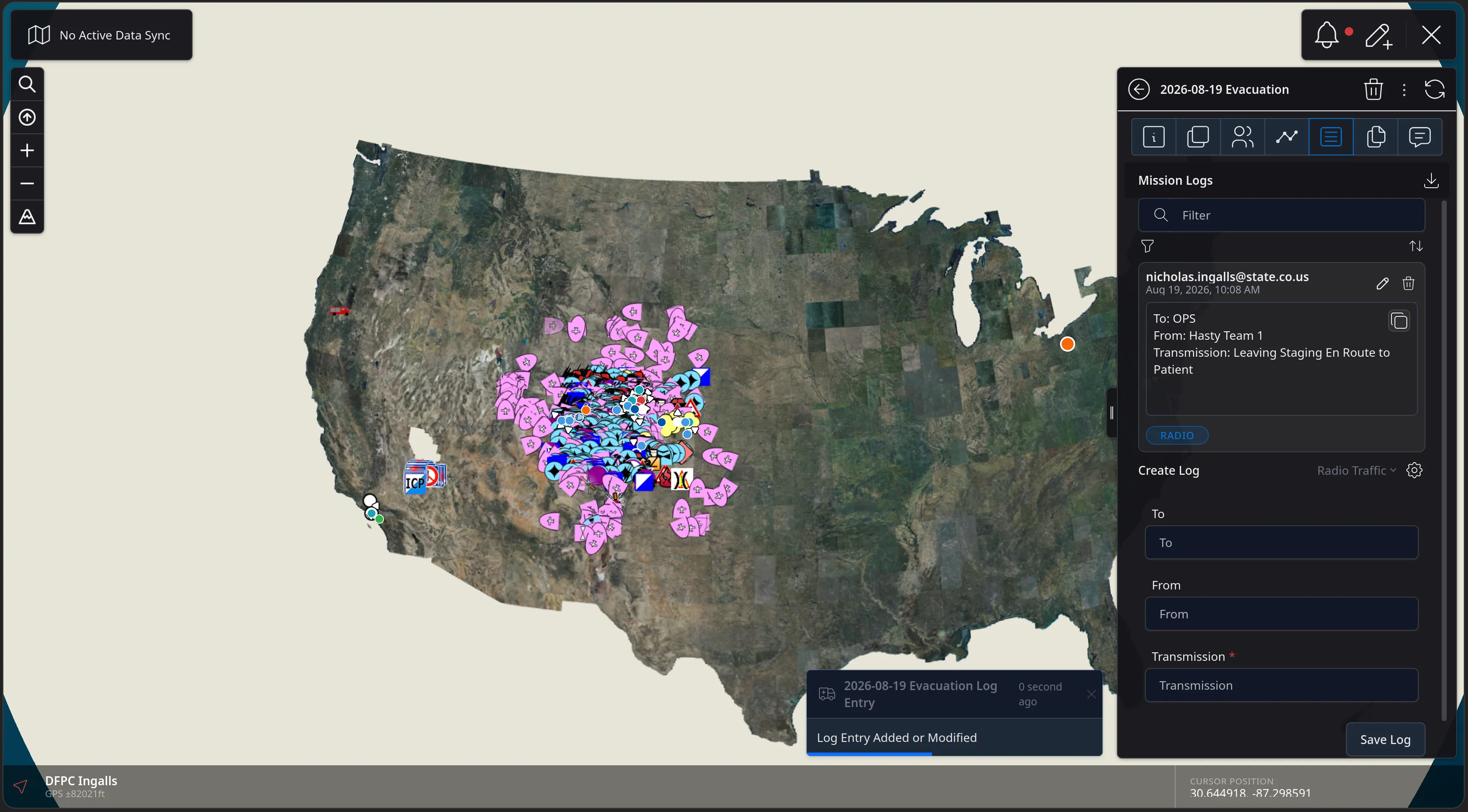
The saved structured log entry in Mission Logs - attributed to nicholas.ingalls@state.co.us with To, From and Transmission fields and a RADIO tag - alongside a Log Entry Added or Modified notification and an empty form ready for the next transmission.
Feature Walkthrough · 07 — Weather

Reverse Geocoding Context

Right clicking (or long press on mobile) on the map will open up a menu giving you information about that location

Current conditions, an hourly forecast with wind, humidity, dewpoint and precipitation, the sun and moon state and magnetic declination

The next two slides query a point inside a live search area.
Feature Walkthrough · 07 — Weather · 1/2
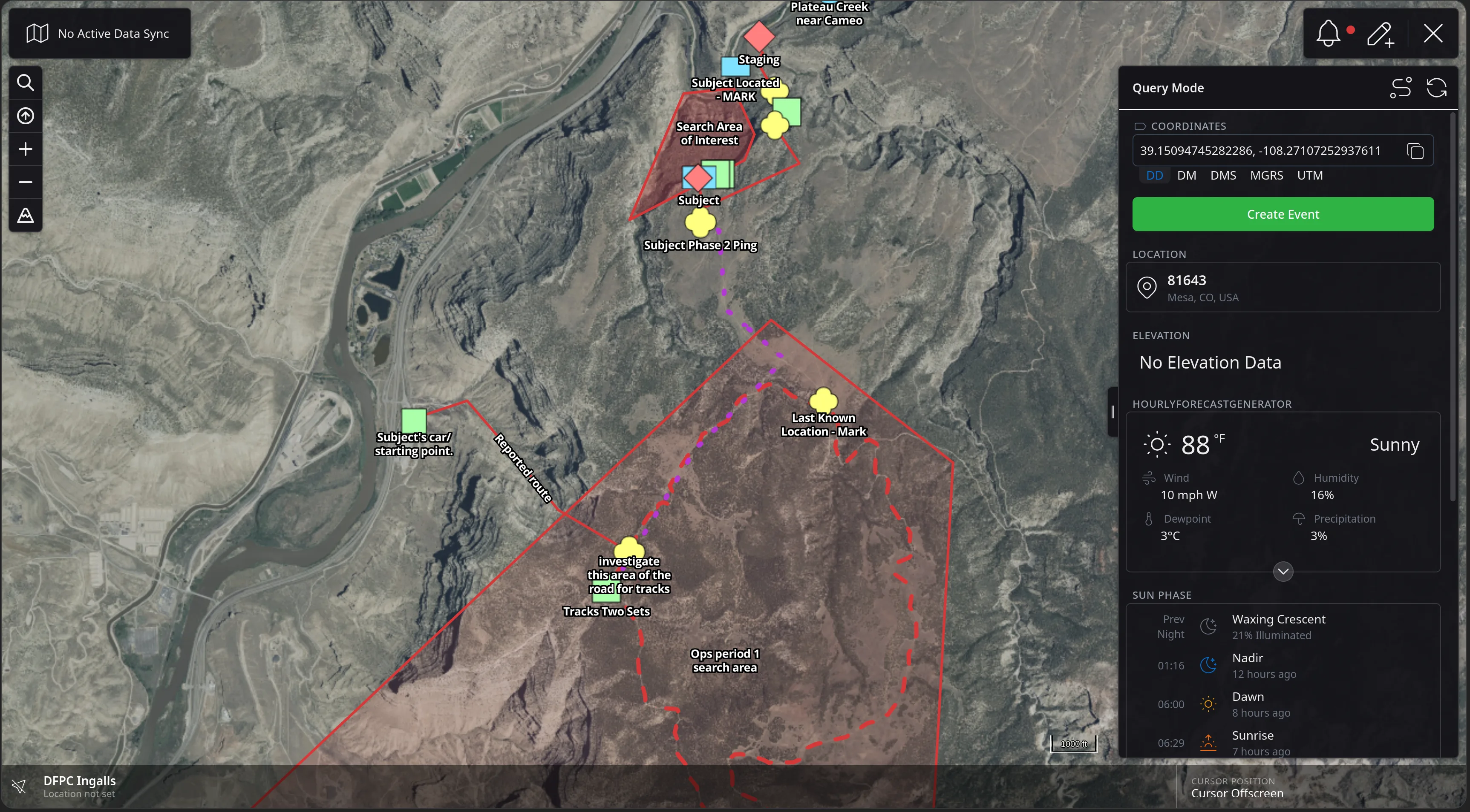
The CloudTAK map over a SAR search area with the Query Mode panel open, showing coordinates in decimal degrees with DD, DM, DMS, MGRS and UTM options, a Create Event button, a reverse-geocoded location of 81643 Mesa, CO, USA, No Elevation Data, and an hourly forecast reading 88 degrees Fahrenheit and Sunny with wind 10 mph W, humidity 16 percent, dewpoint 3 degrees C and precipitation 3 percent.
Feature Walkthrough · 07 — Weather · 2/2
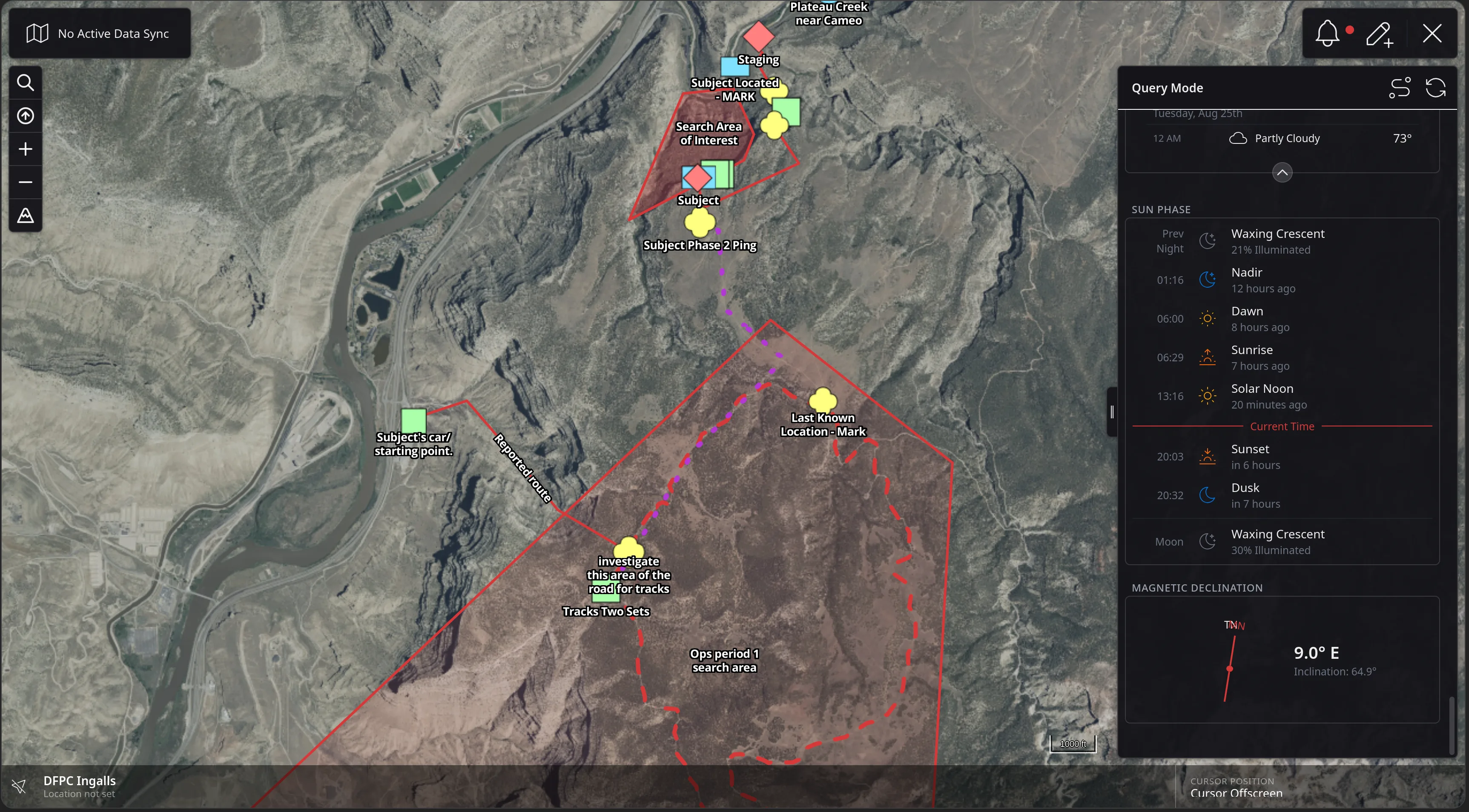
The Query Mode panel scrolled down, showing the tail of the hourly forecast for Tuesday, Aug 25th, a SUN PHASE timeline listing waxing crescent, nadir 01:16, dawn 06:00, sunrise 06:29, solar noon 13:16, a Current Time marker, sunset 20:03 in 6 hours and dusk 20:32 in 7 hours, and a MAGNETIC DECLINATION dial reading 9.0 degrees E with inclination 64.9 degrees.
Feature Walkthrough · 08 — Unified Search

Unified Search

CloudTAK's unified search now searches accross local and server provided geospatial objects and will continue to expand to be a true unified search listing Data Syncs, Data Packages, Basemaps and Overlays.

The next two slides run two queries against the same picture.
Feature Walkthrough · 08 — Unified Search · 1/1
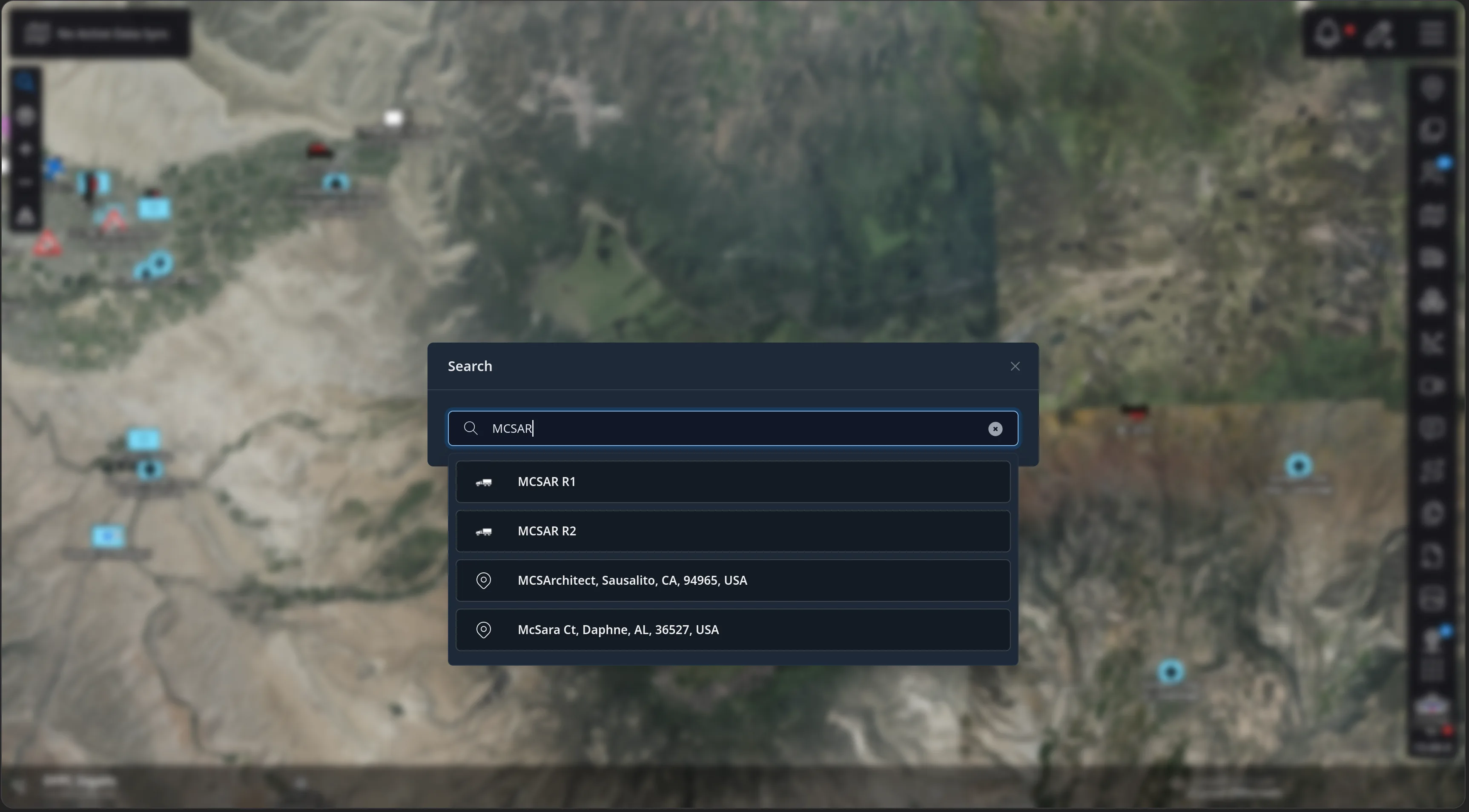
The CloudTAK map with a Search dialog open over it, the query MCSAR typed in, and four results below: the callsigns MCSAR R1 and MCSAR R2 with vehicle icons, and two geocoded addresses, MCSArchitect in Sausalito, CA and McSara Ct in Daphne, AL.
Feature Walkthrough · 09 — Overlays & Basemaps

Overlays & Basemaps Improvements

Overlays and Basemaps have been improved with deeper support for ESRI Map, Image, & Feature servers as well as the ability to import TileJSON endpoints directly.

The next six slides register a county ImageServer and put it on the map.
Feature Walkthrough · 09 — Overlays & Basemaps · 1/6
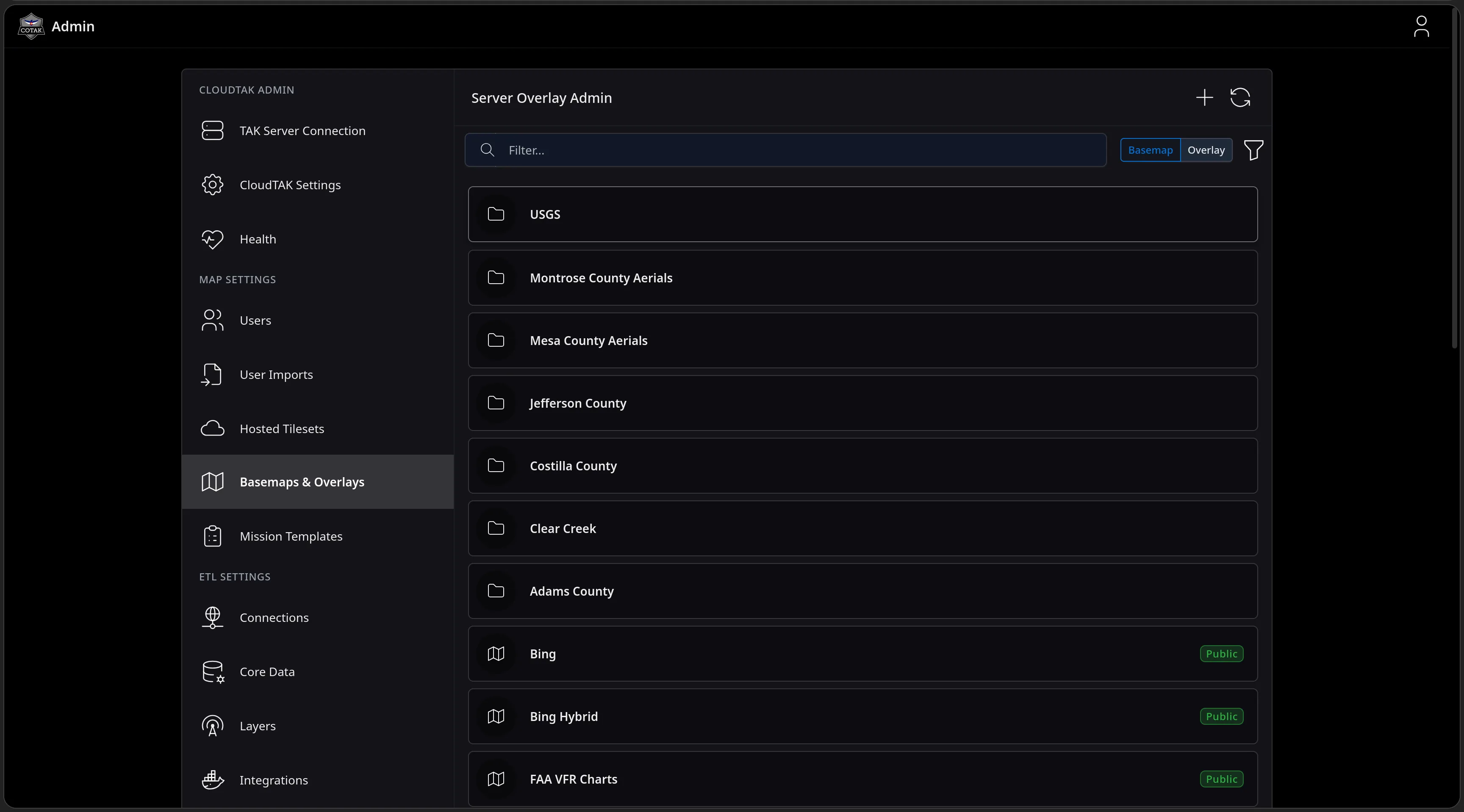
The Server Overlay Admin page in the CloudTAK Admin console with Basemap and Overlay tabs and a filter box, listing folders for USGS and county aerial collections above public basemaps such as Bing, Bing Hybrid and FAA VFR Charts.
Feature Walkthrough · 09 — Overlays & Basemaps · 2/6
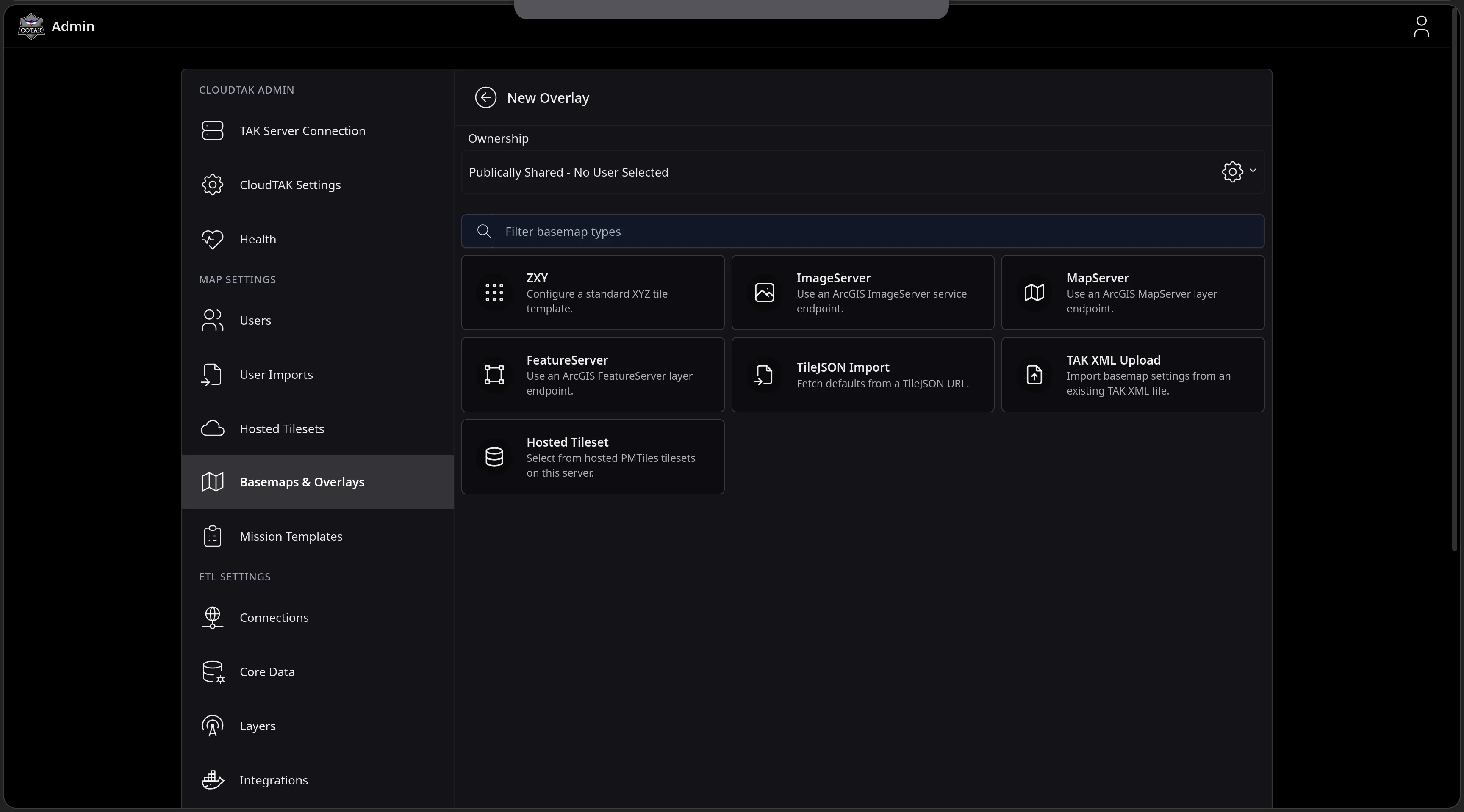
The New Overlay page with an ownership selector and a filterable grid of source types: a ZXY tile template, ArcGIS ImageServer, MapServer and FeatureServer endpoints, TileJSON Import, TAK XML Upload, and Hosted Tileset.
Feature Walkthrough · 09 — Overlays & Basemaps · 3/6
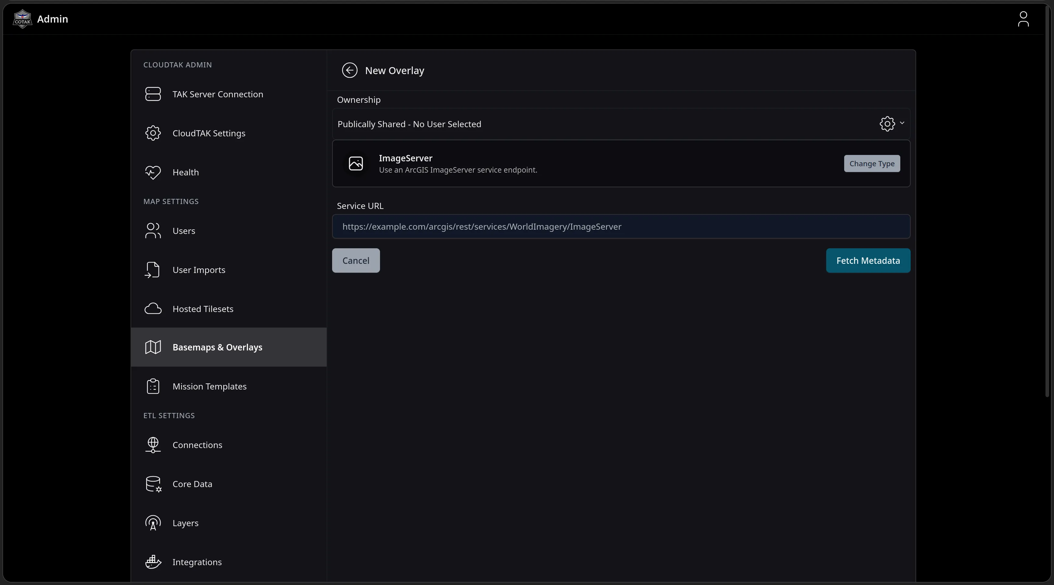
The New Overlay form with the ImageServer type selected, a Change Type button, an example ArcGIS ImageServer Service URL placeholder, and a Fetch Metadata button.
Feature Walkthrough · 09 — Overlays & Basemaps · 4/6
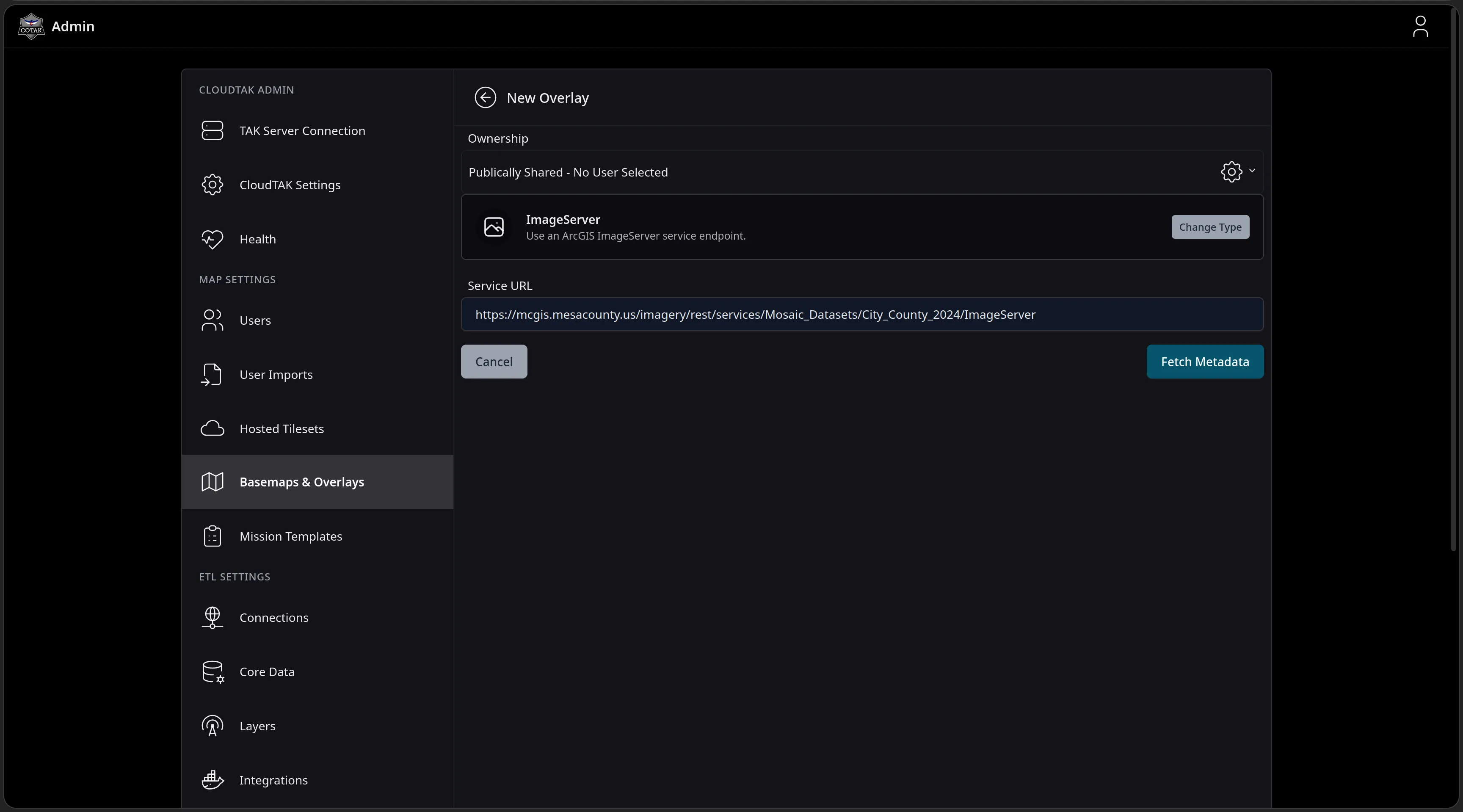
The Service URL filled in with Mesa County's City_County_2024 ArcGIS ImageServer endpoint, ready for Fetch Metadata to interrogate the service.
Feature Walkthrough · 09 — Overlays & Basemaps · 5/6
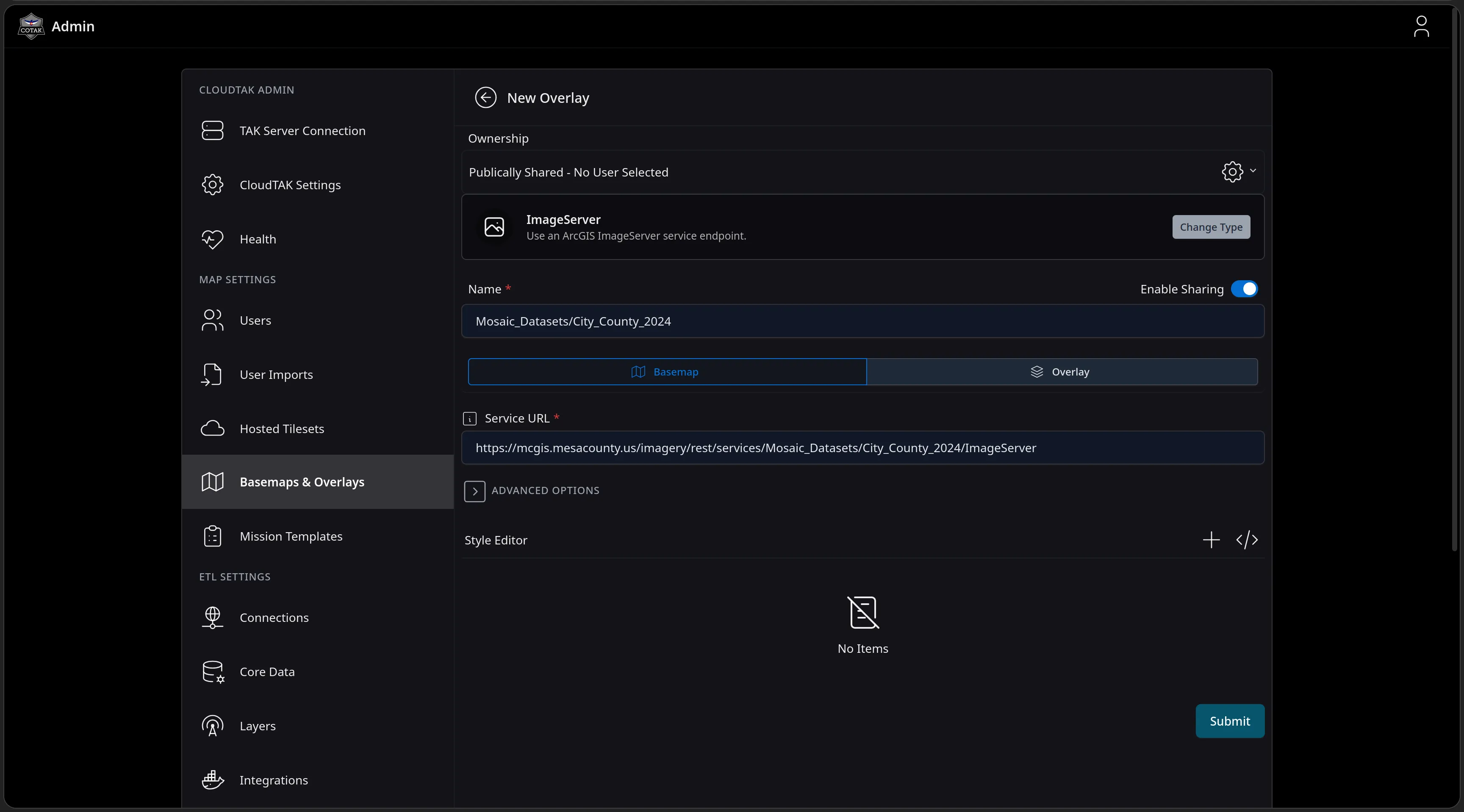
The form after fetching metadata: the name Mosaic_Datasets/City_County_2024 pre-filled from the service, a Basemap or Overlay toggle, an Enable Sharing switch, Advanced Options and a Style Editor above the Submit button.
Feature Walkthrough · 09 — Overlays & Basemaps · 6/6
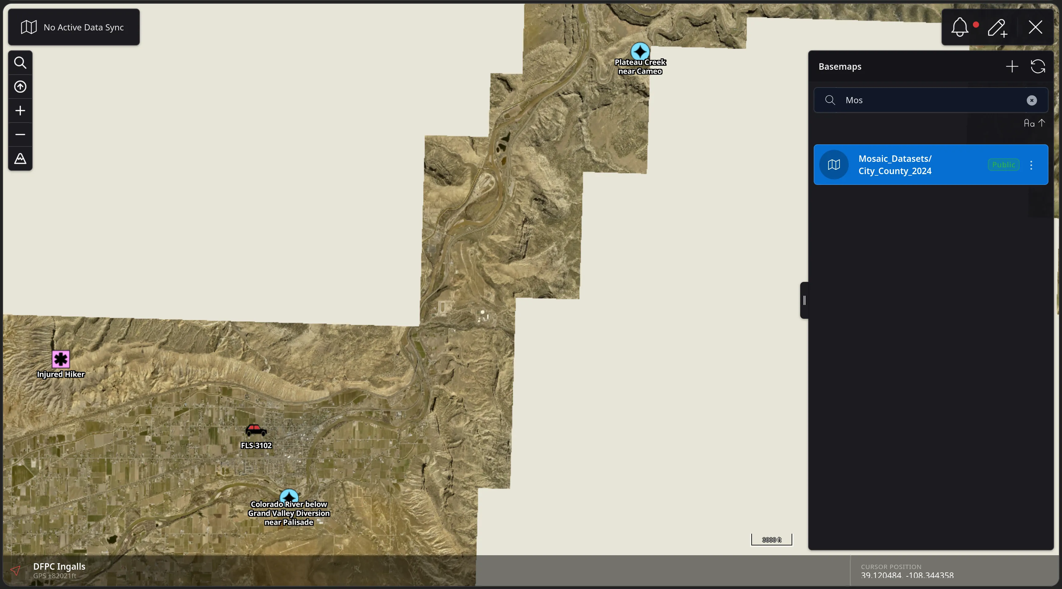
The CloudTAK map rendering the new Mesa County 2024 aerial imagery as the active basemap - its coverage footprint visible against the blank canvas - with the Basemaps panel open and the public Mosaic_Datasets/City_County_2024 entry selected.
The year in three movements

tl;dr Infrastructure

CloudTAK conitued to e

  • 01

    It went native. One codebase now ships as web, PWA, iOS and Android.

  • 02

    It went offline. CloudTAK now works seamlessly between connected and disconnected environments

  • 03

    It scales. API & Database operations can be scaled horizontally

02 — Under the hood · Native Apps

CloudTAK in Your Pocket

The same App from your pocket to your desk

Web Browser

Operational

iOS

Beta

Android

Coming Soon
02 — Under the hood · v13.45

Horizontal Scaling

Field CloudTAK TAK Core Web & PWA any browser iOS & Android CloudTAK Apps Data Integrations CloudTAK ETLs Stateless API web, mobile & ETL routes N tasks · autoscaled Stateful Hub TAK connection pool CoT ingest & fan-out HubClient RPC Aurora Postgres Graviton · jsonb S3 & EFS files · packages PMTiles & Media tiles · elevation · video TAK Server COTAK or any TAK core missions · data syncs

One interface

Stateful interaction routes through a HubClient. Stateless routes never touch connection state.

Split config

Config became stateful and stateless halves; hub RPC runs on the public API's schema framework.

Independent services

Services scale and recover independently via AWS ECS

Postgres Load Balancing

Database queries are balanced accross all instances in a postgres cluster

The ETL Ecosystem

tl;dr Integrations

40 open-source ETLs stream the systems crews already rely on directly into TAK
Active911
ADS-B Exchange
AirData UAV
ArcGIS by Esri
Axon
BRINC
Buddi
Colorado Avalanche Information Center
CalTopo
CentralSquare
COtrip - Colorado Department of Transportation
DroneSense
Dronetag
Everywhere Communications
Garmin inReach
Geotab
NASA ACERO
Skydio
SkyMira
Spidertracks
SPOT by Globalstar
TactiTrack
USGS
Verkada

All logos and trademarks are the property of their respective owners and are shown for identification only; their use does not represent endorsement of, or assent to, this material by those companies.

Feature Walkthrough · 10 — ETLs

Anatomy of an ETL

Every integration is a versioned task container registered with CloudTAK. Operators pair a task with an agency Connection to create a Layer — scheduled, configured, and styled entirely in the browser, and deployed to serverless compute automatically.

The next fourteen slides walk the pipeline from registered task to a live, styled layer.
Feature Walkthrough · 10 — ETLs · 1/14
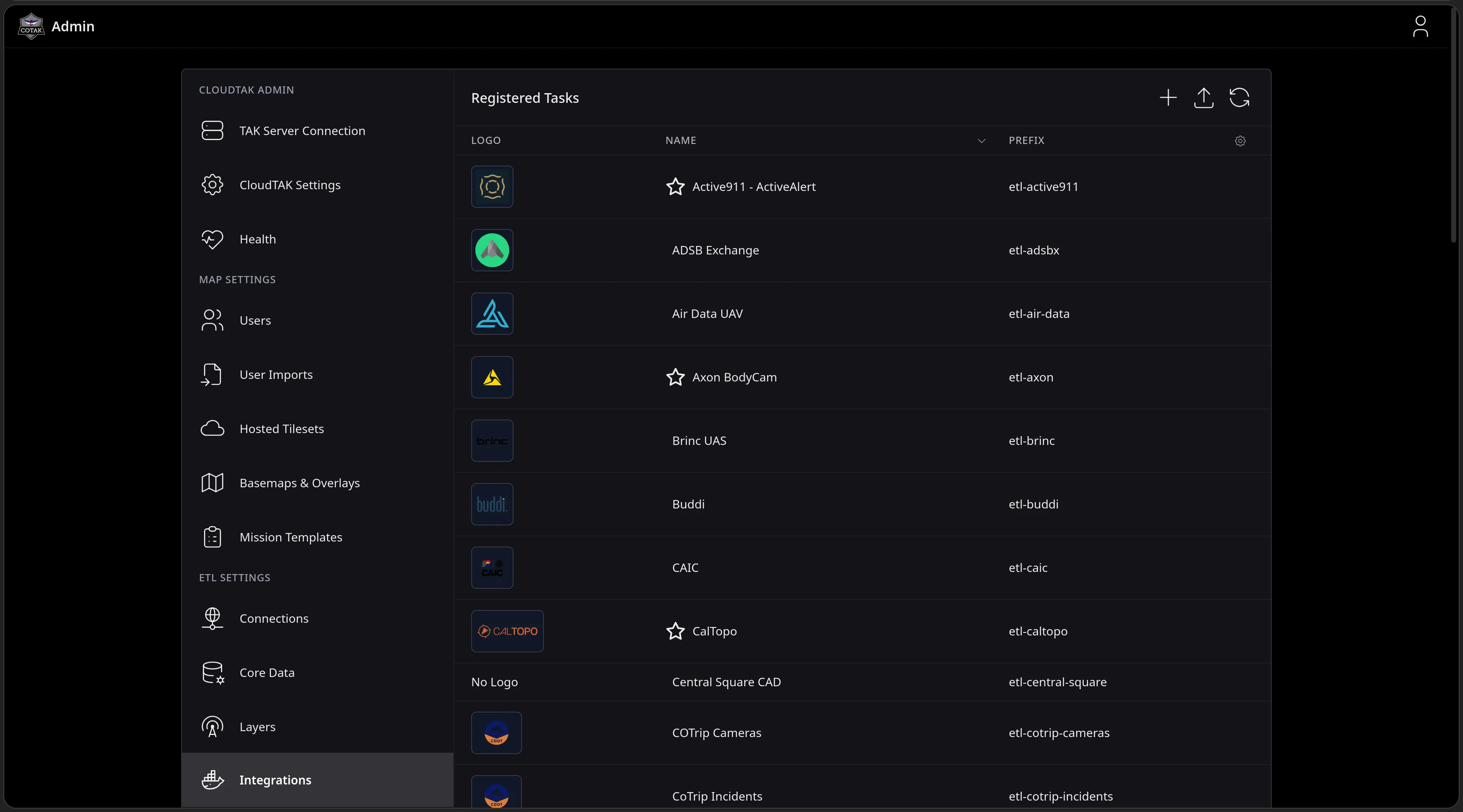
The Registered Tasks page in the CloudTAK Admin console listing ETL containers with their logos and prefixes - Active911, ADSB Exchange, Air Data UAV, Axon BodyCam, Brinc UAS, Buddi, CAIC, CalTopo, Central Square CAD and the COTrip feeds.
Feature Walkthrough · 10 — ETLs · 2/14
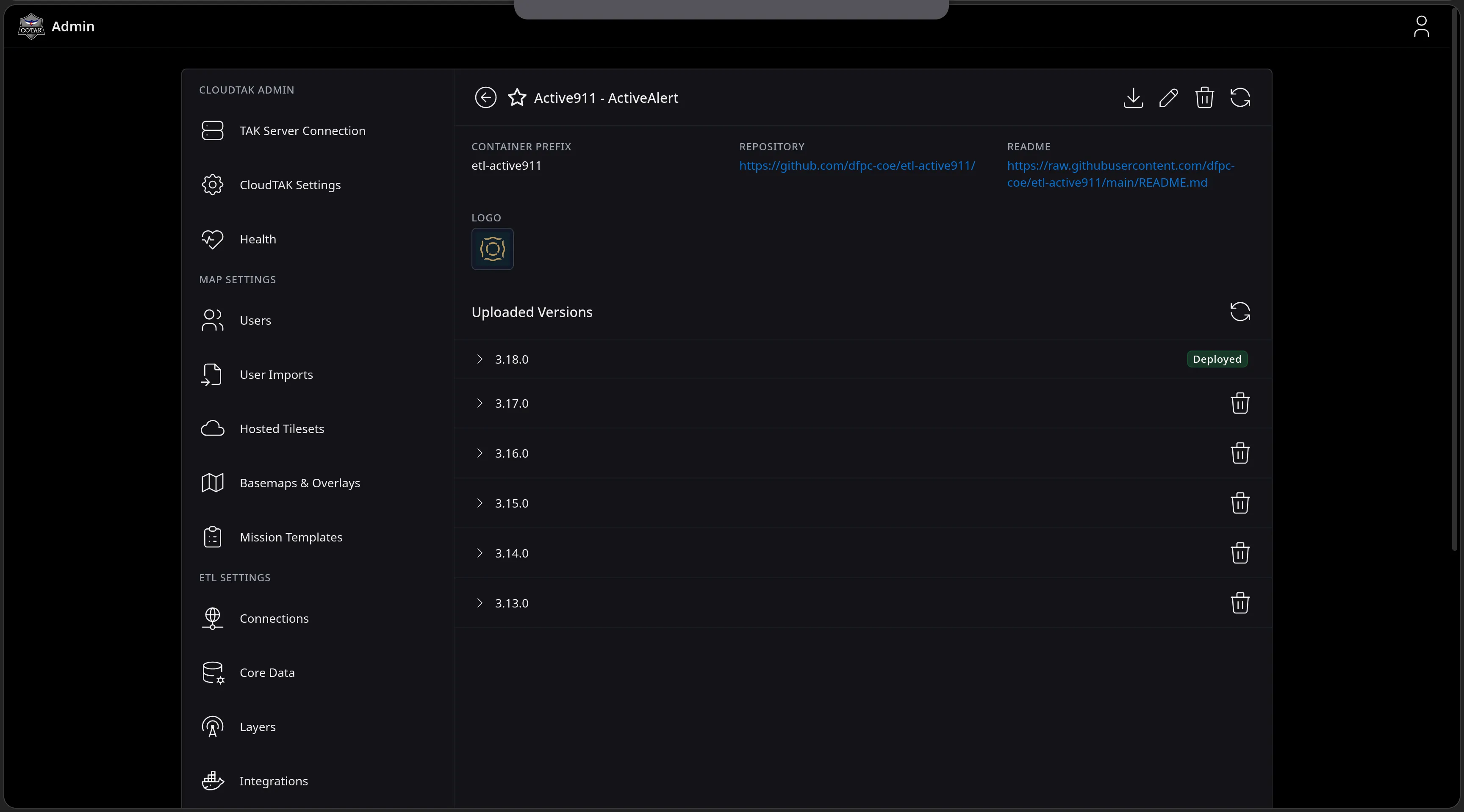
The Active911 - ActiveAlert task detail page showing its container prefix, links to the GitHub repository and README, its logo, and six uploaded versions from 3.13.0 to 3.18.0 with 3.18.0 badged Deployed.
Feature Walkthrough · 10 — ETLs · 3/14
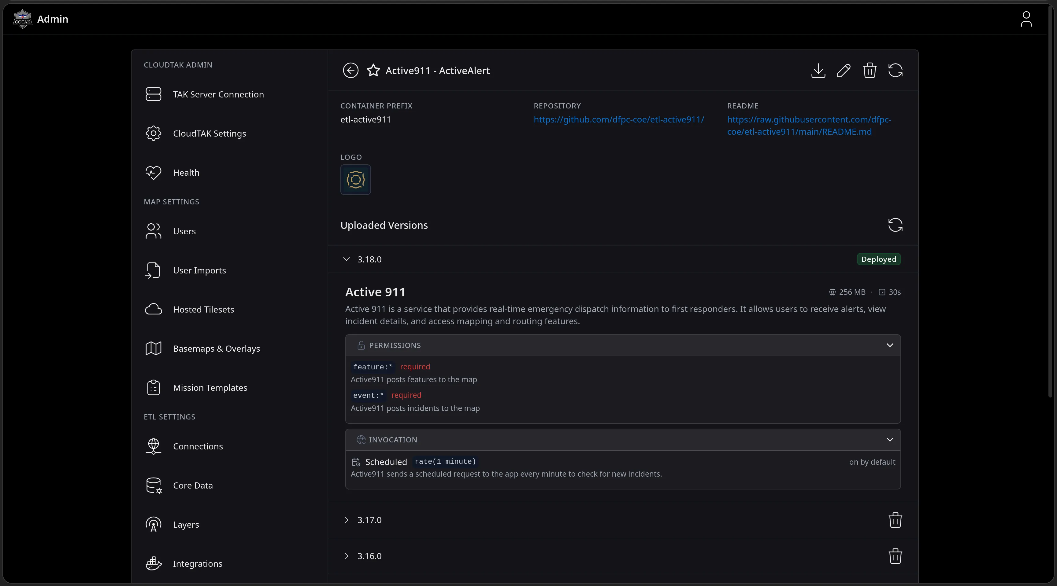
Version 3.18.0 expanded: the task self-describes with its size and timeout, the TAK permissions it requires - posting features and events to the map - and its invocation model, a scheduled request every minute to check for new incidents.
Feature Walkthrough · 10 — ETLs · 4/14
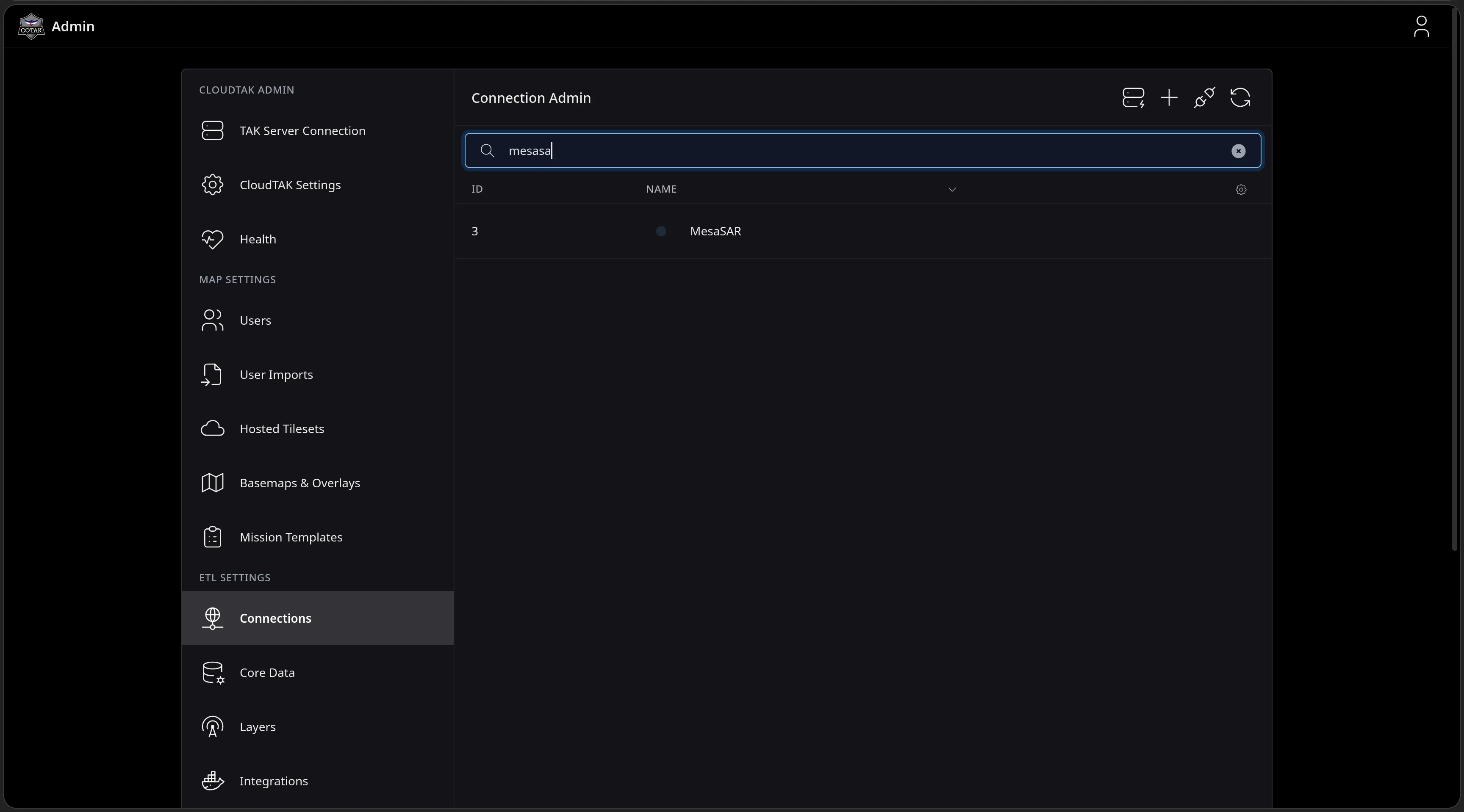
The Connection Admin page filtered to mesasa, returning the MesaSAR connection - the agency identity that ETL layers run under.
Feature Walkthrough · 10 — ETLs · 5/14
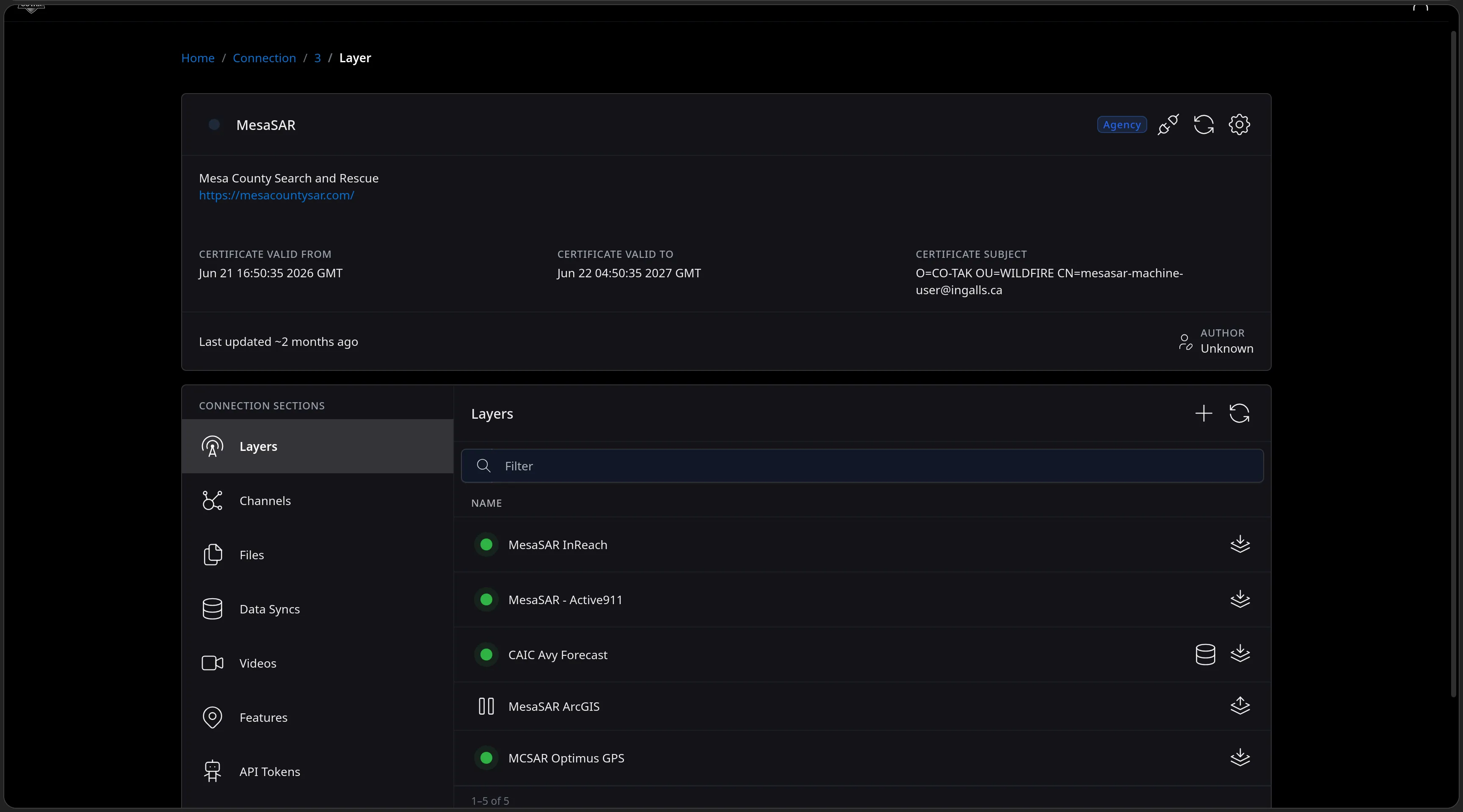
The MesaSAR connection page for Mesa County Search and Rescue showing its TAK certificate validity window and subject, and its existing Layers - MesaSAR InReach, MesaSAR - Active911, CAIC Avy Forecast, MesaSAR ArcGIS and MCSAR Optimus GPS.
Feature Walkthrough · 10 — ETLs · 6/14
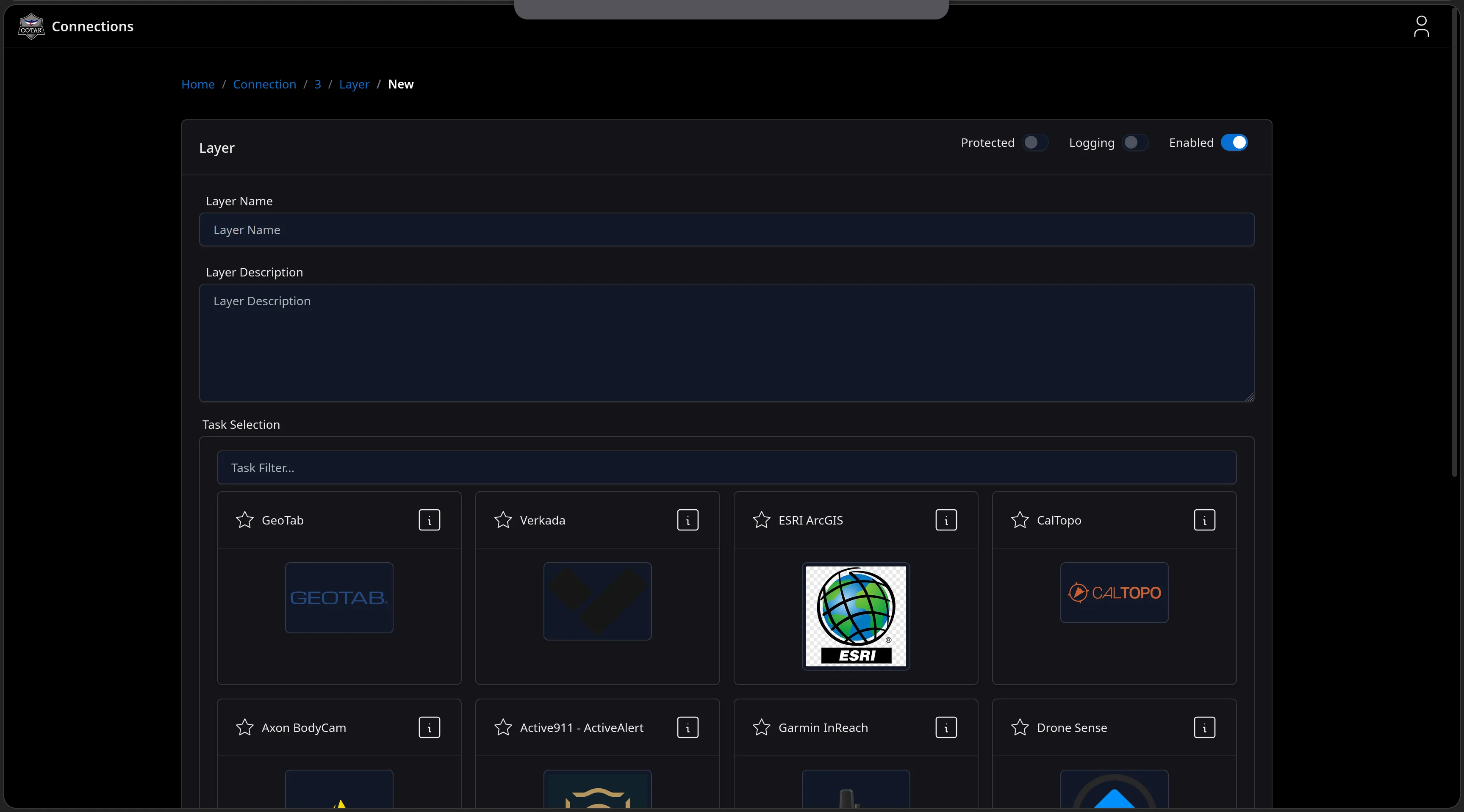
The New Layer form on the connection with Protected, Logging and Enabled toggles, name and description fields, and a filterable Task Selection grid showing GeoTab, Verkada, ESRI ArcGIS, CalTopo, Axon BodyCam, Active911, Garmin InReach and Drone Sense tiles.
Feature Walkthrough · 10 — ETLs · 7/14
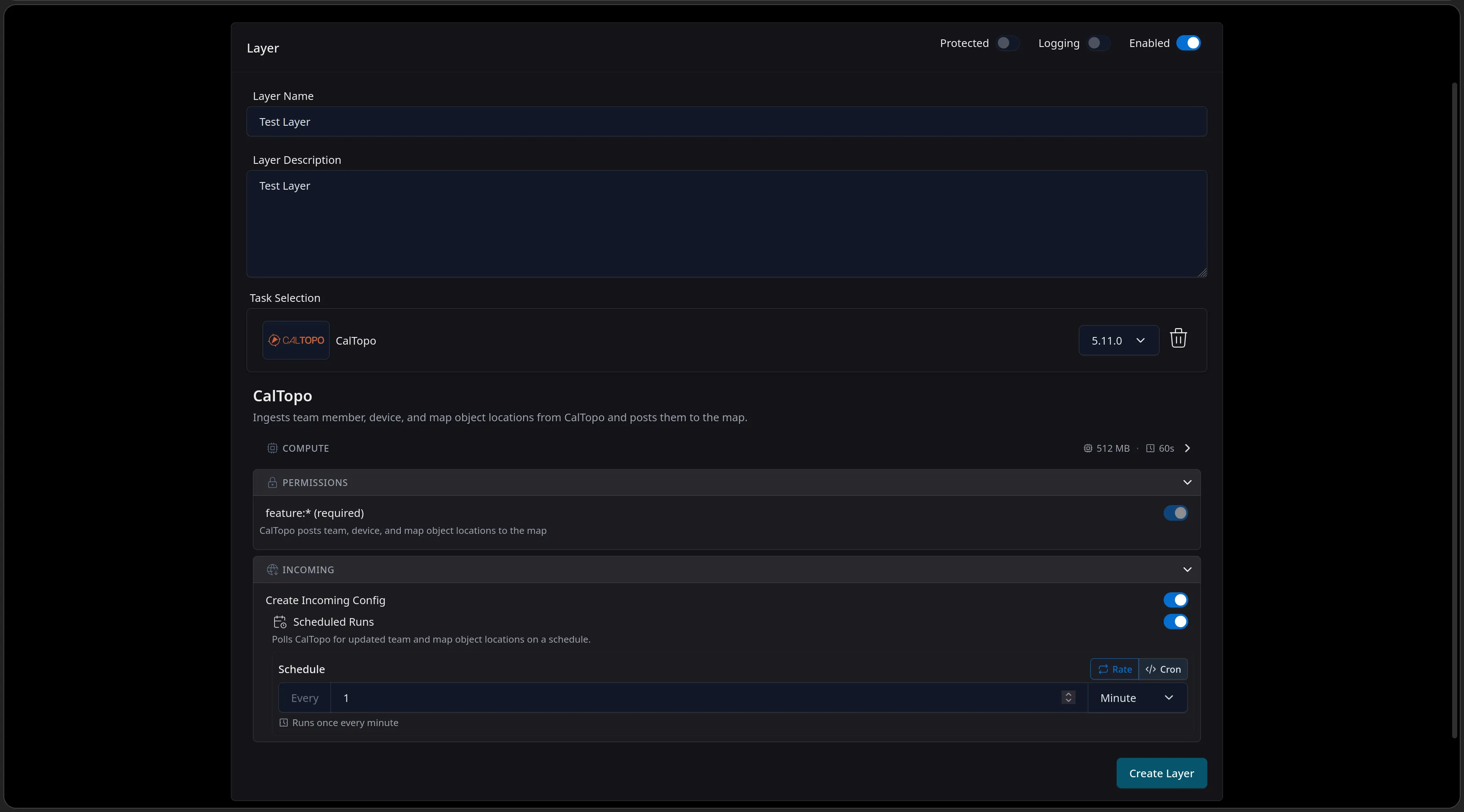
The layer form filled out: the CalTopo task pinned at version 5.11.0, its compute footprint and required feature permission, and an Incoming config with Scheduled Runs polling CalTopo once every minute, above the Create Layer button.
Feature Walkthrough · 10 — ETLs · 8/14
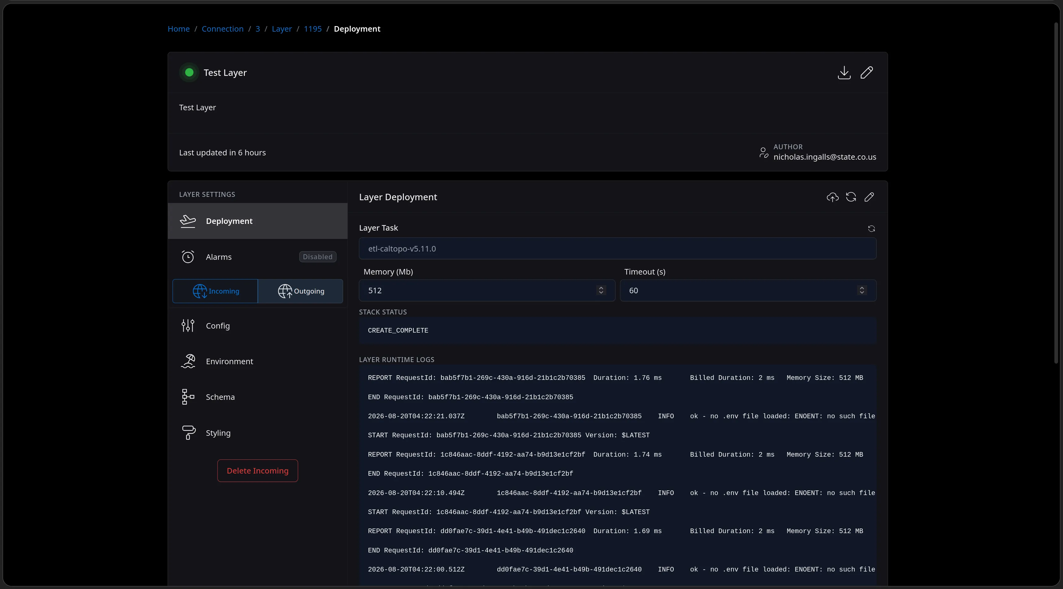
The created layer's Deployment page: the etl-caltopo-v5.11.0 task with its memory and timeout, a CloudFormation stack status of CREATE_COMPLETE, and live Lambda runtime logs streaming one-to-two-millisecond scheduled runs.
Feature Walkthrough · 10 — ETLs · 9/14
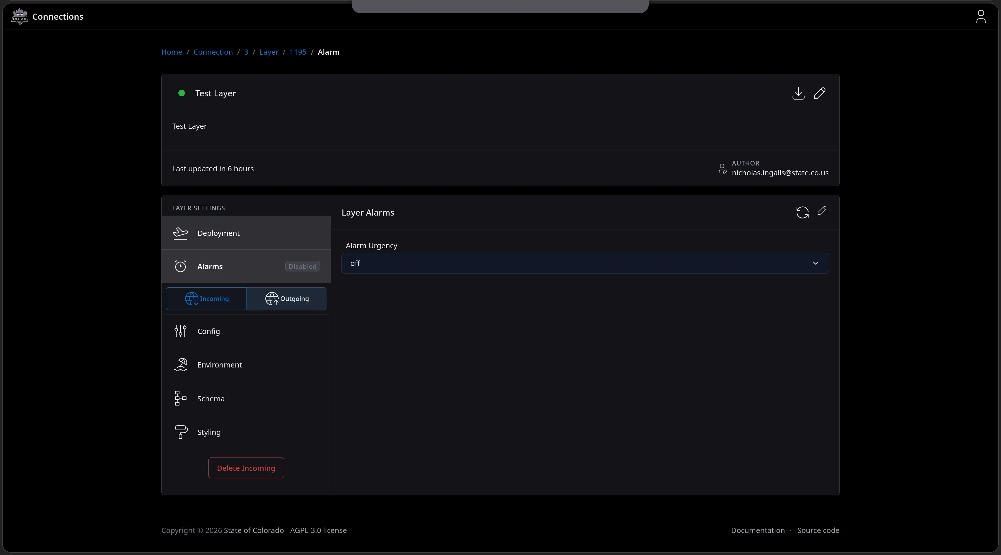
The Layer Alarms page with an Alarm Urgency selector - CloudWatch alarming on the layer, switched off for this test layer.
Feature Walkthrough · 10 — ETLs · 10/14
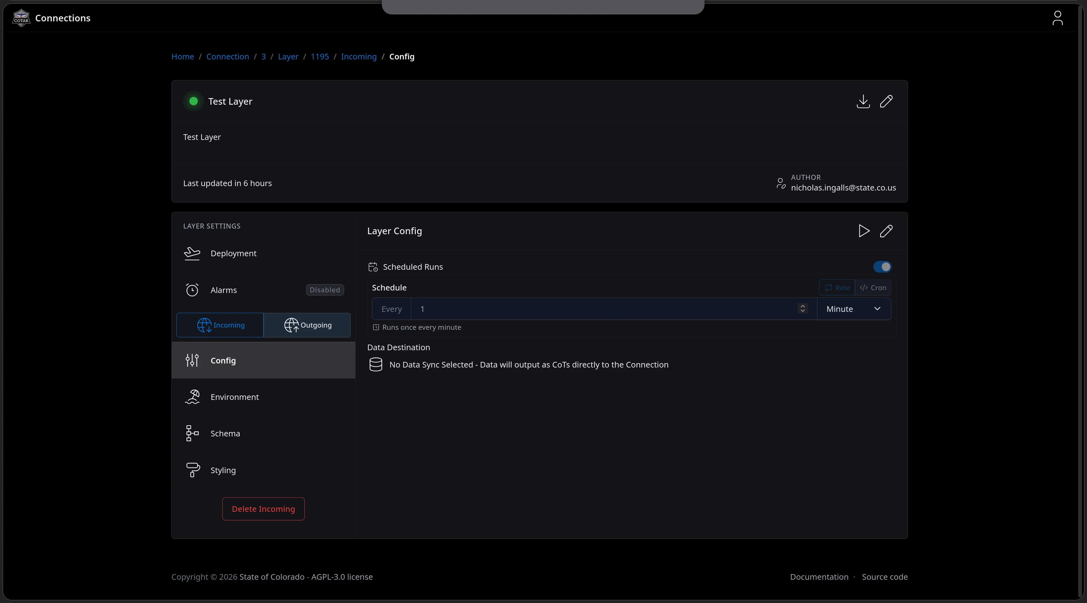
The Layer Config page for the incoming side: Scheduled Runs enabled with a Rate schedule of once every minute, and a Data Destination reading No Data Sync Selected - Data will output as CoTs directly to the Connection.
Feature Walkthrough · 10 — ETLs · 11/14
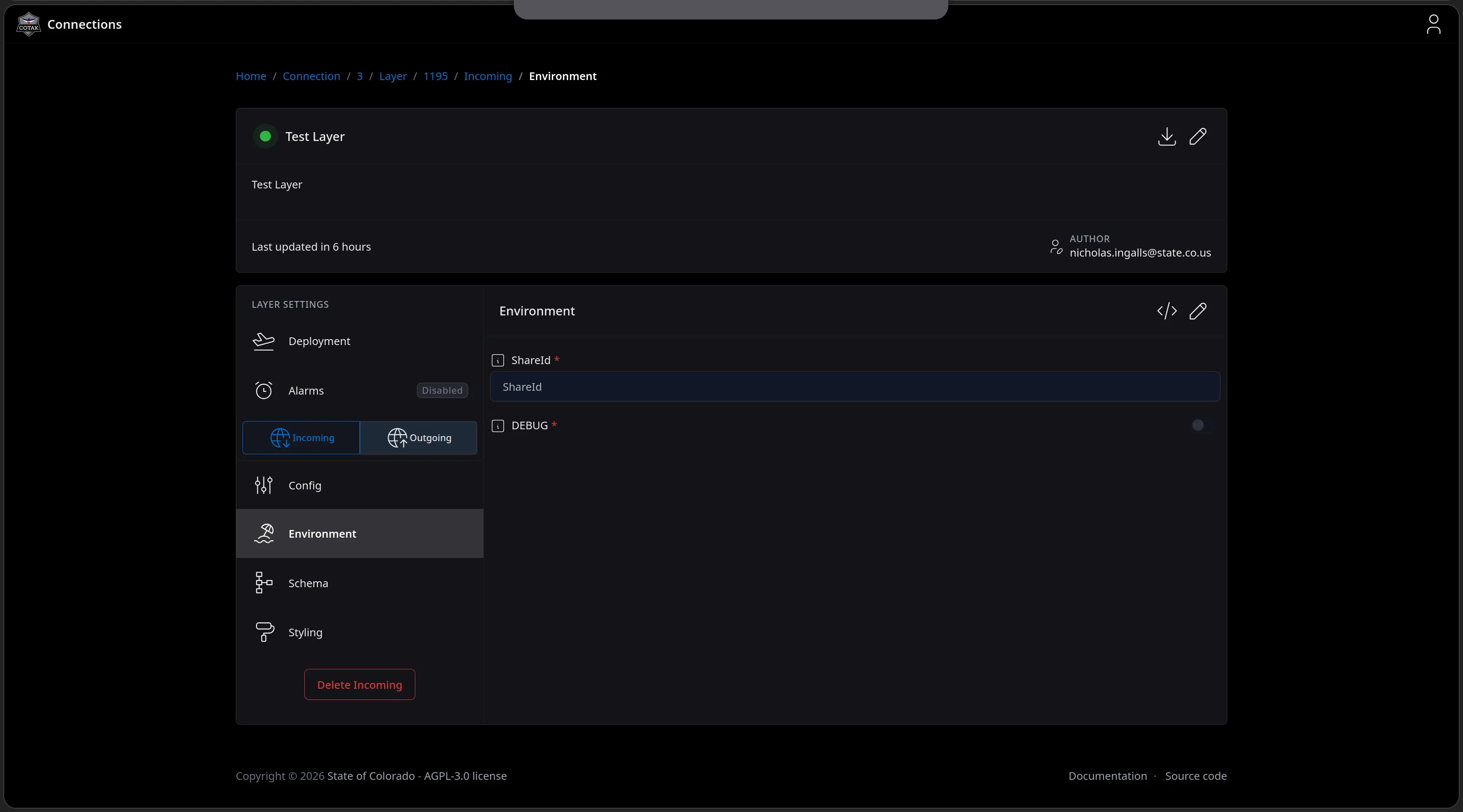
The Environment page rendering the task's own config schema as a form - a required ShareId field and a DEBUG toggle for the CalTopo task.
Feature Walkthrough · 10 — ETLs · 12/14
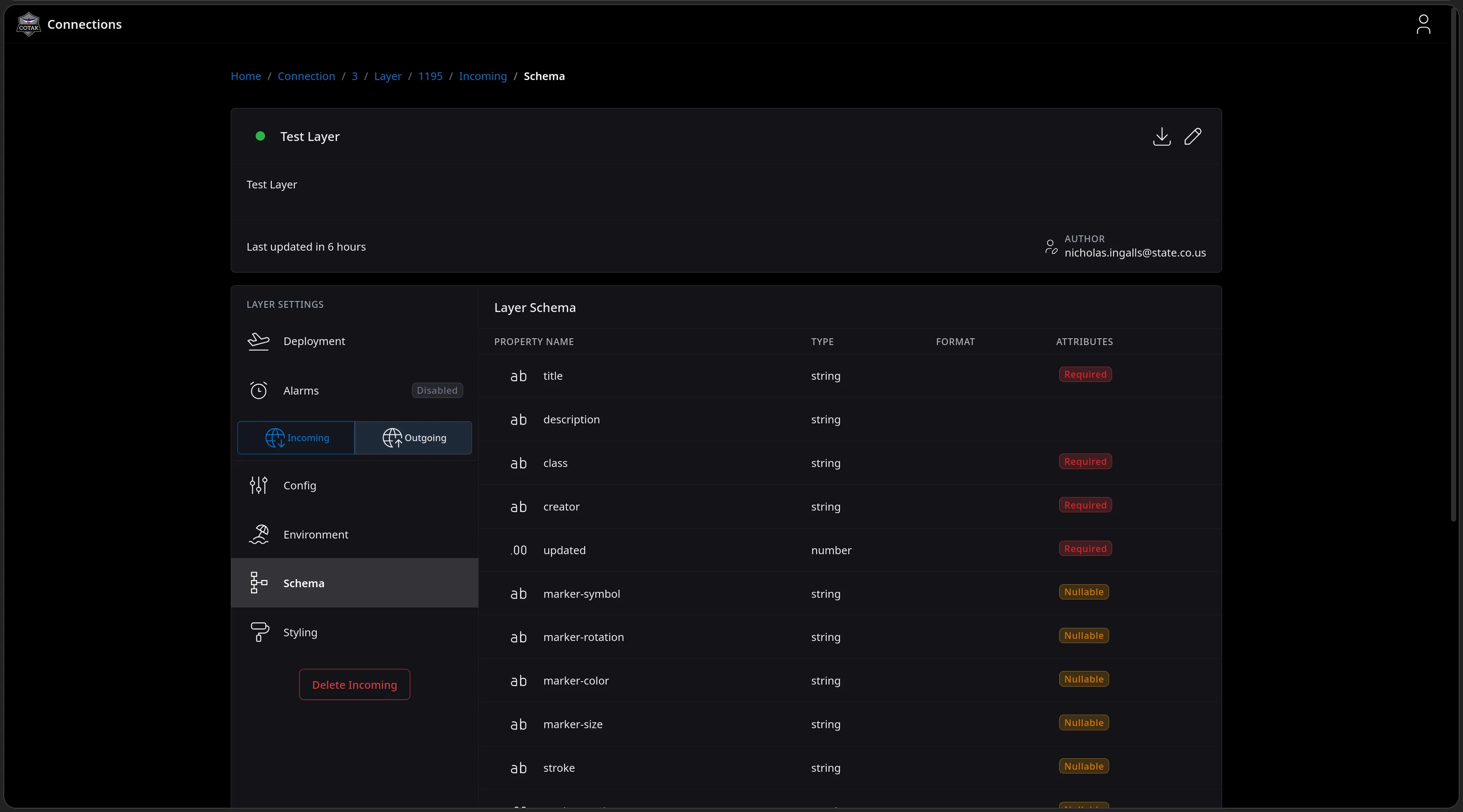
The Layer Schema page listing the properties the task emits - title, description, class, creator and updated marked Required, with nullable marker-symbol, marker-rotation, marker-color, marker-size and stroke styling fields.
Feature Walkthrough · 10 — ETLs · 13/14
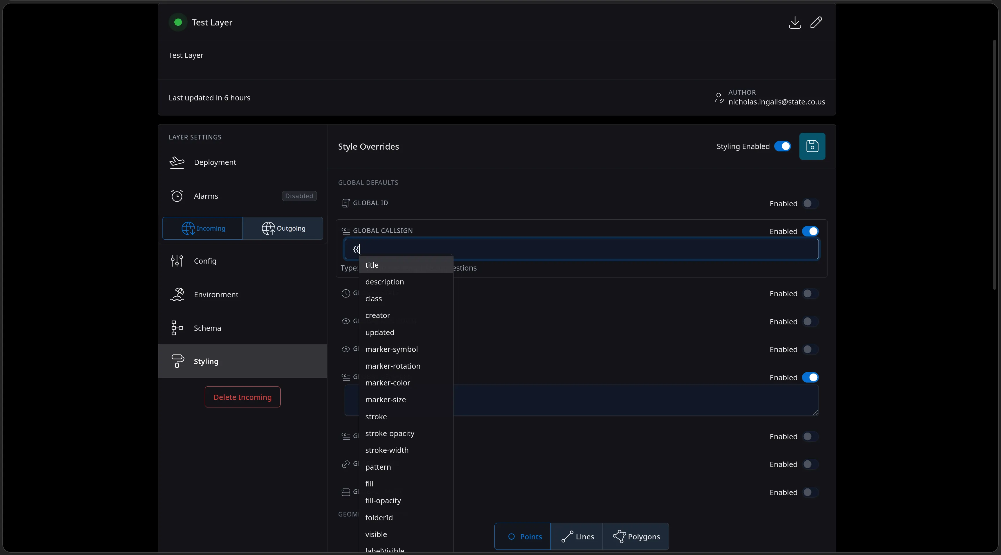
The Styling page's Global Callsign override mid-edit: typing a template opens an autocomplete of the schema's own properties - title, description, class, creator, marker and stroke fields - for building callsigns from feed data.
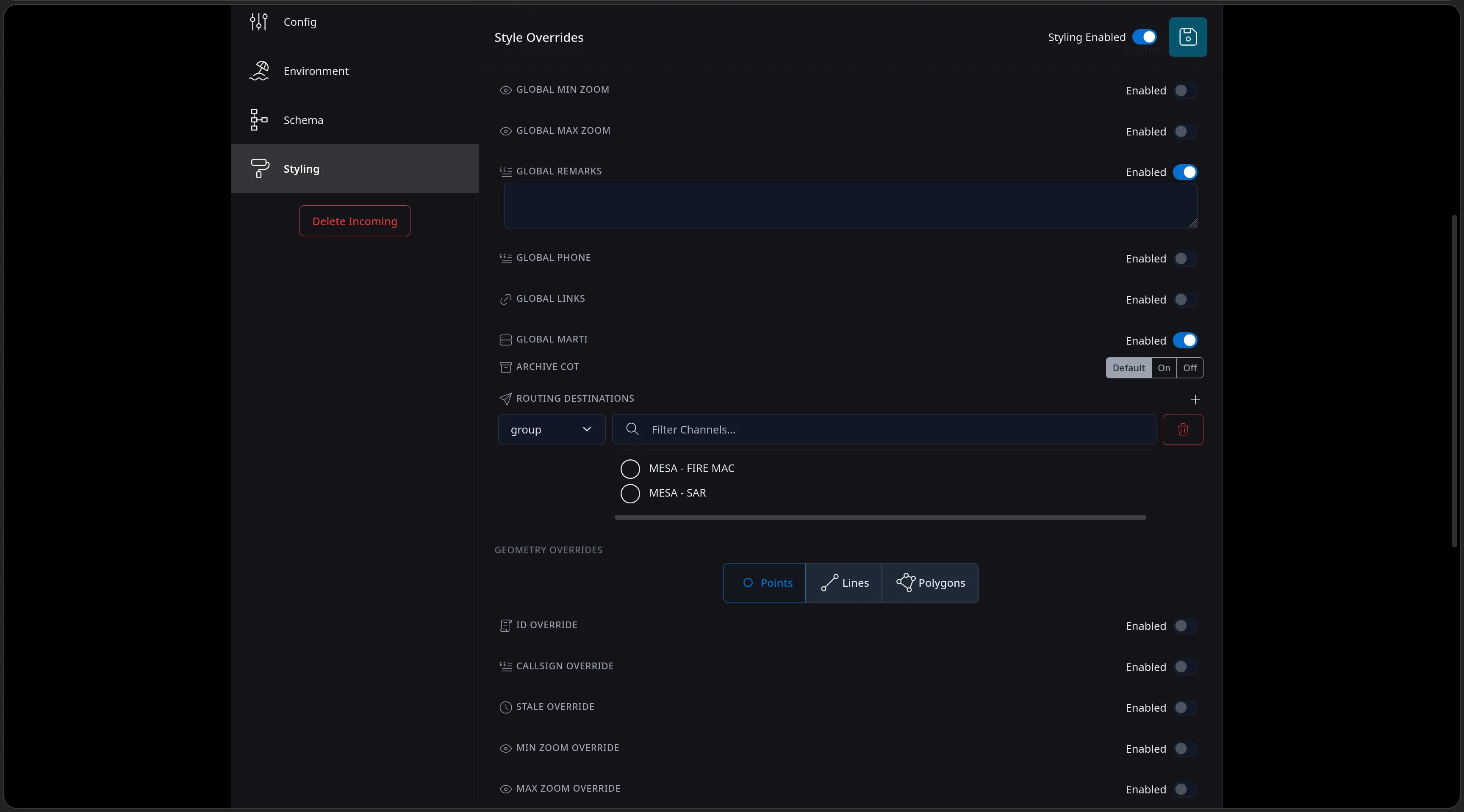
Feature Walkthrough · 10 — ETLs · 14/14
The Styling page scrolled to global overrides - remarks, MARTI and Archive CoT controls, Routing Destinations targeting the MESA - FIRE MAC or MESA - SAR channels, and per-geometry override tabs for Points, Lines and Polygons.
Open Source AGPL-3.0 v13.68.1

All of it is open-source.

CloudTAK is hosted on GitHub, allowing any program or individual to deploy it as is or modify it to fit their needs

  • Sourcegithub.com/dfpc-coe/CloudTAK
  • Documentationdocs.cloudtak.io
  • ContactNicholas Ingalls · nicholas.ingalls@state.co.us
    Brad Schmidt · brad.schmidt@state.co.us
QR code linking to cloudtak.io
cloudtak.io Scan for the project, docs, and source
Questions
DFPC Center of Excellence